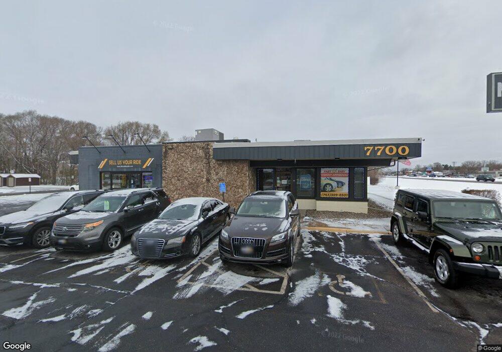
7700 Highway 65 NE Spring Lake Park, MN 55432
Estimated Value: $1,098,104
--
Bed
--
Bath
3,862
Sq Ft
$284/Sq Ft
Est. Value
About This Home
This home is located at 7700 Highway 65 NE, Spring Lake Park, MN 55432 and is currently estimated at $1,098,104, approximately $284 per square foot. 7700 Highway 65 NE is a home located in Anoka County with nearby schools including Park Terrace Elementary School, Westwood Intermediate and Middle School, and Grace Lutheran School.
Ownership History
Date
Name
Owned For
Owner Type
Purchase Details
Closed on
Oct 15, 2020
Sold by
Sunnyside Property Management Llc
Bought by
Citi Group Auto Inc
Current Estimated Value
Home Financials for this Owner
Home Financials are based on the most recent Mortgage that was taken out on this home.
Original Mortgage
$435,200
Outstanding Balance
$236,939
Interest Rate
2.9%
Mortgage Type
Commercial
Estimated Equity
$861,165
Purchase Details
Closed on
Jun 18, 2013
Sold by
Sas Of Spring Lake Park Llc
Bought by
Sunnyside Property Management Llc
Home Financials for this Owner
Home Financials are based on the most recent Mortgage that was taken out on this home.
Original Mortgage
$255,000
Interest Rate
3.43%
Mortgage Type
Commercial
Purchase Details
Closed on
Jun 30, 2003
Sold by
P T Y & Associates
Bought by
Sas Of Spring Lake Park Llc
Create a Home Valuation Report for This Property
The Home Valuation Report is an in-depth analysis detailing your home's value as well as a comparison with similar homes in the area
Home Values in the Area
Average Home Value in this Area
Purchase History
| Date | Buyer | Sale Price | Title Company |
|---|---|---|---|
| Citi Group Auto Inc | $850,000 | Land Title Inc | |
| Sunnyside Property Management Llc | $495,000 | All American Commercial Titl | |
| Sas Of Spring Lake Park Llc | $450,000 | -- |
Source: Public Records
Mortgage History
| Date | Status | Borrower | Loan Amount |
|---|---|---|---|
| Open | Citi Group Auto Inc | $435,200 | |
| Previous Owner | Sunnyside Property Management Llc | $255,000 |
Source: Public Records
Tax History Compared to Growth
Tax History
| Year | Tax Paid | Tax Assessment Tax Assessment Total Assessment is a certain percentage of the fair market value that is determined by local assessors to be the total taxable value of land and additions on the property. | Land | Improvement |
|---|---|---|---|---|
| 2025 | $19,605 | $704,200 | $460,600 | $243,600 |
| 2024 | $19,605 | $709,400 | $436,500 | $272,900 |
| 2023 | $10,571 | $683,500 | $415,700 | $267,800 |
| 2022 | $12,304 | $421,400 | $332,400 | $89,000 |
| 2021 | $12,516 | $422,400 | $332,400 | $90,000 |
| 2020 | $10,594 | $427,500 | $332,400 | $95,100 |
| 2019 | $10,753 | $351,000 | $236,300 | $114,700 |
| 2018 | $11,112 | $345,400 | $0 | $0 |
| 2017 | $12,062 | $342,400 | $0 | $0 |
| 2016 | $11,546 | $320,100 | $0 | $0 |
| 2015 | $11,782 | $320,100 | $236,300 | $83,800 |
| 2014 | -- | $318,800 | $236,300 | $82,500 |
Source: Public Records
Map
Nearby Homes
- 7717 Able St NE
- 1010 North Cir NE
- 7446 Oakley St NE Unit D446
- 7811 Jackson St NE
- 7324 West Cir NE Unit K324
- 1240 80th Ave NE
- 1270 80th Ave NE
- 1324 Crown Oaks Dr
- 7317 West Cir NE Unit K317
- 7310 Taylor St NE
- 1390 76th Ave NE
- 8132 Fillmore St NE
- 8018 Hayes St NE
- 8157 Taylor St NE
- 657 79th Ave NE
- 7350 Jackson St NE
- 757 81st Ave NE
- 601 79th Ave NE
- 8009 Garfield St NE
- 8032 Madison St NE
- 7718 Taylor St NE Unit 23
- 1040 Osborne Rd NE
- 7730 Taylor St NE Unit 22
- 7742 Taylor St NE Unit 21
- 7754 Taylor St NE Unit 20
- 7705 Tyler St NE
- 7711 Tyler St NE
- 7701 Tyler St NE
- 7766 Taylor St NE Unit 19
- 7717 Tyler St NE
- 7778 Taylor St NE Unit 18
- 7790 Taylor St NE Unit 17
- 7723 Tyler St NE
- 7800 Taylor St NE
- 7806 Taylor St NE Unit 15
- 7699 Highway 65 NE
- 7733 Tyler St NE
- 7700 Tyler St NE
- 7812 Taylor St NE Unit 14
- 7708 Tyler St NE