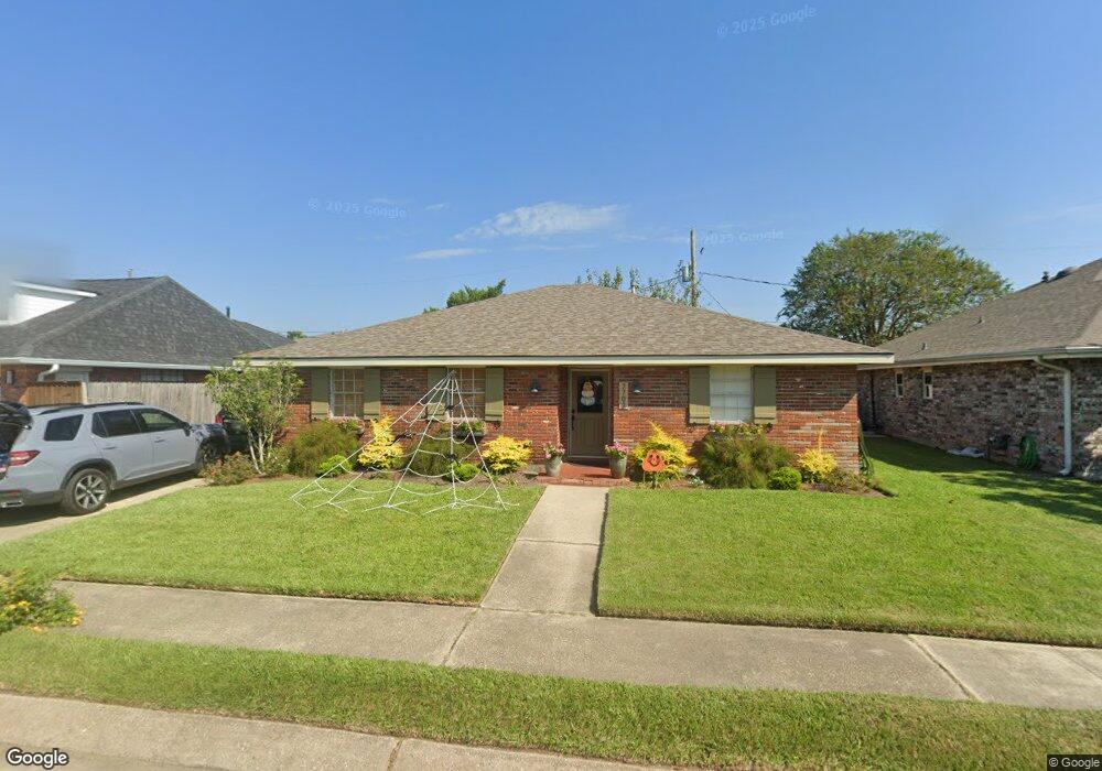
7701 Norton Ave New Orleans, LA 70123
Estimated Value: $315,000 - $361,000
3
Beds
2
Baths
1,884
Sq Ft
$180/Sq Ft
Est. Value
About This Home
This home is located at 7701 Norton Ave, New Orleans, LA 70123 and is currently estimated at $338,963, approximately $179 per square foot. 7701 Norton Ave is a home located in Jefferson Parish with nearby schools including Harahan Elementary School, Airline Park Academy For Advanced Studies, and Greenfield Middle School.
Ownership History
Date
Name
Owned For
Owner Type
Purchase Details
Closed on
Mar 9, 2009
Sold by
Patterson Harold B
Bought by
Lavigne Brian
Current Estimated Value
Home Financials for this Owner
Home Financials are based on the most recent Mortgage that was taken out on this home.
Original Mortgage
$181,649
Outstanding Balance
$116,905
Interest Rate
5.36%
Mortgage Type
FHA
Estimated Equity
$222,058
Create a Home Valuation Report for This Property
The Home Valuation Report is an in-depth analysis detailing your home's value as well as a comparison with similar homes in the area
Home Values in the Area
Average Home Value in this Area
Purchase History
| Date | Buyer | Sale Price | Title Company |
|---|---|---|---|
| Lavigne Brian | $185,000 | -- |
Source: Public Records
Mortgage History
| Date | Status | Borrower | Loan Amount |
|---|---|---|---|
| Open | Lavigne Brian | $181,649 |
Source: Public Records
Tax History Compared to Growth
Tax History
| Year | Tax Paid | Tax Assessment Tax Assessment Total Assessment is a certain percentage of the fair market value that is determined by local assessors to be the total taxable value of land and additions on the property. | Land | Improvement |
|---|---|---|---|---|
| 2024 | $755 | $23,140 | $8,770 | $14,370 |
| 2023 | $1,691 | $21,410 | $8,770 | $12,640 |
| 2022 | $2,268 | $21,410 | $8,770 | $12,640 |
| 2021 | $2,117 | $21,410 | $8,770 | $12,640 |
| 2020 | $2,099 | $21,410 | $8,770 | $12,640 |
| 2019 | $1,930 | $19,240 | $8,770 | $10,470 |
| 2018 | $778 | $19,240 | $8,770 | $10,470 |
| 2017 | $1,621 | $19,240 | $8,770 | $10,470 |
| 2016 | $1,615 | $19,240 | $8,770 | $10,470 |
| 2015 | $737 | $18,500 | $8,770 | $9,730 |
| 2014 | $737 | $18,500 | $8,770 | $9,730 |
Source: Public Records
Map
Nearby Homes
- 0 Colonial Club Dr
- 98 Colonial Club Dr
- 240 Penfold Place
- 412 Stratford Dr
- 7501 Wilson St
- 233 Penfold Place
- 509 Kenmore Dr
- 420 Roseland Pkwy
- 201 Colonial Club Dr
- 333 Roseland Pkwy
- 447 Roseland Pkwy
- 212 Mayo Ave
- 471 Roseland Pkwy
- 200 MacQue Dr
- 194 Sedgefield Dr
- 328 Halsey Dr
- 350 Carolyn Dr
- 292 Halsey Dr
- 367 Carolyn Dr
- 8112 Ferrara Dr
- 7705 Norton Ave
- 7625 Norton Ave
- 7700 Wilson St
- 7700 Norton Ave
- 7706 Wilson St
- 7709 Norton Ave
- 7621 Norton Ave
- 7704 Norton Ave
- 7624 Norton Ave
- 7624 Wilson St
- 7712 Wilson St
- 7620 Norton Ave
- 7708 Norton Ave
- 7713 Norton Ave
- 7620 Wilson St
- 7617 Norton Ave
- 284 Anthony Ave
- 7716 Wilson St
- 44 Ferrara Dr
- 7616 Norton Ave