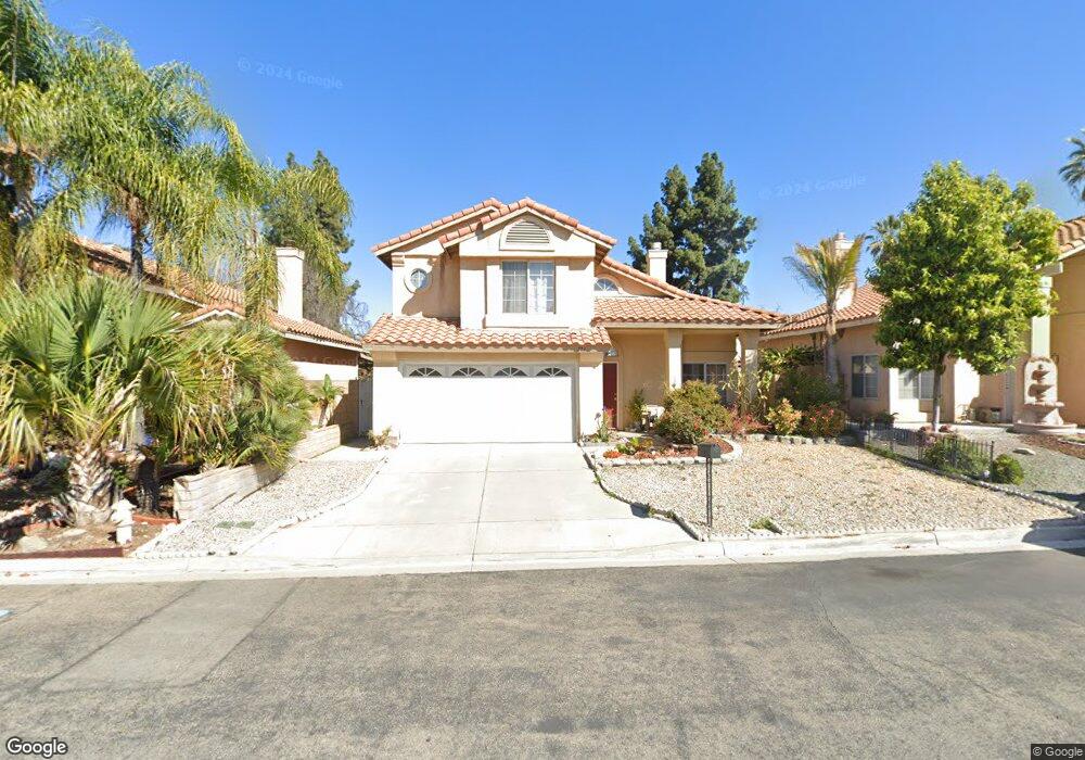
771 Bangor St Pomona, CA 91767
Pomona Valley NeighborhoodEstimated Value: $654,000 - $807,000
3
Beds
3
Baths
1,434
Sq Ft
$497/Sq Ft
Est. Value
About This Home
This home is located at 771 Bangor St, Pomona, CA 91767 and is currently estimated at $712,617, approximately $496 per square foot. 771 Bangor St is a home located in Los Angeles County with nearby schools including Barfield Elementary School, Palomares Academy Of Health Science, and Pomona High School.
Ownership History
Date
Name
Owned For
Owner Type
Purchase Details
Closed on
Sep 4, 2023
Sold by
Nguyen Hung and Nguyen Mai
Bought by
Nguyen-Ha Family Trust and Nguyen
Current Estimated Value
Purchase Details
Closed on
May 30, 2002
Sold by
Nguyen Hung and Nguyen Dan D
Bought by
Nguyen Hung
Home Financials for this Owner
Home Financials are based on the most recent Mortgage that was taken out on this home.
Original Mortgage
$120,000
Interest Rate
6.74%
Create a Home Valuation Report for This Property
The Home Valuation Report is an in-depth analysis detailing your home's value as well as a comparison with similar homes in the area
Home Values in the Area
Average Home Value in this Area
Purchase History
| Date | Buyer | Sale Price | Title Company |
|---|---|---|---|
| Nguyen-Ha Family Trust | -- | None Listed On Document | |
| Nguyen Hung | -- | Southland Title Corporation |
Source: Public Records
Mortgage History
| Date | Status | Borrower | Loan Amount |
|---|---|---|---|
| Previous Owner | Nguyen Hung | $120,000 |
Source: Public Records
Tax History Compared to Growth
Tax History
| Year | Tax Paid | Tax Assessment Tax Assessment Total Assessment is a certain percentage of the fair market value that is determined by local assessors to be the total taxable value of land and additions on the property. | Land | Improvement |
|---|---|---|---|---|
| 2025 | $3,720 | $291,986 | $144,277 | $147,709 |
| 2024 | $3,720 | $286,262 | $141,449 | $144,813 |
| 2023 | $3,644 | $280,650 | $138,676 | $141,974 |
| 2022 | $3,585 | $275,148 | $135,957 | $139,191 |
| 2021 | $3,498 | $269,754 | $133,292 | $136,462 |
| 2019 | $3,565 | $261,755 | $129,340 | $132,415 |
| 2018 | $3,277 | $256,623 | $126,804 | $129,819 |
| 2016 | $3,068 | $246,660 | $121,881 | $124,779 |
| 2015 | $3,041 | $242,956 | $120,051 | $122,905 |
| 2014 | $3,021 | $238,198 | $117,700 | $120,498 |
Source: Public Records
Map
Nearby Homes
- 2401 N Towne Ave
- 2196 Stocker St
- 720 Toluca Ave
- 2405 Highland Pines Rd
- 2410 N Towne Ave
- 2410 N Towne Ave Unit 63
- 2360 Lovejoy St
- 2415 Lovejoy St
- 2183 Sinclair St
- 2440 Merrywood St
- 1064 E La Verne Ave
- 370 E La Verne Ave
- 732 James Place
- 1936 Royalty Dr
- 1968 Miramar St
- 1924 Royalty Dr
- 1935 Royalty Dr
- 1934 Bobolink Way
- 1924 Bobolink Way
- 2178 Anne Place
- 765 Bangor St
- 781 Bangor St
- 759 Bangor St
- 787 Bangor St
- 2289 N San Antonio Ave
- 774 Bangor St
- 768 Bangor St
- 784 Bangor St
- 762 Bangor St
- 790 Bangor St
- 756 Bangor St
- 745 Bangor St
- 746 Bangor St
- 2246 N San Antonio Ave
- 2295 N San Antonio Ave
- 738 Bangor St
- 2270 N Towne Ave Unit 4
- 2270 N Towne Ave Unit 2
- 2270 N Towne Ave Unit 1
- 2238 N San Antonio Ave