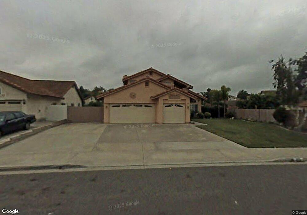
771 Corona Dr Oceanside, CA 92057
Guajome NeighborhoodEstimated Value: $1,011,312 - $1,120,000
4
Beds
3
Baths
2,180
Sq Ft
$493/Sq Ft
Est. Value
About This Home
This home is located at 771 Corona Dr, Oceanside, CA 92057 and is currently estimated at $1,073,828, approximately $492 per square foot. 771 Corona Dr is a home located in San Diego County with nearby schools including Alamosa Park Elementary School, Roosevelt Middle School, and Vista High School.
Ownership History
Date
Name
Owned For
Owner Type
Purchase Details
Closed on
Mar 24, 2025
Sold by
Courts Ronald W and Courts Christine E
Bought by
Ronald And Christine Courts Living Trust and Courts
Current Estimated Value
Purchase Details
Closed on
Dec 27, 1994
Sold by
Bankamerica National Trust Company
Bought by
Courts Ronald W and Courts Christine E
Home Financials for this Owner
Home Financials are based on the most recent Mortgage that was taken out on this home.
Original Mortgage
$177,990
Interest Rate
9.16%
Purchase Details
Closed on
Dec 6, 1994
Sold by
Sison Cornelio L and Sison Edith A
Bought by
Bankamerica National Trust Company
Home Financials for this Owner
Home Financials are based on the most recent Mortgage that was taken out on this home.
Original Mortgage
$177,990
Interest Rate
9.16%
Purchase Details
Closed on
Jul 12, 1989
Purchase Details
Closed on
Oct 21, 1988
Create a Home Valuation Report for This Property
The Home Valuation Report is an in-depth analysis detailing your home's value as well as a comparison with similar homes in the area
Home Values in the Area
Average Home Value in this Area
Purchase History
| Date | Buyer | Sale Price | Title Company |
|---|---|---|---|
| Ronald And Christine Courts Living Trust | -- | None Listed On Document | |
| Courts Ronald W | $175,000 | Stewart Title Company | |
| Bankamerica National Trust Company | $167,500 | Benefit Land Title Company | |
| -- | $258,900 | -- | |
| -- | $1,595,000 | -- |
Source: Public Records
Mortgage History
| Date | Status | Borrower | Loan Amount |
|---|---|---|---|
| Previous Owner | Courts Ronald W | $177,990 |
Source: Public Records
Tax History
| Year | Tax Paid | Tax Assessment Tax Assessment Total Assessment is a certain percentage of the fair market value that is determined by local assessors to be the total taxable value of land and additions on the property. | Land | Improvement |
|---|---|---|---|---|
| 2025 | $4,807 | $437,434 | $83,967 | $353,467 |
| 2024 | $4,807 | $428,858 | $82,321 | $346,537 |
| 2023 | $4,693 | $420,450 | $80,707 | $339,743 |
| 2022 | $4,679 | $412,207 | $79,125 | $333,082 |
| 2021 | $4,569 | $404,125 | $77,574 | $326,551 |
| 2020 | $3,095 | $267,982 | $76,779 | $191,203 |
| 2019 | $3,051 | $262,728 | $75,274 | $187,454 |
| 2018 | $2,907 | $257,578 | $73,799 | $183,779 |
| 2017 | $2,855 | $252,528 | $72,352 | $180,176 |
| 2016 | $2,790 | $247,578 | $70,934 | $176,644 |
| 2015 | $2,778 | $243,860 | $69,869 | $173,991 |
| 2014 | $2,713 | $239,084 | $68,501 | $170,583 |
Source: Public Records
Map
Nearby Homes
- 652 Montage Rd
- 761 Masters Dr
- 872 Oro Grande St
- 5010 Golondrina Way Unit 64
- 5005 Codorniz Way Unit 8
- 838 Masters Dr
- 1852 Red Willow Way
- 5524 Giovanni Way
- 4802 Baroque Terrace
- 997 Masters Dr
- 4791 Macadamia Ct
- 254 Saguaro Place
- 255 Flame Tree Place
- 1216 Woodview Dr
- 4885 Baroque Terrace
- 4743 Maclura St
- 209 Madison St
- 4733 Dalea Place
- 4877 Merida Way
- 4885 Merida Way
- 775 Corona Dr
- 5195 Winona Ct
- 5191 Winona Ct
- 766 Tawny Ct
- 5187 Winona Ct
- 762 Tawny Ct
- 776 Corona Dr
- 772 Corona Dr
- 758 Tawny Ct
- 5183 Winona Ct
- 5195 Silver Bluff Dr
- 5191 Silver Bluff Dr
- 768 Corona Dr
- 5203 Silver Bluff Dr
- 5198 Winona Ct
- 5187 Silver Bluff Dr
- 5194 Winona Ct
- 767 Puerto Oro Ct Unit 4
- 754 Tawny Ct
- 863 Puerto Oro Ct
Your Personal Tour Guide
Ask me questions while you tour the home.