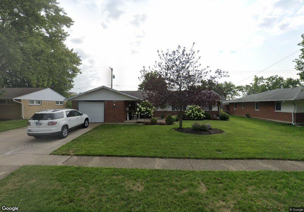
7712 Blackshear Dr Dayton, OH 45424
Estimated Value: $154,000 - $205,000
3
Beds
2
Baths
1,301
Sq Ft
$144/Sq Ft
Est. Value
About This Home
This home is located at 7712 Blackshear Dr, Dayton, OH 45424 and is currently estimated at $187,682, approximately $144 per square foot. 7712 Blackshear Dr is a home located in Montgomery County with nearby schools including Wayne High School and Huber Heights Christian Academy.
Ownership History
Date
Name
Owned For
Owner Type
Purchase Details
Closed on
Apr 11, 2007
Sold by
Fannie Mae
Bought by
Brown Sarah and Brown Sarah L
Current Estimated Value
Home Financials for this Owner
Home Financials are based on the most recent Mortgage that was taken out on this home.
Original Mortgage
$65,600
Outstanding Balance
$39,729
Interest Rate
6.18%
Mortgage Type
Purchase Money Mortgage
Estimated Equity
$147,953
Purchase Details
Closed on
Jan 26, 2007
Sold by
Williams Margaret S and Select Portfolio Servicing Inc
Bought by
Federal National Mortgage Association
Purchase Details
Closed on
Feb 10, 2000
Sold by
Williams Perry T and Williams Margaret S
Bought by
Williams Perry T and Williams Margaret S
Purchase Details
Closed on
Dec 21, 1994
Sold by
Garrett Anthony and Garrett Dayna
Bought by
Williams Perry T
Purchase Details
Closed on
Sep 2, 1994
Sold by
Garrett Dayna M
Bought by
Garrett Anthony and Garrett Dayna
Create a Home Valuation Report for This Property
The Home Valuation Report is an in-depth analysis detailing your home's value as well as a comparison with similar homes in the area
Home Values in the Area
Average Home Value in this Area
Purchase History
| Date | Buyer | Sale Price | Title Company |
|---|---|---|---|
| Brown Sarah | $82,000 | None Available | |
| Federal National Mortgage Association | $75,000 | None Available | |
| Williams Perry T | -- | -- | |
| Williams Perry T | -- | Equity Land Title Agency Inc | |
| Garrett Anthony | -- | -- |
Source: Public Records
Mortgage History
| Date | Status | Borrower | Loan Amount |
|---|---|---|---|
| Open | Brown Sarah | $65,600 |
Source: Public Records
Tax History Compared to Growth
Tax History
| Year | Tax Paid | Tax Assessment Tax Assessment Total Assessment is a certain percentage of the fair market value that is determined by local assessors to be the total taxable value of land and additions on the property. | Land | Improvement |
|---|---|---|---|---|
| 2024 | $2,561 | $49,640 | $10,150 | $39,490 |
| 2023 | $2,561 | $49,640 | $10,150 | $39,490 |
| 2022 | $2,238 | $34,200 | $7,000 | $27,200 |
| 2021 | $2,271 | $34,200 | $7,000 | $27,200 |
| 2020 | $2,273 | $34,200 | $7,000 | $27,200 |
| 2019 | $2,216 | $29,480 | $7,000 | $22,480 |
| 2018 | $2,224 | $29,480 | $7,000 | $22,480 |
| 2017 | $2,209 | $29,480 | $7,000 | $22,480 |
| 2016 | $2,092 | $27,200 | $7,000 | $20,200 |
| 2015 | $2,066 | $27,200 | $7,000 | $20,200 |
| 2014 | $2,066 | $27,200 | $7,000 | $20,200 |
| 2012 | -- | $29,810 | $8,750 | $21,060 |
Source: Public Records
Map
Nearby Homes
- 7833 Harshmanville Rd
- 7866 Harshmanville Rd
- 7500 Mount Ranier Unit 12077
- 6150 Taylorsville Rd
- 6447 Highbury Rd
- 7371 Damascus Dr
- 5580 Clagston Ct
- 6089 Green Knolls Dr
- 5582 Camerford Dr
- 6681 Spokane Dr
- 8282 Briar Ridge Ct
- 8436 Indian Mound Dr
- 6701 Springport Way
- 6605 Highbury Rd
- 6219 Beacon Tree Ct
- 7126 Mandrake Dr
- 6601 Grovehill Dr
- 6245 Longford Rd
- 6334 Shull Rd
- 7315 Glengate Ct
- 7718 Blackshear Dr
- 7706 Blackshear Dr
- 7713 Harshmanville Rd
- 7707 Harshmanville Rd
- 7719 Harshmanville Rd
- 7724 Blackshear Dr
- 7700 Blackshear Dr
- 7715 Blackshear Dr
- 7709 Blackshear Dr
- 7701 Harshmanville Rd
- 7725 Harshmanville Rd
- 7721 Blackshear Dr
- 7703 Blackshear Dr
- 7730 Blackshear Dr
- 7642 Blackshear Dr
- 7649 Harshmanville Rd
- 7731 Harshmanville Rd
- 7645 Blackshear Dr
- 7727 Blackshear Dr
- 7712 Harshmanville Rd