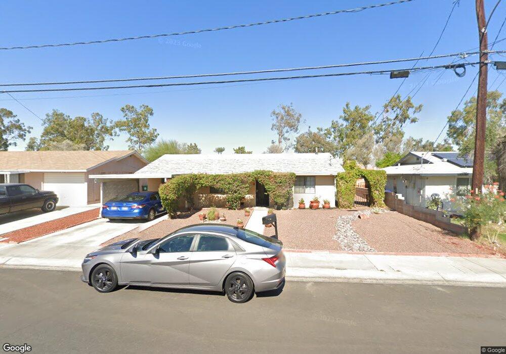
77130 Michigan Dr Palm Desert, CA 92211
Estimated Value: $329,000 - $464,000
3
Beds
2
Baths
1,500
Sq Ft
$273/Sq Ft
Est. Value
About This Home
This home is located at 77130 Michigan Dr, Palm Desert, CA 92211 and is currently estimated at $409,180, approximately $272 per square foot. 77130 Michigan Dr is a home located in Riverside County with nearby schools including Gerald R. Ford Elementary School, Colonel Mitchell Paige Middle School, and Palm Desert High School.
Ownership History
Date
Name
Owned For
Owner Type
Purchase Details
Closed on
Sep 27, 2000
Sold by
Luyties William H and Luyties Claudia D
Bought by
Esposito Joe F and Esposito Francine D
Current Estimated Value
Home Financials for this Owner
Home Financials are based on the most recent Mortgage that was taken out on this home.
Original Mortgage
$104,141
Interest Rate
7.82%
Mortgage Type
FHA
Create a Home Valuation Report for This Property
The Home Valuation Report is an in-depth analysis detailing your home's value as well as a comparison with similar homes in the area
Home Values in the Area
Average Home Value in this Area
Purchase History
| Date | Buyer | Sale Price | Title Company |
|---|---|---|---|
| Esposito Joe F | $105,000 | Southland Title |
Source: Public Records
Mortgage History
| Date | Status | Borrower | Loan Amount |
|---|---|---|---|
| Previous Owner | Esposito Joe F | $104,141 |
Source: Public Records
Tax History Compared to Growth
Tax History
| Year | Tax Paid | Tax Assessment Tax Assessment Total Assessment is a certain percentage of the fair market value that is determined by local assessors to be the total taxable value of land and additions on the property. | Land | Improvement |
|---|---|---|---|---|
| 2025 | $2,910 | $179,096 | $39,539 | $139,557 |
| 2023 | $2,910 | $172,143 | $38,004 | $134,139 |
| 2022 | $2,682 | $168,768 | $37,259 | $131,509 |
| 2021 | $2,614 | $165,460 | $36,529 | $128,931 |
| 2020 | $2,574 | $163,764 | $36,155 | $127,609 |
| 2019 | $2,530 | $160,554 | $35,447 | $125,107 |
| 2018 | $2,487 | $157,406 | $34,753 | $122,653 |
| 2017 | $2,439 | $154,321 | $34,072 | $120,249 |
| 2016 | $2,388 | $151,296 | $33,404 | $117,892 |
| 2015 | $2,377 | $149,025 | $32,903 | $116,122 |
| 2014 | $2,202 | $146,108 | $32,259 | $113,849 |
Source: Public Records
Map
Nearby Homes
- 77178 Pauma Valley Way
- 77190 Minnesota Ave
- 77050 Pauma Valley Way
- 41934 Preston Trail
- 41811 Kansas St
- 77235 Minnesota Ave
- 42265 Wisconsin Ave
- 42440 Kansas St
- 41968 Preston Trail
- 76955 Turendot St
- 41537 Princeville Ln
- 42405 Turqueries Ave
- 77322 Missouri Dr
- 41531 Peach Tree Ct
- 77380 Minnesota Ave
- 41806 Jupiter Hills Ct
- 41451 Kansas St
- 76895 Morocco Rd
- 42660 Iowa St
- 42660 Wisconsin Ave
- 77120 Michigan Dr
- 77140 Michigan Dr
- 77110 Michigan Dr
- 77150 Michigan Dr
- 77135 Michigan Dr
- 77125 Michigan Dr
- 77145 Michigan Dr
- 77100 Michigan Dr
- 77160 Michigan Dr
- 77115 Michigan Dr
- 77155 Michigan Dr
- 77160 Pauma Valley Way Unit 17-20
- 77160 Pauma Valley Way
- 77166 Pauma Valley Way Unit 16-20
- 77166 Pauma Valley Way
- 77154 Pauma Valley Way
- 77090 Michigan Dr
- 77105 Michigan Dr
- 77170 Michigan Dr
- 77170 Pauma Valley Way