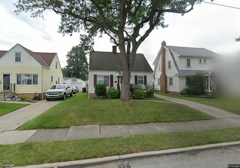
7715 Lanyard Dr Cleveland, OH 44129
Estimated Value: $184,000 - $213,000
3
Beds
2
Baths
1,170
Sq Ft
$172/Sq Ft
Est. Value
About This Home
This home is located at 7715 Lanyard Dr, Cleveland, OH 44129 and is currently estimated at $200,666, approximately $171 per square foot. 7715 Lanyard Dr is a home located in Cuyahoga County with nearby schools including Renwood Elementary School, Thoreau Park Elementary School, and Greenbriar Middle School.
Ownership History
Date
Name
Owned For
Owner Type
Purchase Details
Closed on
Jul 27, 1989
Sold by
Cowie George
Bought by
Summers David A
Current Estimated Value
Purchase Details
Closed on
Dec 6, 1979
Sold by
Cowie George and Cowie Ida E
Bought by
Cowie George
Purchase Details
Closed on
Jan 1, 1975
Bought by
Cowie George and Cowie Ida E
Create a Home Valuation Report for This Property
The Home Valuation Report is an in-depth analysis detailing your home's value as well as a comparison with similar homes in the area
Home Values in the Area
Average Home Value in this Area
Purchase History
| Date | Buyer | Sale Price | Title Company |
|---|---|---|---|
| Summers David A | $58,500 | -- | |
| Cowie George | -- | -- | |
| Cowie George | -- | -- |
Source: Public Records
Tax History Compared to Growth
Tax History
| Year | Tax Paid | Tax Assessment Tax Assessment Total Assessment is a certain percentage of the fair market value that is determined by local assessors to be the total taxable value of land and additions on the property. | Land | Improvement |
|---|---|---|---|---|
| 2024 | $3,564 | $58,380 | $10,710 | $47,670 |
| 2023 | $3,222 | $45,400 | $9,450 | $35,950 |
| 2022 | $3,191 | $45,400 | $9,450 | $35,950 |
| 2021 | $3,283 | $45,400 | $9,450 | $35,950 |
| 2020 | $2,875 | $34,930 | $7,280 | $27,650 |
| 2019 | $2,754 | $99,800 | $20,800 | $79,000 |
| 2018 | $2,770 | $34,930 | $7,280 | $27,650 |
| 2017 | $2,598 | $30,460 | $6,270 | $24,190 |
| 2016 | $2,582 | $30,460 | $6,270 | $24,190 |
| 2015 | $2,474 | $30,460 | $6,270 | $24,190 |
| 2014 | $2,474 | $31,090 | $6,410 | $24,680 |
Source: Public Records
Map
Nearby Homes
- 6136 Ridge Rd
- 7503 Whittington Dr
- 6168 Manchester Rd
- 6227 Ridge Rd
- 6234 N Canterbury Rd
- 8017 Wainstead Dr
- 6111 Manchester Rd
- 6096 Wareham Dr
- 8017 Ackley Rd
- 6298 Chestnut Hills Dr
- 8514 Deerfield Dr
- 7014 Thornton Dr
- 7514 Spring Garden Rd
- 6610 Renwood Dr
- 7115 Hampstead Ave
- 6708 Thornton Dr
- 7615 Bertha Ave
- 5972 Westminster Dr
- 6510 Belmere Dr
- 6818 Hampstead Ave
- 7719 Lanyard Dr
- 7709 Lanyard Dr
- 7801 Lanyard Dr
- 7703 Lanyard Dr
- 6164 Holburn Rd
- 6170 Holburn Rd
- 7710 Pelham Dr
- 7716 Pelham Dr
- 7805 Lanyard Dr
- 7800 Pelham Dr
- 7714 Lanyard Dr
- 7615 Lanyard Dr
- 7710 Lanyard Dr
- 7809 Lanyard Dr
- 7804 Pelham Dr
- 7704 Lanyard Dr
- 7808 Pelham Dr
- 7618 Lanyard Dr
- 7813 Lanyard Dr
- 7614 Lanyard Dr