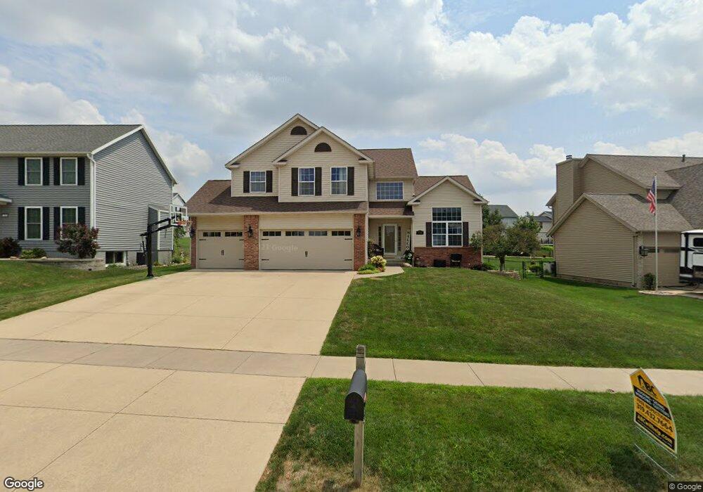
7718 Thorndale Dr NE Cedar Rapids, IA 52402
Estimated Value: $345,000 - $378,000
4
Beds
3
Baths
2,424
Sq Ft
$151/Sq Ft
Est. Value
About This Home
This home is located at 7718 Thorndale Dr NE, Cedar Rapids, IA 52402 and is currently estimated at $365,533, approximately $150 per square foot. 7718 Thorndale Dr NE is a home located in Linn County with nearby schools including Bowman Woods Elementary School, Oak Ridge School, and Linn-Mar High School.
Ownership History
Date
Name
Owned For
Owner Type
Purchase Details
Closed on
Feb 6, 2003
Sold by
Voss Gregory A
Bought by
Voss Gregory A and Voss Debra L
Current Estimated Value
Purchase Details
Closed on
Dec 12, 1997
Sold by
Midwest Development Co
Bought by
Voss Gregory A
Home Financials for this Owner
Home Financials are based on the most recent Mortgage that was taken out on this home.
Original Mortgage
$142,000
Interest Rate
7.35%
Mortgage Type
Balloon
Create a Home Valuation Report for This Property
The Home Valuation Report is an in-depth analysis detailing your home's value as well as a comparison with similar homes in the area
Home Values in the Area
Average Home Value in this Area
Purchase History
| Date | Buyer | Sale Price | Title Company |
|---|---|---|---|
| Voss Gregory A | -- | -- | |
| Voss Gregory A | $220,000 | -- |
Source: Public Records
Mortgage History
| Date | Status | Borrower | Loan Amount |
|---|---|---|---|
| Closed | Voss Gregory A | $142,000 |
Source: Public Records
Tax History Compared to Growth
Tax History
| Year | Tax Paid | Tax Assessment Tax Assessment Total Assessment is a certain percentage of the fair market value that is determined by local assessors to be the total taxable value of land and additions on the property. | Land | Improvement |
|---|---|---|---|---|
| 2025 | $6,424 | $338,600 | $62,200 | $276,400 |
| 2024 | $6,020 | $327,900 | $62,200 | $265,700 |
| 2023 | $6,020 | $327,900 | $62,200 | $265,700 |
| 2022 | $5,540 | $263,400 | $56,500 | $206,900 |
| 2021 | $5,694 | $250,200 | $52,800 | $197,400 |
| 2020 | $5,694 | $242,500 | $43,300 | $199,200 |
| 2019 | $5,362 | $230,800 | $43,300 | $187,500 |
| 2018 | $5,134 | $230,800 | $43,300 | $187,500 |
| 2017 | $5,350 | $233,500 | $43,300 | $190,200 |
| 2016 | $5,074 | $226,800 | $43,300 | $183,500 |
| 2015 | $5,012 | $223,793 | $26,375 | $197,418 |
| 2014 | $5,012 | $223,793 | $26,375 | $197,418 |
| 2013 | $4,846 | $223,793 | $26,375 | $197,418 |
Source: Public Records
Map
Nearby Homes
- 3310 Timber Ridge Ct
- 7320 Hampshire Dr NE
- 8901 Zeppelin Ave NE
- 226 Mccarran Ave NE
- 222 Mccarran Ave NE
- 219 Mccarran Ave NE
- 7415 Pin Tail Dr NE
- 342 Cambridge Dr NE
- 207 Meadows Field Dr NE
- 219 Meadows Field Dr NE
- 8800 Zeppelin Ave
- 7502 Summerset Ave NE
- 7599 Summerset Ave NE
- 1000 Hampshire Cir
- 1150 Bedford Ct
- 980 Hampshire Cir
- 960 Hampshire Cir
- 316 Sussex Dr NE
- 948 Hampshire Cir
- 803 73rd St NE
- 7714 Thorndale Dr NE
- 7802 Thorndale Dr NE
- 7709 Princeton Dr NE
- 7710 Thorndale Dr NE
- 7715 Princeton Dr NE
- 7703 Princeton Dr NE
- 7805 Thorndale Dr NE
- 7717 Thorndale Dr NE
- 7806 Thorndale Dr NE
- 7721 Princeton Dr NE
- 7706 Thorndale Dr NE
- 7625 Princeton Dr NE
- 7713 Thorndale Dr NE
- 7810 Thorndale Dr NE Unit 1089
- 7709 Thorndale Dr NE
- 7729 Princeton Dr NE
- 7702 Thorndale Dr NE
- 7619 Princeton Dr NE
- 7814 Thorndale Dr NE
- 7800 Winston Dr NE