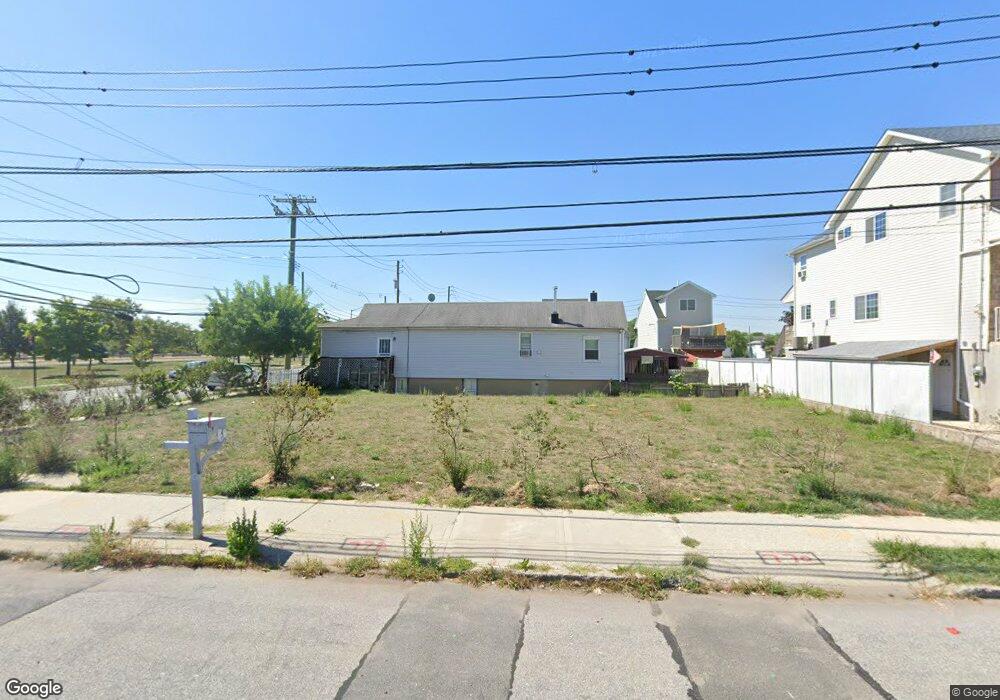
772 Seaview Ave Staten Island, NY 10305
Ocean Breeze NeighborhoodEstimated Value: $27,982 - $820,000
--
Bed
4
Baths
1,795
Sq Ft
$228/Sq Ft
Est. Value
About This Home
This home is located at 772 Seaview Ave, Staten Island, NY 10305 and is currently estimated at $409,746, approximately $228 per square foot. 772 Seaview Ave is a home located in Richmond County with nearby schools including P.S. 052 John C. Thompson, Is 2 George L Egbert, and New Dorp High School.
Ownership History
Date
Name
Owned For
Owner Type
Purchase Details
Closed on
Jul 30, 2020
Sold by
Housing Trust Fund Corporation
Bought by
August Edward
Current Estimated Value
Purchase Details
Closed on
Jan 11, 2017
Sold by
Denning Edward J
Bought by
Housing Trust Fund Corporation
Purchase Details
Closed on
Feb 14, 2000
Sold by
Manger Michelle B
Bought by
Denning Edward J
Create a Home Valuation Report for This Property
The Home Valuation Report is an in-depth analysis detailing your home's value as well as a comparison with similar homes in the area
Home Values in the Area
Average Home Value in this Area
Purchase History
| Date | Buyer | Sale Price | Title Company |
|---|---|---|---|
| August Edward | $22,599 | None Available | |
| Housing Trust Fund Corporation | -- | Commonwealth Land Title Insu | |
| Denning Edward J | -- | Commonwealth Land Title Ins |
Source: Public Records
Tax History Compared to Growth
Tax History
| Year | Tax Paid | Tax Assessment Tax Assessment Total Assessment is a certain percentage of the fair market value that is determined by local assessors to be the total taxable value of land and additions on the property. | Land | Improvement |
|---|---|---|---|---|
| 2025 | $422 | $2,454 | $2,225 | $229 |
| 2024 | $422 | $2,580 | $2,099 | $481 |
| 2023 | $402 | $2,226 | $2,226 | $0 |
| 2022 | $419 | $2,100 | $2,100 | $0 |
| 2021 | $467 | $2,220 | $2,220 | $0 |
| 2020 | $298 | $2,340 | $2,340 | $0 |
| 2019 | $0 | $2,460 | $2,460 | $0 |
| 2018 | $0 | $15,077 | $1,748 | $13,329 |
| 2017 | $0 | $14,224 | $1,973 | $12,251 |
| 2016 | $2,683 | $13,419 | $2,516 | $10,903 |
| 2015 | $2,430 | $12,660 | $2,400 | $10,260 |
| 2014 | $2,430 | $12,660 | $2,400 | $10,260 |
Source: Public Records
Map
Nearby Homes
- 762 Seaview Ave
- 0 Quincy Ave
- 000 Quincy Ave
- 431 Patterson Ave
- 602 Seaview Ave
- 795 Father Capodanno Blvd
- 797 Father Capodanno Blvd
- 799 Father Capodanno Blvd
- 498 Dongan Hills Ave
- 521 Buel Ave
- 517 Buel Ave
- 473 Dongan Hills Ave
- 467 Dongan Hills Ave
- 9 Iroquois St
- 929 Father Capodanno Blvd
- 197 Slater Blvd
- 00 Baden Place
- 0 Baden Place Unit 2503276
- 188 Graham Blvd Unit B
- 665 Hunter Ave
- 770 Seaview Ave
- 774 Seaview Ave
- 637 Oceanside Ave
- 768 Seaview Ave
- 639 Oceanside Ave
- 766 Seaview Ave
- 641 Oceanside Ave
- 764 Seaview Ave
- 643 Oceanside Ave
- 645 Oceanside Ave
- 737 Liberty Ave
- 647 Oceanside Ave
- 735 Liberty Ave
- 0 Oceanside Ave
- 733 Liberty Ave
- 760 Seaview Ave
- 649 Oceanside Ave
- 731 Liberty Ave
- 756 Seaview Ave
- 729 Liberty Ave