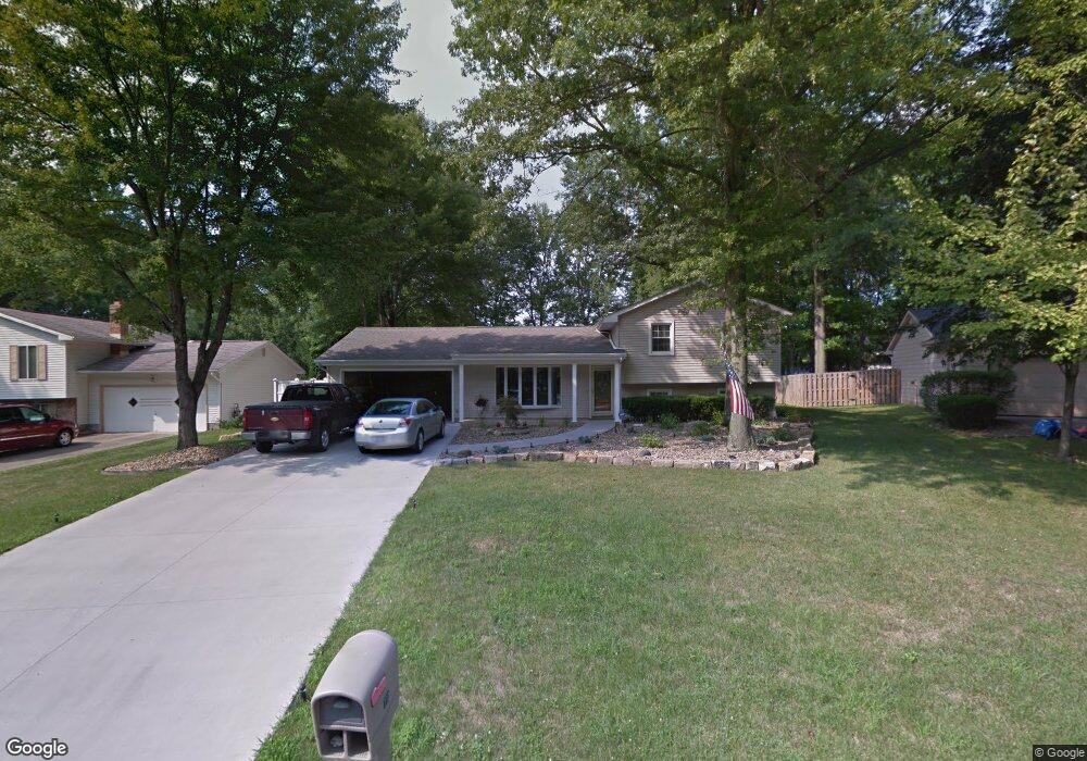
772 Squirrel Hill Ct Youngstown, OH 44512
Estimated Value: $356,000 - $391,000
4
Beds
3
Baths
2,346
Sq Ft
$160/Sq Ft
Est. Value
About This Home
This home is located at 772 Squirrel Hill Ct, Youngstown, OH 44512 and is currently estimated at $375,093, approximately $159 per square foot. 772 Squirrel Hill Ct is a home located in Mahoning County with nearby schools including Stadium Drive Elementary School, Boardman Center Middle School, and Boardman High School.
Ownership History
Date
Name
Owned For
Owner Type
Purchase Details
Closed on
Aug 12, 2005
Sold by
Scott Donna M
Bought by
Angeloff Gregory
Current Estimated Value
Home Financials for this Owner
Home Financials are based on the most recent Mortgage that was taken out on this home.
Original Mortgage
$165,000
Interest Rate
5.38%
Mortgage Type
Fannie Mae Freddie Mac
Purchase Details
Closed on
Nov 19, 1986
Bought by
Scott George S
Create a Home Valuation Report for This Property
The Home Valuation Report is an in-depth analysis detailing your home's value as well as a comparison with similar homes in the area
Home Values in the Area
Average Home Value in this Area
Purchase History
| Date | Buyer | Sale Price | Title Company |
|---|---|---|---|
| Angeloff Gregory | $215,000 | -- | |
| Scott George S | $20,300 | -- |
Source: Public Records
Mortgage History
| Date | Status | Borrower | Loan Amount |
|---|---|---|---|
| Closed | Angeloff Gregory | $165,000 |
Source: Public Records
Tax History Compared to Growth
Tax History
| Year | Tax Paid | Tax Assessment Tax Assessment Total Assessment is a certain percentage of the fair market value that is determined by local assessors to be the total taxable value of land and additions on the property. | Land | Improvement |
|---|---|---|---|---|
| 2024 | $5,252 | $103,460 | $14,280 | $89,180 |
| 2023 | $5,181 | $103,460 | $14,280 | $89,180 |
| 2022 | $5,053 | $77,200 | $14,460 | $62,740 |
| 2021 | $5,057 | $77,200 | $14,460 | $62,740 |
| 2020 | $5,083 | $77,200 | $14,460 | $62,740 |
| 2019 | $5,269 | $71,480 | $13,390 | $58,090 |
| 2018 | $4,525 | $71,480 | $13,390 | $58,090 |
| 2017 | $4,444 | $71,480 | $13,390 | $58,090 |
| 2016 | $4,366 | $68,330 | $13,390 | $54,940 |
| 2015 | $4,278 | $68,330 | $13,390 | $54,940 |
| 2014 | $4,291 | $68,330 | $13,390 | $54,940 |
| 2013 | $4,236 | $68,330 | $13,390 | $54,940 |
Source: Public Records
Map
Nearby Homes
- 7511 E Parkside Dr
- 7556 Jaguar Dr
- 7544 Jaguar Dr
- 7716 Silver Fox Dr
- 7603 Red Fox Dr
- 7784 Hitchcock Rd
- 7553 Glenwood Ave
- 0 Pinewood Dr Unit 5140025
- 179 Southwoods Ave
- 6938 Ron Park Place
- 7387 Oregon Trail
- 7367 Oregon Trail
- 2319 Hunters Ridge
- 1193 Red Tail Hawk Ct Unit 1
- 6632 Harrington Ave
- 1133 Red Tail Hawk Ct Unit 6
- 813 Brookfield Ave
- 6892 Glenwood Ave
- 7005 Paxton Rd
- 7851 Huntington Cir
- 772 Squirrel Hill Ct
- 766 Squirrel Hill Ct
- 780 Squirrel Hill Ct
- 780 Squirrel Hill Ct
- 758 Squirrel Hill Ct
- 790 Squirrel Hill Ct
- 745 Sabrina Dr
- 755 Sabrina Dr
- 735 Sabrina Dr
- 765 Sabrina Dr
- 779 Squirrel Hill Ct
- 765 Squirrel Hill Ct
- 771 Sabrina Dr
- 750 Squirrel Hill Ct
- 800 Squirrel Hill Ct
- 779 Sabrina Dr
- 757 Squirrel Hill Ct
- 787 Squirrel Hill Ct
- 723 Sabrina Dr
- 742 Squirrel Hill Ct