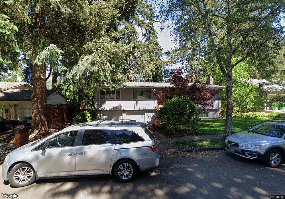
7720 SW 141st Ave Beaverton, OR 97008
Highland NeighborhoodEstimated Value: $624,000 - $653,000
4
Beds
3
Baths
2,120
Sq Ft
$302/Sq Ft
Est. Value
About This Home
This home is located at 7720 SW 141st Ave, Beaverton, OR 97008 and is currently estimated at $640,056, approximately $301 per square foot. 7720 SW 141st Ave is a home located in Washington County with nearby schools including Fir Grove Elementary School, Highland Park Middle School, and Southridge High School.
Ownership History
Date
Name
Owned For
Owner Type
Purchase Details
Closed on
Jul 22, 2009
Sold by
Nesius Robert A
Bought by
Macleod Daniel J and Macleod Vanessa
Current Estimated Value
Home Financials for this Owner
Home Financials are based on the most recent Mortgage that was taken out on this home.
Original Mortgage
$287,807
Outstanding Balance
$189,733
Interest Rate
5.59%
Mortgage Type
VA
Estimated Equity
$450,323
Purchase Details
Closed on
Nov 13, 2002
Sold by
Millar Alan D I and Millar Anne
Bought by
Nesius Robert A
Home Financials for this Owner
Home Financials are based on the most recent Mortgage that was taken out on this home.
Original Mortgage
$172,000
Interest Rate
5.95%
Purchase Details
Closed on
Aug 11, 1998
Sold by
Maher Thomas J and Maher Jennifer
Bought by
Millar Alan D I and Millar Anne
Home Financials for this Owner
Home Financials are based on the most recent Mortgage that was taken out on this home.
Original Mortgage
$156,000
Interest Rate
6.95%
Create a Home Valuation Report for This Property
The Home Valuation Report is an in-depth analysis detailing your home's value as well as a comparison with similar homes in the area
Home Values in the Area
Average Home Value in this Area
Purchase History
| Date | Buyer | Sale Price | Title Company |
|---|---|---|---|
| Macleod Daniel J | $281,750 | Chicago Title Insurance Co | |
| Nesius Robert A | $215,000 | Stewart Title | |
| Millar Alan D I | $195,100 | Chicago Title Insurance Co |
Source: Public Records
Mortgage History
| Date | Status | Borrower | Loan Amount |
|---|---|---|---|
| Open | Macleod Daniel J | $287,807 | |
| Previous Owner | Nesius Robert A | $172,000 | |
| Previous Owner | Millar Alan D I | $156,000 |
Source: Public Records
Tax History Compared to Growth
Tax History
| Year | Tax Paid | Tax Assessment Tax Assessment Total Assessment is a certain percentage of the fair market value that is determined by local assessors to be the total taxable value of land and additions on the property. | Land | Improvement |
|---|---|---|---|---|
| 2026 | $7,497 | $366,020 | -- | -- |
| 2025 | $7,497 | $355,360 | -- | -- |
| 2024 | $6,875 | $353,530 | -- | -- |
| 2023 | $6,875 | $325,300 | $0 | $0 |
| 2022 | $6,579 | $325,300 | $0 | $0 |
| 2021 | $6,349 | $306,640 | $0 | $0 |
| 2020 | $6,156 | $297,710 | $0 | $0 |
| 2019 | $5,961 | $289,040 | $0 | $0 |
| 2018 | $5,771 | $280,630 | $0 | $0 |
| 2017 | $5,556 | $272,460 | $0 | $0 |
| 2016 | $5,297 | $264,530 | $0 | $0 |
| 2015 | $5,107 | $256,830 | $0 | $0 |
| 2014 | $5,002 | $249,350 | $0 | $0 |
Source: Public Records
Map
Nearby Homes
- 14375 SW Wilson Dr
- 13820 SW Hart Rd
- 13525 SW Fircrest Ct
- 7135 SW Wilson Ave
- 13920 SW Secretariet Ln
- 7144 SW Murray Blvd Unit 107
- 8100 SW 147th Terrace
- 13465 SW Lancewood St
- 7116 SW Murray Blvd
- 13235 SW Barberry Dr
- 14320 SW Cherryhill Dr
- 8225 SW Gearhart Dr
- 7830 SW Murray Blvd
- 14775 SW Citrine Way
- 6939 SW 148th Ct
- 14770 SW Citrine Way
- 14350 SW 22nd St
- 8800 SW 147th Terrace Unit 103
- 13850 SW Martingale Ct
- 12720 SW Brockman St
- 7690 SW 141st Ave
- 7790 SW 141st Ave
- 7725 SW 140th Ave
- 7795 SW 140th Ave
- 7745 SW 141st Ave
- 7670 SW 141st Ave
- 14125 SW Wilson Dr
- 7675 SW 140th Ave
- 14125 SW Kimberly Dr
- 14150 SW Kimberly Dr
- 14090 SW Wilson Dr
- 14050 SW Wilson Dr
- 7650 SW 141st Ave
- 14155 SW Wilson Dr
- 7720 SW 140th Ave
- 7655 SW 140th Ave
- 7690 SW 140th Ave
- 14120 SW Wilson Dr
- 7790 SW 140th Ave
- 7670 SW 140th Ave