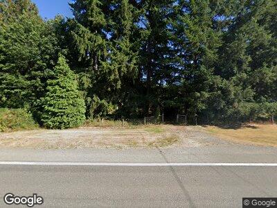
7721 State Route 92 Lake Stevens, WA 98258
Lochsloy NeighborhoodEstimated Value: $471,000 - $888,000
4
Beds
3
Baths
3,000
Sq Ft
$246/Sq Ft
Est. Value
About This Home
This home is located at 7721 State Route 92, Lake Stevens, WA 98258 and is currently estimated at $736,854, approximately $245 per square foot. 7721 State Route 92 is a home located in Snohomish County with nearby schools including Granite Falls High School.
Ownership History
Date
Name
Owned For
Owner Type
Purchase Details
Closed on
Apr 2, 2008
Sold by
Bakko Marvin D and Bakko Mary J
Bought by
Loth Leon and Loth Ronna
Current Estimated Value
Home Financials for this Owner
Home Financials are based on the most recent Mortgage that was taken out on this home.
Original Mortgage
$417,900
Interest Rate
6.22%
Mortgage Type
Purchase Money Mortgage
Create a Home Valuation Report for This Property
The Home Valuation Report is an in-depth analysis detailing your home's value as well as a comparison with similar homes in the area
Home Values in the Area
Average Home Value in this Area
Purchase History
| Date | Buyer | Sale Price | Title Company |
|---|---|---|---|
| Loth Leon | $597,000 | Multiple |
Source: Public Records
Mortgage History
| Date | Status | Borrower | Loan Amount |
|---|---|---|---|
| Open | Loth Leon | $398,400 | |
| Closed | Loth Leon | $417,900 | |
| Previous Owner | Bakko Marvin D | $250,000 | |
| Previous Owner | Bakko Marvin D | $250,000 |
Source: Public Records
Tax History Compared to Growth
Tax History
| Year | Tax Paid | Tax Assessment Tax Assessment Total Assessment is a certain percentage of the fair market value that is determined by local assessors to be the total taxable value of land and additions on the property. | Land | Improvement |
|---|---|---|---|---|
| 2025 | $3,075 | $344,300 | $42,900 | $301,400 |
| 2024 | $3,075 | $339,400 | $39,100 | $300,300 |
| 2023 | $3,133 | $372,700 | $44,100 | $328,600 |
| 2022 | $3,140 | $304,700 | $41,900 | $262,800 |
| 2020 | $3,130 | $257,500 | $30,800 | $226,700 |
| 2019 | $2,795 | $244,100 | $28,700 | $215,400 |
| 2018 | $3,129 | $235,800 | $31,100 | $204,700 |
| 2017 | $2,814 | $214,100 | $26,500 | $187,600 |
| 2016 | $2,861 | $207,300 | $24,300 | $183,000 |
| 2015 | $3,042 | $204,800 | $24,600 | $180,200 |
| 2013 | $2,836 | $170,000 | $21,500 | $148,500 |
Source: Public Records
Map
Nearby Homes
- 8216 158th Dr NE
- 8231 Washington 92
- 17616 72nd St NE
- 15026 64th St NE
- 17906 80th St NE
- 14017 66th St NE
- 8922 Pilchuck Tree Farm Rd
- 17 XXX Crooked Mile Rd
- 9912 146th Ave NE
- 18411 90th St NE
- 322 Raybird Ave
- 323 Raybird Ave
- 17705 Ashe Ct
- 413 Raybird Ave
- 415 Raybird Ave
- 8327 Skinner Rd
- 10015 Messner Ave
- 13410 94th St NE
- 4625 147th Ave NE
- 14823 43rd Place NE
- 7721 State Route 92
- 7603 State Route 92
- 7728 State Route 92
- 7812 State Route 92
- 7808 State Route 92
- 7517 State Route 92
- 7912 161st Ave NE
- 7925 161st Ave NE
- 7928 161st Ave NE
- 7805 State Route 92
- 7419 State Route 92
- 8019 161st Ave NE
- 8029 161st Ave NE
- 7327 State Route 92
- 8102 161st Ave NE
- 8107 161st Ave NE
- 15424 77th St NE
- 7315 State Route 92
- 16022 82nd St NE
- 15516 75th St NE
