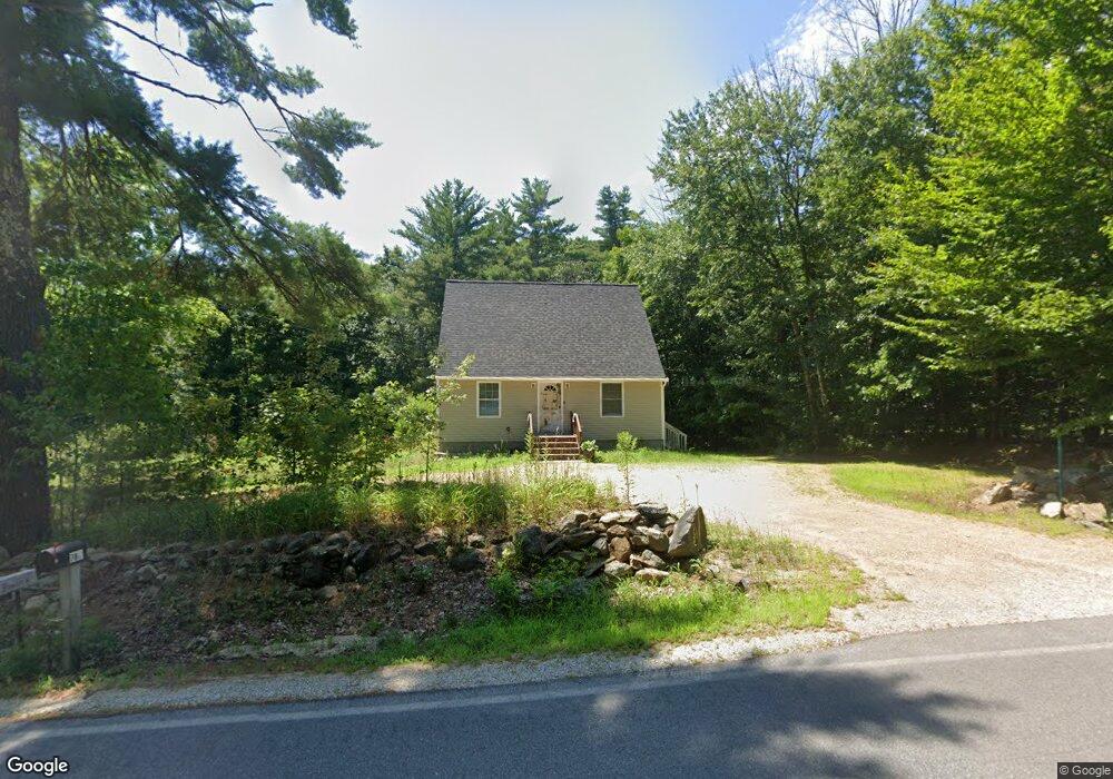
773 2nd Crown Point Rd Strafford, NH 03884
Estimated Value: $468,410 - $507,000
3
Beds
3
Baths
1,365
Sq Ft
$355/Sq Ft
Est. Value
About This Home
This home is located at 773 2nd Crown Point Rd, Strafford, NH 03884 and is currently estimated at $485,103, approximately $355 per square foot. 773 2nd Crown Point Rd is a home located in Strafford County with nearby schools including Strafford School and Coe-Brown Northwood Academy.
Ownership History
Date
Name
Owned For
Owner Type
Purchase Details
Closed on
Jun 25, 2008
Sold by
Hawkins William J
Bought by
Helm Andrew
Current Estimated Value
Home Financials for this Owner
Home Financials are based on the most recent Mortgage that was taken out on this home.
Original Mortgage
$14,000
Outstanding Balance
$9,032
Interest Rate
6.07%
Mortgage Type
Purchase Money Mortgage
Estimated Equity
$476,071
Create a Home Valuation Report for This Property
The Home Valuation Report is an in-depth analysis detailing your home's value as well as a comparison with similar homes in the area
Home Values in the Area
Average Home Value in this Area
Purchase History
| Date | Buyer | Sale Price | Title Company |
|---|---|---|---|
| Helm Andrew | $6,300 | -- | |
| Helm Andrew | $6,300 | -- |
Source: Public Records
Mortgage History
| Date | Status | Borrower | Loan Amount |
|---|---|---|---|
| Open | Helm Andrew | $14,000 | |
| Closed | Helm Andrew | $14,000 |
Source: Public Records
Tax History Compared to Growth
Tax History
| Year | Tax Paid | Tax Assessment Tax Assessment Total Assessment is a certain percentage of the fair market value that is determined by local assessors to be the total taxable value of land and additions on the property. | Land | Improvement |
|---|---|---|---|---|
| 2024 | $5,317 | $269,100 | $67,300 | $201,800 |
| 2023 | $5,016 | $269,100 | $67,300 | $201,800 |
| 2022 | $4,610 | $269,100 | $67,300 | $201,800 |
| 2021 | $4,960 | $268,700 | $67,300 | $201,400 |
| 2020 | $65 | $211,700 | $59,500 | $152,200 |
| 2019 | $67 | $211,700 | $59,500 | $152,200 |
| 2018 | $4,969 | $210,300 | $59,500 | $150,800 |
| 2016 | $4,469 | $210,300 | $59,500 | $150,800 |
| 2015 | $4,443 | $203,700 | $74,700 | $129,000 |
| 2014 | $4,718 | $203,700 | $74,700 | $129,000 |
| 2013 | $4,330 | $190,900 | $74,700 | $116,200 |
| 2012 | $3,878 | $173,300 | $74,700 | $98,600 |
Source: Public Records
Map
Nearby Homes
- 825 Second Crown Point Rd
- 0 Strafford Rd Unit 5057984
- 948 Strafford Rd
- 83 Sloper Rd
- 0 Sloper Rd Unit 6
- 243 Second Crown Point Rd
- 86 Long Shores Dr
- 38 Strafford Rd
- 68 Berry River Rd
- 57 Batchelder Ln
- 0 Long Shores Dr Unit 5057687
- 8 King Arthur Dr
- 00 Squire Rd
- TBD Merlin Rd
- 30 Avalon Rd
- Map 220 Lot 16 Four Rod Rd
- 163 Estes Rd
- 1226 First Crown Point Rd
- 28-1 Range Rd
- 217-13 Washington St
- TBD Second Crown Point Rd Unit Map 19 Lot 48-1
- 757 2nd Crown Point Rd
- 780 2nd Crown Point Rd
- 789 2nd Crown Point Rd
- 774 2nd Crown Point Rd
- 633-ABCDE Second Crown Point Rd
- 0 Second Crown Point Rd
- 796 2nd Crown Point Rd
- 750 2nd Crown Point Rd
- 801 2nd Crown Point Rd
- 758 2nd Crown Point Rd
- 736 2nd Crown Point Rd
- 818 2nd Crown Point Rd
- 730 2nd Crown Point Rd
- 825 2nd Crown Point Rd
- 48-1 Second Crown Point Rd
- 708 2nd Crown Point Rd
- 48-2 Second Crown Point Rd
- 837 2nd Crown Point Rd
- 844 Second Crown Point Rd