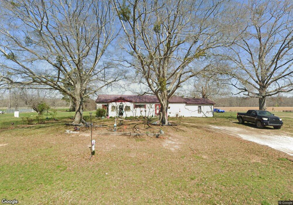
773 Henson Rd SW Cave Spring, GA 30124
Estimated Value: $216,435 - $322,000
--
Bed
2
Baths
1,774
Sq Ft
$158/Sq Ft
Est. Value
About This Home
This home is located at 773 Henson Rd SW, Cave Spring, GA 30124 and is currently estimated at $279,478, approximately $157 per square foot. 773 Henson Rd SW is a home located in Floyd County with nearby schools including Coosa Middle School and Coosa High School.
Ownership History
Date
Name
Owned For
Owner Type
Purchase Details
Closed on
Aug 19, 2022
Sold by
Menard Donna E
Bought by
Menard William Donald
Current Estimated Value
Purchase Details
Closed on
Oct 2, 2006
Sold by
Not Provided
Bought by
Menard Donna E
Home Financials for this Owner
Home Financials are based on the most recent Mortgage that was taken out on this home.
Original Mortgage
$37,000
Interest Rate
6.25%
Mortgage Type
New Conventional
Purchase Details
Closed on
Jan 30, 1995
Sold by
Chastain & Associates Inc
Bought by
Gosdin Larry J
Purchase Details
Closed on
Jan 18, 1995
Sold by
Sailors Jimmy D
Bought by
Chastain & Associates Inc
Purchase Details
Closed on
Dec 31, 1991
Sold by
Chastain Paul
Bought by
Sailors Jimmy D
Purchase Details
Closed on
Sep 25, 1990
Bought by
Chastain Paul
Create a Home Valuation Report for This Property
The Home Valuation Report is an in-depth analysis detailing your home's value as well as a comparison with similar homes in the area
Home Values in the Area
Average Home Value in this Area
Purchase History
| Date | Buyer | Sale Price | Title Company |
|---|---|---|---|
| Menard William Donald | -- | -- | |
| Menard Donna E | $25,500 | -- | |
| Gosdin Larry J | $52,000 | -- | |
| Chastain & Associates Inc | -- | -- | |
| Sailors Jimmy D | $30,000 | -- | |
| Chastain Paul | $1,000 | -- |
Source: Public Records
Mortgage History
| Date | Status | Borrower | Loan Amount |
|---|---|---|---|
| Previous Owner | Menard Donna E | $37,000 |
Source: Public Records
Tax History Compared to Growth
Tax History
| Year | Tax Paid | Tax Assessment Tax Assessment Total Assessment is a certain percentage of the fair market value that is determined by local assessors to be the total taxable value of land and additions on the property. | Land | Improvement |
|---|---|---|---|---|
| 2024 | $982 | $79,584 | $16,500 | $63,084 |
| 2023 | $798 | $68,536 | $15,000 | $53,536 |
| 2022 | $463 | $48,336 | $11,900 | $36,436 |
| 2021 | $440 | $40,169 | $10,824 | $29,345 |
| 2020 | $431 | $36,946 | $9,412 | $27,534 |
| 2019 | $920 | $35,135 | $9,412 | $25,723 |
| 2018 | $880 | $32,876 | $8,964 | $23,912 |
| 2017 | $842 | $31,118 | $8,300 | $22,818 |
| 2016 | $794 | $29,210 | $8,280 | $20,930 |
| 2015 | $779 | $29,210 | $8,280 | $20,930 |
| 2014 | $779 | $29,210 | $8,280 | $20,930 |
Source: Public Records
Map
Nearby Homes
- 2053 Buttermilk Rd SW
- 412 County Road 164
- 14365 U S 411
- 14365 Us Highway 411 N
- 907 Gadsden Rd SW
- 0 Rocky Hollow Rd Unit 25202567
- 12325 Us Highway 411 N
- 12325 U S 411
- 0 Melson Rd SW Unit 7676052
- 0 Melson Rd SW Unit 10636997
- 5598 Fosters Mill Rd
- 5677 Fosters Mill Rd SW
- 286 County Rd 28
- Lot 13 County Road 480
- 26.64 County Road 16
- 0 George Rd SW Unit 10567389
- 0 George Rd SW Unit 7618177
- 7 Herschel Mize Dr SW
- 7 Herschel Mize Dr
- 8203 Blacks Bluff Rd SW
- 750 Henson Rd SW Unit B19-026
- 750 Henson Rd SW
- 270 County Road 390 Rd
- 427 County Road 390
- 446 County Road 390
- 409 County Road 390
- 530 Henson Rd SW
- 3455 Co Rd 101
- 0 Buttermilk Rd SW Unit 8399955
- 0 Buttermilk Rd SW Unit 5924472
- 0 Buttermilk Rd SW Unit 8276691
- 0 Buttermilk Rd SW Unit 7 & 8 2841928
- 0 Buttermilk Rd SW Unit 25352785
- 0 Buttermilk Rd SW Unit 22437934
- 0 Buttermilk Rd SW Unit 7586673
- 0 Buttermilk Rd SW Unit 7605667
- 0 Buttermilk Rd SW Unit 3941916
- 0 Buttermilk Rd SW Unit 5645585
- 0 Buttermilk Rd SW Unit 8886214
- 0 Buttermilk Rd SW Unit 6806375