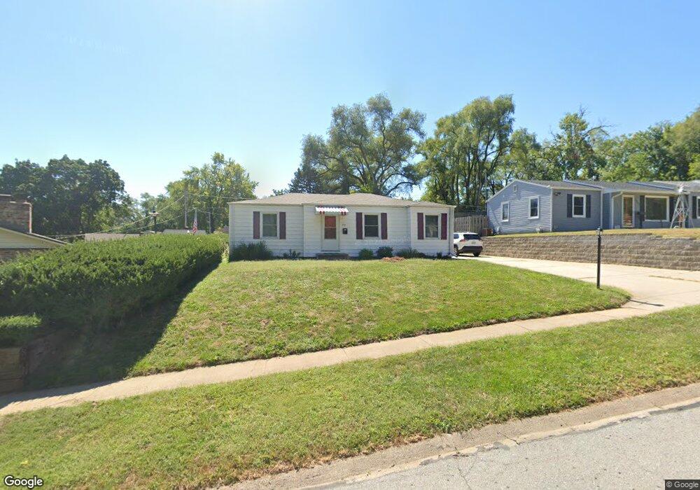
7731 Cuming Cir Omaha, NE 68114
West Central Omaha NeighborhoodEstimated Value: $173,729 - $189,000
3
Beds
1
Bath
954
Sq Ft
$191/Sq Ft
Est. Value
About This Home
This home is located at 7731 Cuming Cir, Omaha, NE 68114 and is currently estimated at $182,432, approximately $191 per square foot. 7731 Cuming Cir is a home located in Douglas County with nearby schools including Westbrook Elementary School, Westside Middle School, and Westside High School.
Ownership History
Date
Name
Owned For
Owner Type
Purchase Details
Closed on
Jul 23, 2010
Sold by
Secretary Of Housing & Urban Development
Bought by
Melia Hill Investment Group Llc
Current Estimated Value
Purchase Details
Closed on
Oct 13, 2009
Sold by
Midfirst Bank
Bought by
Secretary Of Housing & Urban Development
Purchase Details
Closed on
Jan 22, 2009
Sold by
Shirley Patricia A
Bought by
Midfirst Bank
Create a Home Valuation Report for This Property
The Home Valuation Report is an in-depth analysis detailing your home's value as well as a comparison with similar homes in the area
Home Values in the Area
Average Home Value in this Area
Purchase History
| Date | Buyer | Sale Price | Title Company |
|---|---|---|---|
| Melia Hill Investment Group Llc | -- | None Available | |
| Secretary Of Housing & Urban Development | -- | Fc Title | |
| Midfirst Bank | $105,516 | None Available |
Source: Public Records
Tax History Compared to Growth
Tax History
| Year | Tax Paid | Tax Assessment Tax Assessment Total Assessment is a certain percentage of the fair market value that is determined by local assessors to be the total taxable value of land and additions on the property. | Land | Improvement |
|---|---|---|---|---|
| 2024 | $2,955 | $156,300 | $20,800 | $135,500 |
| 2023 | $2,955 | $144,900 | $20,800 | $124,100 |
| 2022 | $2,775 | $126,800 | $20,800 | $106,000 |
| 2021 | $2,531 | $114,100 | $20,800 | $93,300 |
| 2020 | $2,575 | $114,100 | $20,800 | $93,300 |
| 2019 | $2,212 | $96,900 | $20,800 | $76,100 |
| 2018 | $2,109 | $92,100 | $20,800 | $71,300 |
| 2017 | $1,903 | $85,000 | $20,800 | $64,200 |
| 2016 | $1,596 | $71,700 | $7,500 | $64,200 |
| 2015 | $1,572 | $71,700 | $7,500 | $64,200 |
| 2014 | $1,572 | $71,700 | $7,500 | $64,200 |
Source: Public Records
Map
Nearby Homes
- 728 N 77th Ave
- 833 N 75th St
- 702 N 75th St
- 8324 Webster St
- 1629 Post Dr
- 8339 Izard St
- 533 N 72nd Ave
- 1741 Bowie Dr
- 602 N 85th St
- 1817 N 78th St
- 8539-8545 Underwood Ave
- 7401 Decatur St
- 8535 Cuming St
- 8549 Underwood Ave
- 7422 Schuyler Dr
- 1417 N 85th St
- 8525 Lafayette Ave
- 7437 Schuyler Dr
- 1106 N 87th St
- 7518 Blondo St
- 814 Cole Creek Dr
- 7735 Cuming Cir
- 7739 Cuming Cir
- 7732 Burt St
- 806 Cole Creek Dr
- 7732 Cuming Cir
- 7736 Burt St
- 906 Cole Creek Dr
- 7736 Cuming Cir
- 7743 Cuming Cir
- 7740 Burt St
- 7740 Cuming Cir
- 819 Cole Creek Dr
- 7748 Cuming Cir
- 815 Cole Creek Dr
- 811 Cole Creek Dr
- 914 Cole Creek Dr
- 903 Cole Creek Dr
- 807 Cole Creek Dr
- 7744 Burt St