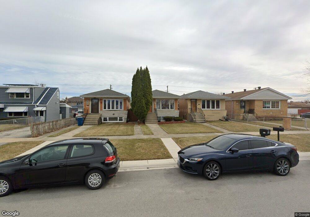
7739 Laramie Ave Burbank, IL 60459
Estimated Value: $285,000 - $324,000
4
Beds
2
Baths
1,000
Sq Ft
$306/Sq Ft
Est. Value
About This Home
This home is located at 7739 Laramie Ave, Burbank, IL 60459 and is currently estimated at $306,088, approximately $306 per square foot. 7739 Laramie Ave is a home located in Cook County with nearby schools including J.B. Kennedy Elementary School, Reavis High School, and St Albert the Great Catholic School.
Ownership History
Date
Name
Owned For
Owner Type
Purchase Details
Closed on
Jun 18, 1999
Sold by
Kasper Robert D and Kasper Catherine A
Bought by
Bomba Pawel and Bomba Danuta
Current Estimated Value
Home Financials for this Owner
Home Financials are based on the most recent Mortgage that was taken out on this home.
Original Mortgage
$119,700
Outstanding Balance
$31,829
Interest Rate
7.15%
Estimated Equity
$274,259
Create a Home Valuation Report for This Property
The Home Valuation Report is an in-depth analysis detailing your home's value as well as a comparison with similar homes in the area
Home Values in the Area
Average Home Value in this Area
Purchase History
| Date | Buyer | Sale Price | Title Company |
|---|---|---|---|
| Bomba Pawel | $126,000 | Heritage Title Company |
Source: Public Records
Mortgage History
| Date | Status | Borrower | Loan Amount |
|---|---|---|---|
| Open | Bomba Pawel | $119,700 |
Source: Public Records
Tax History Compared to Growth
Tax History
| Year | Tax Paid | Tax Assessment Tax Assessment Total Assessment is a certain percentage of the fair market value that is determined by local assessors to be the total taxable value of land and additions on the property. | Land | Improvement |
|---|---|---|---|---|
| 2024 | $6,108 | $19,857 | $2,755 | $17,102 |
| 2023 | $4,297 | $23,000 | $2,755 | $20,245 |
| 2022 | $4,297 | $14,564 | $2,393 | $12,171 |
| 2021 | $4,145 | $14,563 | $2,392 | $12,171 |
| 2020 | $4,080 | $14,563 | $2,392 | $12,171 |
| 2019 | $4,978 | $17,323 | $2,175 | $15,148 |
| 2018 | $4,834 | $17,323 | $2,175 | $15,148 |
| 2017 | $4,694 | $17,323 | $2,175 | $15,148 |
| 2016 | $4,062 | $14,027 | $1,812 | $12,215 |
| 2015 | $3,868 | $14,027 | $1,812 | $12,215 |
| 2014 | $3,770 | $14,027 | $1,812 | $12,215 |
| 2013 | $4,374 | $17,181 | $1,812 | $15,369 |
Source: Public Records
Map
Nearby Homes
- 7814 Leamington Ave
- 7840 Leclaire Ave
- 5120 W 79th St
- 5116 W 79th St
- 7701 Latrobe Ave
- 7810 S Lockwood Ave
- 7714 Lawler Ave
- 5304 W 79th St
- 5002 W 79th St
- 7714 Lavergne Ave
- 7657 Lawler Ave
- 7650 Lavergne Ave
- 7829 Laporte Ave
- 7832 Lamon Ave
- 7519 Latrobe Ave
- 7927 Lotus Ave
- 5009 Briartree Ln Unit 317
- 7707 Linder Ave
- 5023 W 81st St
- 8026 Linder Ave
- 7735 Laramie Ave
- 7755 Laramie Ave
- 7729 Laramie Ave
- 7729 Laramie Ave
- 7729 Laramie Ave
- 7759 Laramie Ave
- 7759 Laramie Ave
- 7727 Laramie Ave
- 7727 Laramie Ave
- 7736 Leamington Ave
- 7740 Leamington Ave
- 7732 Leamington Ave
- 7744 Leamington Ave
- 7725 Laramie Ave
- 7725 Laramie Ave
- 7728 Leamington Ave
- 7746 Laramie Ave
- 7746 Laramie Ave
- 7740 Laramie Ave
- 7740 Laramie Ave