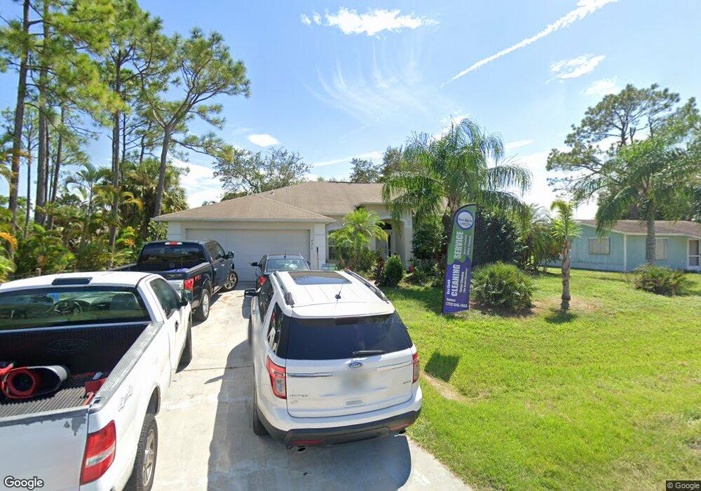
774 Rolling Hill Dr Sebastian, FL 32958
Sebastian Highlands NeighborhoodEstimated Value: $357,684 - $446,000
3
Beds
2
Baths
2,080
Sq Ft
$196/Sq Ft
Est. Value
About This Home
This home is located at 774 Rolling Hill Dr, Sebastian, FL 32958 and is currently estimated at $408,671, approximately $196 per square foot. 774 Rolling Hill Dr is a home located in Indian River County with nearby schools including Pelican Island Elementary School, Sebastian River Middle School, and Sebastian River High School.
Ownership History
Date
Name
Owned For
Owner Type
Purchase Details
Closed on
Aug 19, 2003
Sold by
Holiday Bldr Inc
Bought by
Campbell Patrick
Current Estimated Value
Home Financials for this Owner
Home Financials are based on the most recent Mortgage that was taken out on this home.
Original Mortgage
$17,500
Interest Rate
5.56%
Purchase Details
Closed on
Jun 21, 2003
Sold by
Wright Charles A
Bought by
Holiday Bldr Inc
Home Financials for this Owner
Home Financials are based on the most recent Mortgage that was taken out on this home.
Original Mortgage
$17,500
Interest Rate
5.56%
Create a Home Valuation Report for This Property
The Home Valuation Report is an in-depth analysis detailing your home's value as well as a comparison with similar homes in the area
Home Values in the Area
Average Home Value in this Area
Purchase History
| Date | Buyer | Sale Price | Title Company |
|---|---|---|---|
| Campbell Patrick | $10,500 | -- | |
| Holiday Bldr Inc | $10,500 | -- |
Source: Public Records
Mortgage History
| Date | Status | Borrower | Loan Amount |
|---|---|---|---|
| Previous Owner | Holiday Bldr Inc | $17,500 |
Source: Public Records
Tax History Compared to Growth
Tax History
| Year | Tax Paid | Tax Assessment Tax Assessment Total Assessment is a certain percentage of the fair market value that is determined by local assessors to be the total taxable value of land and additions on the property. | Land | Improvement |
|---|---|---|---|---|
| 2024 | $4,688 | $308,617 | $54,400 | $254,217 |
| 2023 | $4,688 | $259,703 | $0 | $0 |
| 2022 | $4,140 | $257,548 | $31,960 | $225,588 |
| 2021 | $3,790 | $214,630 | $31,960 | $182,670 |
| 2020 | $3,654 | $202,426 | $24,140 | $178,286 |
| 2019 | $3,588 | $202,426 | $24,140 | $178,286 |
| 2018 | $3,494 | $202,325 | $22,100 | $180,225 |
| 2017 | $3,213 | $182,936 | $0 | $0 |
| 2016 | $2,947 | $156,210 | $0 | $0 |
| 2015 | $2,763 | $137,490 | $0 | $0 |
| 2014 | $2,437 | $119,600 | $0 | $0 |
Source: Public Records
Map
Nearby Homes
- 795 Rolling Hill Dr
- 774 Belfast Terrace
- 1464 Laconia St
- 1625 Whitmore St
- 1361 Clearbrook St
- 1641 Seahouse St
- 1483 Bevan Dr
- 654 Cavern Terrace
- 1485 Bevan Dr
- 907 Starflower Ave
- 1401 Seahouse St
- 1381 Seahouse St
- 832 Majestic Ave
- 1628 Fatima Ct
- 665 Rolling Hill Dr
- 1685 Coral Reef St
- 561 Carnival Terrace
- 1371 Laconia St
- 932 Starflower Ave
- 1782 Laconia St Unit 11
- 778 Rolling Hill Dr
- 749 Periwinkle Dr
- 757 Periwinkle Dr
- 789 Rolling Hill Dr
- 785 Rolling Hill Dr
- 761 Periwinkle Dr
- 791 Rolling Hill Dr
- 762 Rolling Hill Dr
- 779 Rolling Hill Dr
- 741 Periwinkle Dr
- 765 Periwinkle Dr
- 762 Brookedge Terrace
- 793 Rolling Hill Dr
- 768 Brookedge Terrace
- 756 Brookedge Terrace
- 790 Rolling Hill Dr
- 1501 Ocean Cove St
- 774 Brookedge Terrace
- 750 Brookedge Terrace
- 737 Periwinkle Dr