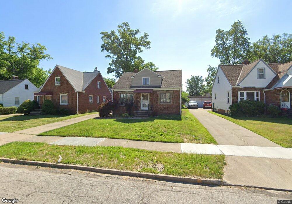
775 E 232nd St Euclid, OH 44123
Estimated Value: $137,000 - $156,000
3
Beds
2
Baths
1,331
Sq Ft
$111/Sq Ft
Est. Value
About This Home
This home is located at 775 E 232nd St, Euclid, OH 44123 and is currently estimated at $147,992, approximately $111 per square foot. 775 E 232nd St is a home located in Cuyahoga County with nearby schools including Arbor Elementary School, Euclid Middle School, and Euclid High School.
Ownership History
Date
Name
Owned For
Owner Type
Purchase Details
Closed on
Sep 18, 2020
Sold by
Pratt Darleen F
Bought by
775 E 232Nd St Llc
Current Estimated Value
Purchase Details
Closed on
Sep 11, 2020
Sold by
Pratt Darleen F and Kleinhenz Charles J
Bought by
Pratt Darleen F
Purchase Details
Closed on
Aug 26, 2015
Sold by
Serafin Carol A
Bought by
Kleinhenz Charles J and Pratt Darleen F
Purchase Details
Closed on
Nov 4, 1992
Sold by
Caimi Doris E
Bought by
Caimi Doris E Trustee
Purchase Details
Closed on
Jan 1, 1975
Bought by
Caimi Doris E
Create a Home Valuation Report for This Property
The Home Valuation Report is an in-depth analysis detailing your home's value as well as a comparison with similar homes in the area
Home Values in the Area
Average Home Value in this Area
Purchase History
| Date | Buyer | Sale Price | Title Company |
|---|---|---|---|
| 775 E 232Nd St Llc | $63,000 | Everest Land Title | |
| Pratt Darleen F | -- | Everest Land Title | |
| Kleinhenz Charles J | $52,000 | Enterprise Title Agency | |
| Caimi Doris E Trustee | -- | -- | |
| Caimi Doris E | -- | -- |
Source: Public Records
Tax History
| Year | Tax Paid | Tax Assessment Tax Assessment Total Assessment is a certain percentage of the fair market value that is determined by local assessors to be the total taxable value of land and additions on the property. | Land | Improvement |
|---|---|---|---|---|
| 2024 | $3,200 | $45,885 | $9,310 | $36,575 |
| 2023 | $1,987 | $22,050 | $7,350 | $14,700 |
| 2022 | $1,944 | $22,050 | $7,350 | $14,700 |
| 2021 | $2,169 | $22,050 | $7,350 | $14,700 |
| 2020 | $2,486 | $23,280 | $5,570 | $17,710 |
| 2019 | $2,238 | $66,500 | $15,900 | $50,600 |
| 2018 | $2,258 | $23,280 | $5,570 | $17,710 |
| 2017 | $2,298 | $19,750 | $3,680 | $16,070 |
| 2016 | $2,304 | $19,750 | $3,680 | $16,070 |
| 2015 | $1,204 | $19,750 | $3,680 | $16,070 |
| 2014 | $1,204 | $19,750 | $3,680 | $16,070 |
Source: Public Records
Map
Nearby Homes
- 797 Babbitt Rd Unit 15
- 22931 Arms Ave
- 22670 Arms Ave
- 22751 Fox Ave
- 521 Kenwood Dr Unit B-5
- 422 Clearview Dr Unit J10
- 21670 Crystal Ave
- 450 Kenwood Dr Unit D-12
- 450 Kenwood Dr Unit E12
- 421 Kenwood Dr Unit G
- 21481 Ball Ave
- 890 E 250th St
- 461 Kenwood Dr Unit T3
- 24431 Hartland Rd
- 934 E 223rd St
- 21250 Ball Ave
- 21170 Wilmore Ave
- 21181 Ball Ave
- 324 E 215th St
- 21051 Westport Ave
- 771 E 232nd St
- 777 E 232nd St
- 767 E 232nd St
- 781 E 232nd St
- 763 E 232nd St
- 780 E 236th St
- 790 E 236th St
- 790 E 236th St Unit E
- 774 E 236th St
- 774 E 236th St Unit 186
- 761 E 232nd St
- 774 E 232nd St
- 785 E 232nd St
- 778 E 232nd St
- 770 E 232nd St
- 766 E 232nd St
- 770 E 236th St
- 757 E 232nd St
- 806 E 236th St
- 764 E 232nd St
Your Personal Tour Guide
Ask me questions while you tour the home.