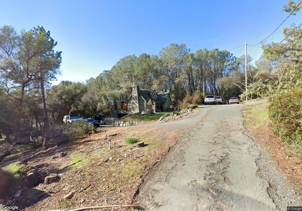
775 Lester Ln Auburn, CA 95603
Estimated Value: $454,000 - $512,781
3
Beds
1
Bath
1,205
Sq Ft
$399/Sq Ft
Est. Value
About This Home
This home is located at 775 Lester Ln, Auburn, CA 95603 and is currently estimated at $480,695, approximately $398 per square foot. 775 Lester Ln is a home located in Placer County with nearby schools including Placer High School, Bowman Charter School, and Alta Vista Community Charter.
Ownership History
Date
Name
Owned For
Owner Type
Purchase Details
Closed on
May 31, 2024
Sold by
Snyder Brent C and Snyder Joy
Bought by
Empire Processing Inc
Current Estimated Value
Home Financials for this Owner
Home Financials are based on the most recent Mortgage that was taken out on this home.
Original Mortgage
$379,400
Outstanding Balance
$374,623
Interest Rate
7.09%
Mortgage Type
New Conventional
Estimated Equity
$106,072
Purchase Details
Closed on
Dec 2, 2010
Sold by
Fannie Mae
Bought by
Snyder Brent C and Snyder Joy
Home Financials for this Owner
Home Financials are based on the most recent Mortgage that was taken out on this home.
Original Mortgage
$239,875
Interest Rate
4.18%
Mortgage Type
New Conventional
Purchase Details
Closed on
Oct 1, 2010
Sold by
Stark Laurie L
Bought by
Federal National Mortgage Association
Purchase Details
Closed on
Oct 19, 2005
Sold by
Stark Bradley W and Stark Laurie Lee
Bought by
Stark Laurie L
Home Financials for this Owner
Home Financials are based on the most recent Mortgage that was taken out on this home.
Original Mortgage
$268,000
Interest Rate
5.67%
Mortgage Type
Stand Alone Refi Refinance Of Original Loan
Purchase Details
Closed on
May 11, 1994
Sold by
Hammond Katherine Ann
Bought by
Stark Bradley W and Stark Laurie Lee
Home Financials for this Owner
Home Financials are based on the most recent Mortgage that was taken out on this home.
Original Mortgage
$93,100
Interest Rate
8.1%
Mortgage Type
Purchase Money Mortgage
Create a Home Valuation Report for This Property
The Home Valuation Report is an in-depth analysis detailing your home's value as well as a comparison with similar homes in the area
Home Values in the Area
Average Home Value in this Area
Purchase History
| Date | Buyer | Sale Price | Title Company |
|---|---|---|---|
| Empire Processing Inc | $287,000 | Placer Title | |
| Snyder Brent C | $252,500 | Old Republic Title Company | |
| Federal National Mortgage Association | $321,188 | Landsafe Title | |
| Stark Laurie L | -- | Chicago Title | |
| Stark Bradley W | $133,000 | Fidelity Title Co |
Source: Public Records
Mortgage History
| Date | Status | Borrower | Loan Amount |
|---|---|---|---|
| Open | Empire Processing Inc | $379,400 | |
| Previous Owner | Snyder Brent C | $239,875 | |
| Previous Owner | Stark Laurie L | $268,000 | |
| Previous Owner | Stark Bradley W | $93,100 |
Source: Public Records
Tax History Compared to Growth
Tax History
| Year | Tax Paid | Tax Assessment Tax Assessment Total Assessment is a certain percentage of the fair market value that is determined by local assessors to be the total taxable value of land and additions on the property. | Land | Improvement |
|---|---|---|---|---|
| 2025 | $3,359 | $292,740 | $122,400 | $170,340 |
| 2024 | $3,359 | $317,146 | $113,042 | $204,104 |
| 2023 | $1,620 | $310,928 | $110,826 | $200,102 |
| 2022 | $1,696 | $304,832 | $108,653 | $196,179 |
| 2021 | $1,630 | $298,856 | $106,523 | $192,333 |
| 2020 | $1,647 | $295,792 | $105,431 | $190,361 |
| 2019 | $3,033 | $289,993 | $103,364 | $186,629 |
| 2018 | $2,868 | $284,308 | $101,338 | $182,970 |
| 2017 | $2,815 | $278,734 | $99,351 | $179,383 |
| 2016 | $2,755 | $273,269 | $97,403 | $175,866 |
| 2015 | $2,687 | $269,165 | $95,940 | $173,225 |
| 2014 | $2,645 | $263,893 | $94,061 | $169,832 |
Source: Public Records
Map
Nearby Homes
- 0 Richards Ln Unit 225114570
- 0 Old Airport Rd Unit 225114571
- 1001 Old Airport Rd
- 371 Channel Hill Rd
- 12925 Mott Ct
- 1447 Love Way
- 209 Channel Hill Rd
- 120 Skipper Cove
- 190 Daniels Dr
- 655 Shockley Rd
- 739 Fisher Dr
- 1130 Summer Ridge Ct
- 1045 Fox Run Ct
- 1333 Wesley Ln
- 1825 Calloway Cir
- 1331 Wesley Ln
- 2505 Bramble Ct
- 2500 Bramble Ct
- 2510 Bramble Ct
- 12318 Pepperwood Cir Unit 228
- 770 Lester Ln
- 755 Lester Ln
- 765 Western Ln
- 750 Lester Ln
- 725 Lester Ln
- 675 Old Airport Rd
- 695 Old Airport Rd
- 565 Old Airport Rd
- 670 Old Airport Rd
- 0 Skyline Dr
- 545 Old Airport Rd
- 590 Old Airport Rd
- 0 Richards Ln Unit 222072662
- 0 Richards Ln Unit 19054737
- 12.6 Richards Ln
- 13700 Richards Ln
- 640 Brown Gables Rd
- 535 Old Airport Rd
- 550 Old Airport Rd
- 625 Keena Dr