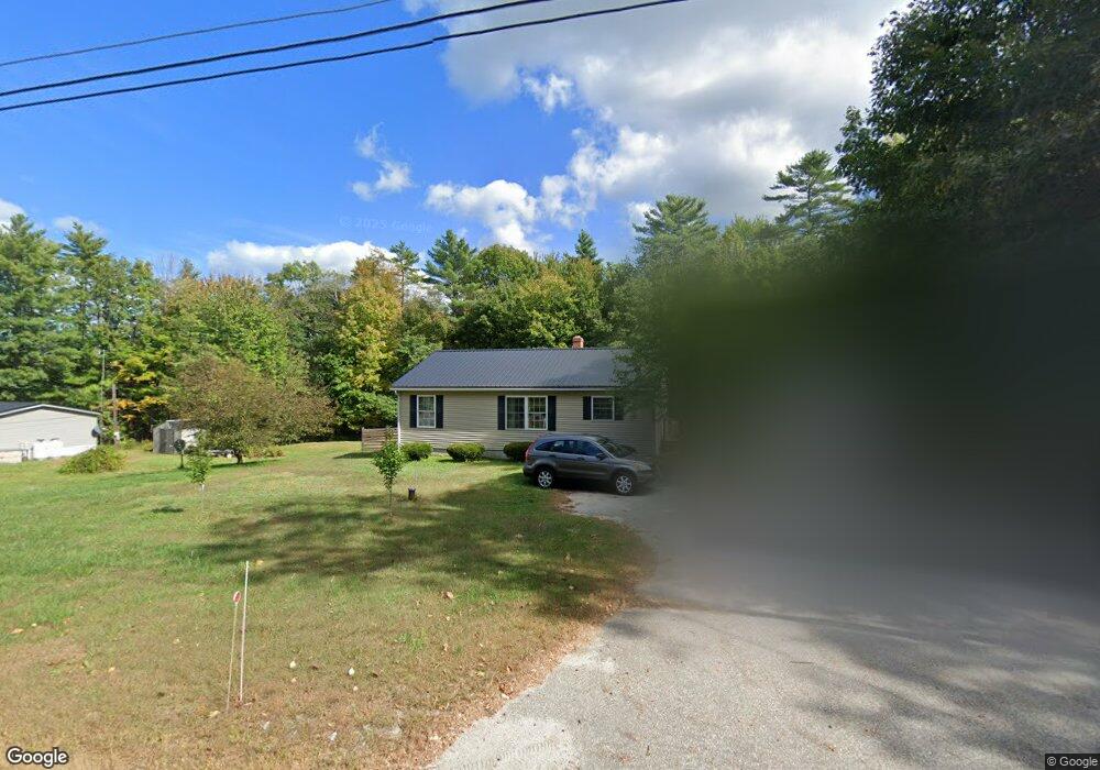
775 Lewiston Rd New Gloucester, ME 04260
Estimated Value: $384,666 - $439,000
3
Beds
2
Baths
1,120
Sq Ft
$362/Sq Ft
Est. Value
About This Home
This home is located at 775 Lewiston Rd, New Gloucester, ME 04260 and is currently estimated at $405,417, approximately $361 per square foot. 775 Lewiston Rd is a home located in Cumberland County with nearby schools including Gray-New Gloucester High School.
Ownership History
Date
Name
Owned For
Owner Type
Purchase Details
Closed on
May 14, 2021
Sold by
Diamond Developments Llc
Bought by
Mann Dawn
Current Estimated Value
Home Financials for this Owner
Home Financials are based on the most recent Mortgage that was taken out on this home.
Original Mortgage
$114,840
Outstanding Balance
$103,630
Interest Rate
3.1%
Mortgage Type
Purchase Money Mortgage
Estimated Equity
$301,787
Purchase Details
Closed on
May 16, 2005
Sold by
Goforth Wanda
Bought by
Goforth Wanda and Brown Michael C
Home Financials for this Owner
Home Financials are based on the most recent Mortgage that was taken out on this home.
Original Mortgage
$163,000
Interest Rate
6.05%
Mortgage Type
Purchase Money Mortgage
Create a Home Valuation Report for This Property
The Home Valuation Report is an in-depth analysis detailing your home's value as well as a comparison with similar homes in the area
Home Values in the Area
Average Home Value in this Area
Purchase History
| Date | Buyer | Sale Price | Title Company |
|---|---|---|---|
| Mann Dawn | -- | None Available | |
| Goforth Wanda | -- | -- |
Source: Public Records
Mortgage History
| Date | Status | Borrower | Loan Amount |
|---|---|---|---|
| Open | Mann Dawn | $114,840 | |
| Previous Owner | Goforth Wanda | $163,000 |
Source: Public Records
Tax History Compared to Growth
Tax History
| Year | Tax Paid | Tax Assessment Tax Assessment Total Assessment is a certain percentage of the fair market value that is determined by local assessors to be the total taxable value of land and additions on the property. | Land | Improvement |
|---|---|---|---|---|
| 2025 | $3,411 | $220,498 | $72,072 | $148,426 |
| 2024 | $3,283 | $220,498 | $72,072 | $148,426 |
| 2023 | $3,151 | $220,498 | $72,072 | $148,426 |
| 2022 | $3,043 | $220,498 | $72,072 | $148,426 |
| 2021 | $3,043 | $220,498 | $72,072 | $148,426 |
| 2020 | $3,010 | $220,498 | $72,072 | $148,426 |
| 2019 | $2,579 | $152,600 | $53,100 | $99,500 |
| 2018 | $2,411 | $152,600 | $53,100 | $99,500 |
| 2017 | $2,381 | $152,600 | $53,100 | $99,500 |
| 2016 | $2,243 | $152,600 | $53,100 | $99,500 |
| 2015 | $2,236 | $152,600 | $53,100 | $99,500 |
| 2014 | $2,213 | $152,600 | $53,100 | $99,500 |
| 2013 | $2,052 | $152,600 | $53,100 | $99,500 |
Source: Public Records
Map
Nearby Homes
- 164 Intervale Rd
- 10 Cobbs Bridge Rd
- 12 Country Charm Ln
- 160 Gloucester Hill Rd
- 22 Shaw Rd
- 24 Swamp Rd
- 271 Bennett Rd
- 155 & 151 Gloucester Hill Rd
- 0018-C Gloucester Hill Rd
- 10-56 C&E Bowdoin Way
- TBD Targett Rd
- 29 Rockwood Dr
- 200 Woodman Rd
- 14 Golden Way
- 161 Beaver Dam Dr
- 423 Sabbathday Rd
- 10 Spring Valley Ln
- 343 Shaker Rd
- 26 Carpenter Rd
- 832 Old Danville Rd
- 781 Lewiston Rd
- 769 Lewiston Rd
- 769B Lewiston Rd
- 770 Lewiston Rd
- 757 Lewiston Rd
- 6 Julias Way
- 792 Lewiston Rd
- 745 Lewiston Rd
- 753 Lewiston Rd
- 17 Julias Way Unit 19
- 800 Lewiston Rd
- 749 Lewiston Rd
- 739 Lewiston Rd
- 774 Lewiston Rd
- 2 Stone Wall Dr
- 6-57A Stonewall Dr
- Lot A S Route 100 Rd
- 0 Stone Wall Dr Unit 1371531
- 0 Stone Wall Dr Unit 1441553
- 00 Stone Wall Dr