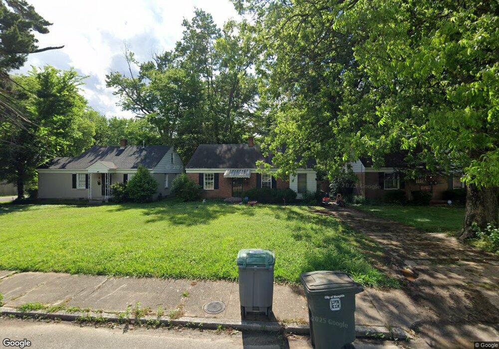
775 Loeb St Memphis, TN 38111
Audubon Park NeighborhoodEstimated Value: $142,970 - $173,000
2
Beds
1
Bath
944
Sq Ft
$172/Sq Ft
Est. Value
About This Home
This home is located at 775 Loeb St, Memphis, TN 38111 and is currently estimated at $162,493, approximately $172 per square foot. 775 Loeb St is a home located in Shelby County with nearby schools including Sherwood Elementary School, Sherwood Middle, and Melrose High School.
Ownership History
Date
Name
Owned For
Owner Type
Purchase Details
Closed on
May 31, 2017
Sold by
Mbl Investments
Bought by
Moss Stephen D
Current Estimated Value
Purchase Details
Closed on
May 27, 2010
Sold by
The Secretary Of Veterans Affairs
Bought by
Mbl Investments Llc
Purchase Details
Closed on
Jan 22, 2010
Sold by
Moore Joshua A
Bought by
The Secretary Of Veterans Affairs
Purchase Details
Closed on
Jun 28, 2002
Sold by
Koleini Hassan Kenneth and Rohani Sina
Bought by
Moore Joshua A
Home Financials for this Owner
Home Financials are based on the most recent Mortgage that was taken out on this home.
Original Mortgage
$82,620
Interest Rate
6.75%
Mortgage Type
VA
Purchase Details
Closed on
Feb 15, 2002
Sold by
Williams Karen Robell
Bought by
Koleini Hassan Kenneth and Rohani Sina
Create a Home Valuation Report for This Property
The Home Valuation Report is an in-depth analysis detailing your home's value as well as a comparison with similar homes in the area
Home Values in the Area
Average Home Value in this Area
Purchase History
| Date | Buyer | Sale Price | Title Company |
|---|---|---|---|
| Moss Stephen D | $100,000 | None Available | |
| Mbl Investments Llc | $58,000 | None Available | |
| The Secretary Of Veterans Affairs | $70,504 | None Available | |
| Moore Joshua A | $81,000 | -- | |
| Koleini Hassan Kenneth | $52,000 | -- |
Source: Public Records
Mortgage History
| Date | Status | Borrower | Loan Amount |
|---|---|---|---|
| Previous Owner | Moore Joshua A | $82,620 |
Source: Public Records
Tax History Compared to Growth
Tax History
| Year | Tax Paid | Tax Assessment Tax Assessment Total Assessment is a certain percentage of the fair market value that is determined by local assessors to be the total taxable value of land and additions on the property. | Land | Improvement |
|---|---|---|---|---|
| 2025 | $896 | $36,075 | $8,150 | $27,925 |
| 2024 | $896 | $26,425 | $6,525 | $19,900 |
| 2023 | $1,610 | $26,425 | $6,525 | $19,900 |
| 2022 | $1,610 | $26,425 | $6,525 | $19,900 |
| 2021 | $1,763 | $28,600 | $6,525 | $22,075 |
| 2020 | $1,619 | $22,350 | $6,525 | $15,825 |
| 2019 | $1,619 | $22,350 | $6,525 | $15,825 |
| 2018 | $1,619 | $22,350 | $6,525 | $15,825 |
| 2017 | $919 | $22,350 | $6,525 | $15,825 |
| 2016 | $930 | $21,275 | $0 | $0 |
| 2014 | $930 | $21,275 | $0 | $0 |
Source: Public Records
Map
Nearby Homes
- 765 Shotwell St
- 781 S Graham St
- 808 Shotwell St
- 803 Shotwell St
- 796 S Graham St
- 716 S Graham St
- 706 S Graham St
- 839 S Graham St
- 734 Watson St
- 3863 Spottswood Ave
- 3800 Marion Ave
- 3779 Spottswood Ave
- 3770 Kearney Ave
- 582 Watson St
- 572 Watson St
- 3739 Spottswood Ave
- 3725 Spottswood Ave
- 719 Echles St
- 991 McEvers Rd
- 955 Goodman St