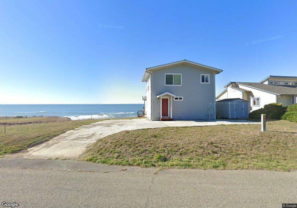
775 Lower Pacific Dr Whitethorn, CA 95589
Estimated Value: $397,977 - $557,000
2
Beds
2
Baths
1,362
Sq Ft
$345/Sq Ft
Est. Value
About This Home
This home is located at 775 Lower Pacific Dr, Whitethorn, CA 95589 and is currently estimated at $469,494, approximately $344 per square foot. 775 Lower Pacific Dr is a home located in Humboldt County.
Ownership History
Date
Name
Owned For
Owner Type
Purchase Details
Closed on
Jul 22, 2004
Sold by
Raffetto Danno R
Bought by
Jeepers Jamboree & Jeep Jamboree Inc
Current Estimated Value
Purchase Details
Closed on
Apr 9, 1997
Sold by
Smith Mark A and Smith Irene B
Bought by
Raffetto Danno R
Purchase Details
Closed on
May 23, 1989
Sold by
Smith Mark A and Smith Irene B
Bought by
Jeepers Jamboree & Jamboree Inc
Create a Home Valuation Report for This Property
The Home Valuation Report is an in-depth analysis detailing your home's value as well as a comparison with similar homes in the area
Purchase History
| Date | Buyer | Sale Price | Title Company |
|---|---|---|---|
| Jeepers Jamboree & Jeep Jamboree Inc | -- | -- | |
| Raffetto Danno R | $235,000 | Fidelity National Title Co | |
| Jeepers Jamboree & Jamboree Inc | -- | -- |
Source: Public Records
Tax History
| Year | Tax Paid | Tax Assessment Tax Assessment Total Assessment is a certain percentage of the fair market value that is determined by local assessors to be the total taxable value of land and additions on the property. | Land | Improvement |
|---|---|---|---|---|
| 2025 | $4,217 | $370,542 | $229,968 | $140,574 |
| 2024 | $4,217 | $363,277 | $225,459 | $137,818 |
| 2023 | $4,233 | $356,155 | $221,039 | $135,116 |
| 2022 | $4,171 | $349,172 | $216,705 | $132,467 |
| 2021 | $4,020 | $342,326 | $212,456 | $129,870 |
| 2020 | $4,043 | $338,817 | $210,278 | $128,539 |
| 2019 | $3,947 | $332,174 | $206,155 | $126,019 |
| 2018 | $3,883 | $325,662 | $202,113 | $123,549 |
| 2017 | $3,713 | $319,277 | $198,150 | $121,127 |
| 2016 | $3,692 | $313,017 | $194,265 | $118,752 |
| 2015 | $3,674 | $308,316 | $191,347 | $116,969 |
| 2014 | $3,521 | $302,277 | $187,599 | $114,678 |
Source: Public Records
Map
Nearby Homes
- 794 & 806 Lower Pacific Dr
- 126 Neptune Dr
- 75 Neptune Rd
- 23 Steelhead Ct
- 454 Lower Pacific Dr
- 806 Lower Pacific Dr
- 58 Lower Pacific Dr
- 680 Lower Pacific Dr
- 1325&1335 Upper Pacific Dr
- 36 Bambi Dr
- 6 Coral Point
- 16 Bambi Dr
- 554 Lower Pacific Dr
- 82 Fawn Dr
- 90 Fawn Dr
- 22 Spruce Ct
- 112 Seafoam Rd
- 60 Spruce Rd
- 142 Oceanview Rd
- 15 Seal Ct
- 755 Lower Pacific Dr
- 747 Lower Pacific Dr
- 52 Neptune Rd
- 42 Neptune Rd
- 64 Neptune Rd
- 78 Neptune Rd
- 5 Steelhead Ct
- 725 Lower Pacific Dr
- 13 Steelhead Ct
- 81 Neptune Rd
- 125 Neptune Rd
- 126 Neptune Rd
- 75 Neptune Dr
- 715 Lower Pacific Dr
- 93 Neptune Rd
- 6 Steelhead Ct
- 710 Lower Pacific Dr
- 849 Lower Pacific Dr
- 883 Lower Pacific Dr
- 0 Steelhead Ct
Your Personal Tour Guide
Ask me questions while you tour the home.