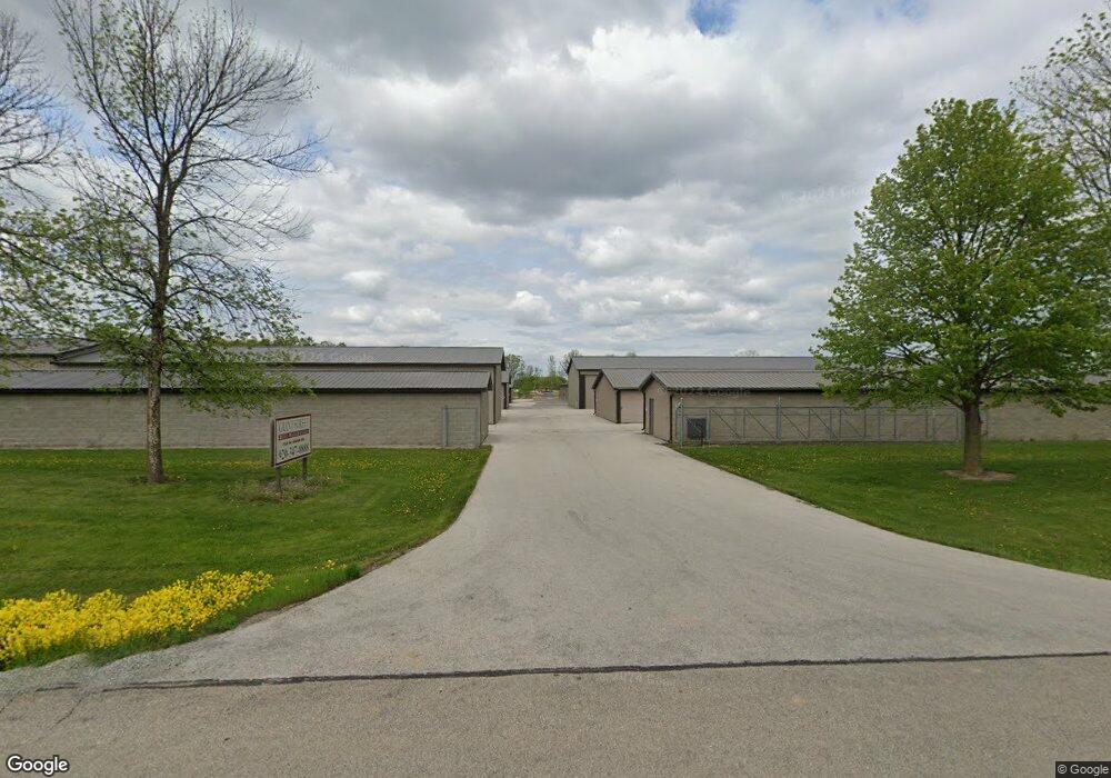
775 W Adam Dr de Pere, WI 54115
Estimated Value: $302,996 - $343,000
--
Bed
--
Bath
--
Sq Ft
5
Acres
About This Home
This home is located at 775 W Adam Dr, de Pere, WI 54115 and is currently estimated at $315,499. 775 W Adam Dr is a home located in Brown County with nearby schools including Hemlock Creek Elementary School, West De Pere Middle School, and West De Pere High School.
Ownership History
Date
Name
Owned For
Owner Type
Purchase Details
Closed on
May 5, 2006
Sold by
Devos Paula A and Vanfrachen Paula A
Bought by
Tollar Darrell D and Tollar Paula A
Current Estimated Value
Home Financials for this Owner
Home Financials are based on the most recent Mortgage that was taken out on this home.
Original Mortgage
$120,000
Interest Rate
6.39%
Mortgage Type
Fannie Mae Freddie Mac
Purchase Details
Closed on
Aug 17, 2005
Sold by
Tollar Paula A and Van Frachen Paula A
Bought by
Tollar Darrell and Tollar Paula A
Home Financials for this Owner
Home Financials are based on the most recent Mortgage that was taken out on this home.
Original Mortgage
$82,500
Interest Rate
5.89%
Mortgage Type
New Conventional
Create a Home Valuation Report for This Property
The Home Valuation Report is an in-depth analysis detailing your home's value as well as a comparison with similar homes in the area
Home Values in the Area
Average Home Value in this Area
Purchase History
| Date | Buyer | Sale Price | Title Company |
|---|---|---|---|
| Tollar Darrell D | -- | None Available | |
| Tollar Darrell | -- | -- |
Source: Public Records
Mortgage History
| Date | Status | Borrower | Loan Amount |
|---|---|---|---|
| Closed | Tollar Darrell D | $120,000 | |
| Closed | Tollar Darrell | $82,500 |
Source: Public Records
Tax History Compared to Growth
Tax History
| Year | Tax Paid | Tax Assessment Tax Assessment Total Assessment is a certain percentage of the fair market value that is determined by local assessors to be the total taxable value of land and additions on the property. | Land | Improvement |
|---|---|---|---|---|
| 2024 | $3,087 | $190,200 | $54,400 | $135,800 |
| 2023 | $2,912 | $190,200 | $54,400 | $135,800 |
| 2022 | $2,961 | $190,200 | $54,400 | $135,800 |
| 2021 | $2,964 | $190,200 | $54,400 | $135,800 |
| 2020 | $2,689 | $134,700 | $37,500 | $97,200 |
| 2019 | $2,592 | $134,700 | $37,500 | $97,200 |
| 2018 | $2,565 | $134,700 | $37,500 | $97,200 |
| 2017 | $2,573 | $134,700 | $37,500 | $97,200 |
| 2016 | $2,620 | $134,700 | $37,500 | $97,200 |
| 2015 | $2,778 | $134,700 | $37,500 | $97,200 |
| 2014 | $2,753 | $134,700 | $37,500 | $97,200 |
| 2013 | $2,753 | $134,700 | $37,500 | $97,200 |
Source: Public Records
Map
Nearby Homes
- 1689 W Main Cir Unit 2
- 0 Fernando Dr
- 1402 Crossroads Dr
- 3111 Ferndell Acres Dr
- 1463 Divinity Dr
- 1390 Crossroads Dr
- 1457 Divinity Dr
- 1451 Divinity Dr
- 1468 Divinity Dr
- 1435 Crossroads Dr
- 1441 Crossroads Dr
- 1424 Divinity Dr
- 1432 Crossroads Dr
- 1417 Crossroads Dr
- 1406 Divinity Dr
- 1411 Crossroads Dr
- 1405 Crossroads Dr
- 1414 Crossroads Dr
- 1408 Crossroads Dr
- 1403 Divinity Dr
- 500 W Adam Dr Unit BLOCK
- 500 W Adam Dr Unit BLOCK
- 700 W Adam Dr
- 774 W Adam Dr
- 710 W Adam Dr
- 2288 S Pine Tree Rd
- 685 W Adam Dr
- 2280 S Pine Tree Rd
- 2264 S Pine Tree Rd
- 2194 S Pine Tree Rd
- 943 W Adam Dr
- 586 W Adam Dr
- 580 W Adam Dr
- 1001 W Adam Dr
- 2140 S Pine Tree Rd
- 609 Silas Dr
- 2120 S Pine Tree Rd
- 581 Silas Dr
- 571 Silas Dr
- 1009 W Adam Dr
