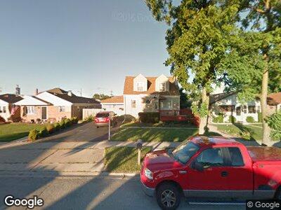
7753 Parkside Ave Burbank, IL 60459
Estimated Value: $268,000 - $343,000
4
Beds
2
Baths
1,561
Sq Ft
$197/Sq Ft
Est. Value
About This Home
This home is located at 7753 Parkside Ave, Burbank, IL 60459 and is currently estimated at $307,235, approximately $196 per square foot. 7753 Parkside Ave is a home located in Cook County with nearby schools including J.B. Kennedy Elementary School, Reavis High School, and St Albert the Great Catholic School.
Ownership History
Date
Name
Owned For
Owner Type
Purchase Details
Closed on
Jan 3, 2019
Sold by
Tomes Ross R and Tomes Idali
Bought by
Sheban
Current Estimated Value
Home Financials for this Owner
Home Financials are based on the most recent Mortgage that was taken out on this home.
Original Mortgage
$204,250
Outstanding Balance
$183,069
Interest Rate
4.7%
Mortgage Type
New Conventional
Estimated Equity
$99,606
Create a Home Valuation Report for This Property
The Home Valuation Report is an in-depth analysis detailing your home's value as well as a comparison with similar homes in the area
Home Values in the Area
Average Home Value in this Area
Purchase History
| Date | Buyer | Sale Price | Title Company |
|---|---|---|---|
| Sheban | $215,000 | Attorney |
Source: Public Records
Mortgage History
| Date | Status | Borrower | Loan Amount |
|---|---|---|---|
| Open | Sheban | $204,250 | |
| Previous Owner | Tomes Ross R | $15,000 | |
| Previous Owner | Tomes Ross R | $32,000 |
Source: Public Records
Tax History Compared to Growth
Tax History
| Year | Tax Paid | Tax Assessment Tax Assessment Total Assessment is a certain percentage of the fair market value that is determined by local assessors to be the total taxable value of land and additions on the property. | Land | Improvement |
|---|---|---|---|---|
| 2024 | $3,423 | $12,501 | $3,506 | $8,995 |
| 2023 | $3,423 | $12,501 | $3,506 | $8,995 |
| 2022 | $3,423 | $8,876 | $3,044 | $5,832 |
| 2021 | $3,275 | $8,875 | $3,044 | $5,831 |
| 2020 | $3,159 | $8,875 | $3,044 | $5,831 |
| 2019 | $3,009 | $8,816 | $2,767 | $6,049 |
| 2018 | $2,929 | $8,816 | $2,767 | $6,049 |
| 2017 | $3,517 | $10,487 | $2,767 | $7,720 |
| 2016 | $2,186 | $6,394 | $2,306 | $4,088 |
| 2015 | $2,083 | $6,394 | $2,306 | $4,088 |
| 2014 | $2,050 | $6,394 | $2,306 | $4,088 |
| 2013 | $1,899 | $6,685 | $2,306 | $4,379 |
Source: Public Records
Map
Nearby Homes
- 7744 Major Ave
- 7711 Massasoit Ave
- 7700 Massasoit Ave
- 7757 Linder Ave
- 7817 Menard Ave
- 7704 Monitor Ave
- 7927 Lotus Ave
- 7720 Lorel Ave
- 8026 Linder Ave
- 7616 S Lorel Ave
- 5922 W 75th Place
- 5721 W 81st St
- 5220 State Rd
- 5641 W 81st Place
- 5932 W 75th Place
- 5700 W 82nd St
- 5710 W 82nd St
- 8209 Central Ave
- 5640 W 82nd Place
- 5708 W 82nd Place
- 7753 Parkside Ave
- 7753 Parkside Ave
- 7749 Parkside Ave
- 7751 Parkside Ave
- 7745 Parkside Ave
- 7741 Parkside Ave
- 7744 Central Ave
- 7742 Central Ave
- 5600 W 78th St
- 5600 W 78th St
- 7740 Central Ave
- 7737 Parkside Ave
- 7736 Central Ave
- 7801 Parkside Ave
- 7732 Central Ave
- 7746 Parkside Ave
- 7748 Parkside Ave
- 7744 Parkside Ave
- 7728 Central Ave
- 7728 Central Ave