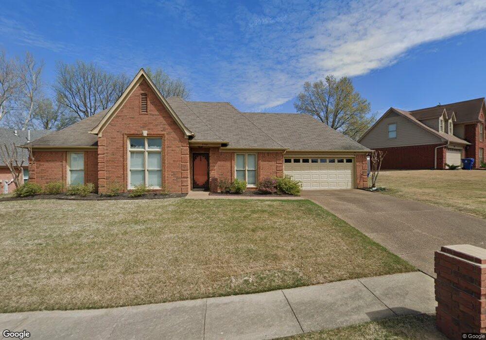
7760 Thunderstone Cir E Memphis, TN 38125
Southern Shelby County NeighborhoodEstimated Value: $248,000 - $295,000
4
Beds
3
Baths
2,190
Sq Ft
$124/Sq Ft
Est. Value
About This Home
This home is located at 7760 Thunderstone Cir E, Memphis, TN 38125 and is currently estimated at $272,233, approximately $124 per square foot. 7760 Thunderstone Cir E is a home located in Shelby County with nearby schools including Lowrance Elementary School, Southwind High School, and Power Center Academy - Southeast.
Ownership History
Date
Name
Owned For
Owner Type
Purchase Details
Closed on
Apr 15, 2025
Sold by
Byrd Caron D
Bought by
Caron Byrd Trust and Byrd
Current Estimated Value
Purchase Details
Closed on
Mar 22, 2006
Sold by
Byrd Eddie
Bought by
Byrd Caron D
Home Financials for this Owner
Home Financials are based on the most recent Mortgage that was taken out on this home.
Original Mortgage
$140,000
Interest Rate
6.25%
Mortgage Type
New Conventional
Purchase Details
Closed on
Jun 29, 1995
Bought by
Eddie Byrd and Eddie Caron D
Create a Home Valuation Report for This Property
The Home Valuation Report is an in-depth analysis detailing your home's value as well as a comparison with similar homes in the area
Home Values in the Area
Average Home Value in this Area
Purchase History
| Date | Buyer | Sale Price | Title Company |
|---|---|---|---|
| Caron Byrd Trust | -- | None Listed On Document | |
| Byrd Caron D | -- | None Available | |
| Eddie Byrd | $130,000 | -- |
Source: Public Records
Mortgage History
| Date | Status | Borrower | Loan Amount |
|---|---|---|---|
| Previous Owner | Byrd Caron D | $140,000 |
Source: Public Records
Tax History
| Year | Tax Paid | Tax Assessment Tax Assessment Total Assessment is a certain percentage of the fair market value that is determined by local assessors to be the total taxable value of land and additions on the property. | Land | Improvement |
|---|---|---|---|---|
| 2025 | $1,688 | $66,375 | $12,000 | $54,375 |
| 2024 | $1,688 | $49,800 | $8,300 | $41,500 |
| 2023 | $1,688 | $49,800 | $8,300 | $41,500 |
| 2022 | $1,688 | $49,800 | $8,300 | $41,500 |
| 2021 | $1,718 | $49,800 | $8,300 | $41,500 |
| 2020 | $1,536 | $37,925 | $8,300 | $29,625 |
| 2019 | $1,536 | $37,925 | $8,300 | $29,625 |
| 2018 | $1,536 | $37,925 | $8,300 | $29,625 |
| 2017 | $1,559 | $37,925 | $8,300 | $29,625 |
| 2016 | $1,498 | $34,275 | $0 | $0 |
| 2014 | $1,498 | $34,275 | $0 | $0 |
Source: Public Records
Map
Nearby Homes
- 7636 Lowrance Rd
- 7893 Collins Wood Cove
- 7680 Carter Creek Cove
- 4333 Rainey Woods Cove
- 4316 Barry Meadows Cove
- 7527 Wilsford Cove
- 4419 Berkley Woods Dr
- 4502 Sweet Whisper Cove
- 7519 Split Rail Cove
- 7743 Freehold Dr
- 7475 Kingsland Dr
- 7703 Driscoll St
- 4290 Creek Manor Ln
- 7271 Barnstable Rd
- 8254 Holston Dr
- 7440 Doncaster Ln
- 7345 Old Dominion Ct
- 7321 Stonington Dr
- 7266 Woodshire Rd
- 3652 Wincross Dr
- 7770 Thunderstone Cir E
- 7750 Thunderstone Cir E
- 7757 Thunderstone Cir E
- 7778 Thunderstone Cir E
- 7740 Thunderstone Cir E
- 4214 Thunderstone Cir W
- 7749 Meadowside Cove
- 7784 Thunderstone Cir E
- 4200 Thunderstone Cir W
- 7777 Thunderstone Cir E
- 7740 Meadowside Cove
- 4222 Thunderstone Cir W
- 7781 Thunderstone Cir E
- 7739 Meadowside Cove
- 7790 Thunderstone Cir E
- 4211 Thunderstone Cir W
- 4190 Thunderstone Cir W
- 4230 Thunderstone Cir W
- 4195 Thunderstone Cir W
- 7787 Thunderstone Cir E
Your Personal Tour Guide
Ask me questions while you tour the home.