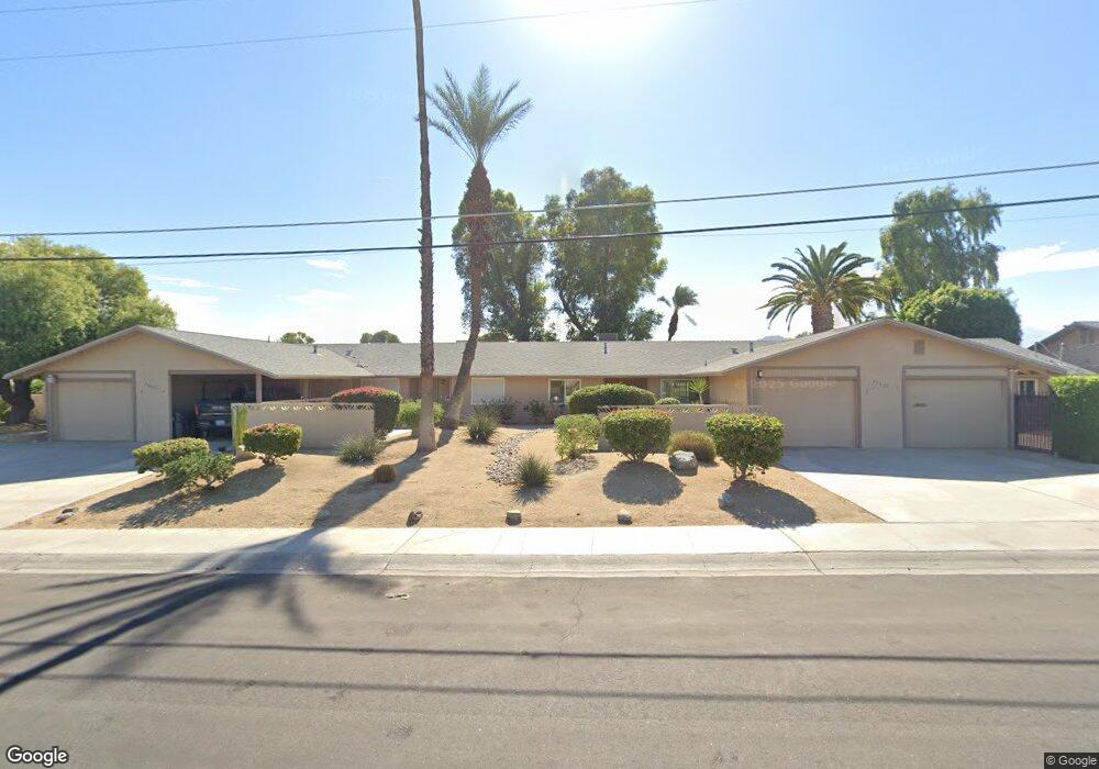
77625 Michigan Dr Unit B2 Palm Desert, CA 92211
Estimated Value: $338,000 - $369,716
2
Beds
2
Baths
1,260
Sq Ft
$280/Sq Ft
Est. Value
About This Home
This home is located at 77625 Michigan Dr Unit B2, Palm Desert, CA 92211 and is currently estimated at $352,429, approximately $279 per square foot. 77625 Michigan Dr Unit B2 is a home located in Riverside County with nearby schools including Gerald R. Ford Elementary School, Colonel Mitchell Paige Middle School, and Palm Desert High School.
Ownership History
Date
Name
Owned For
Owner Type
Purchase Details
Closed on
Dec 4, 2023
Sold by
Evelyn M Garman Living Trust
Bought by
Jackie Garman Living Trust and Garman
Current Estimated Value
Purchase Details
Closed on
Feb 7, 1997
Sold by
Garman Evelyn M
Bought by
Garman Evelyn M and Evelyn M Garman Living Trust
Purchase Details
Closed on
Nov 15, 1996
Sold by
Glascock Jack
Bought by
Garman Evelyn
Purchase Details
Closed on
Apr 19, 1996
Sold by
Mccarthy Dennis V and Mccarthy Dena M
Bought by
Glascock Jack
Home Financials for this Owner
Home Financials are based on the most recent Mortgage that was taken out on this home.
Original Mortgage
$55,000
Interest Rate
7.97%
Mortgage Type
Seller Take Back
Create a Home Valuation Report for This Property
The Home Valuation Report is an in-depth analysis detailing your home's value as well as a comparison with similar homes in the area
Home Values in the Area
Average Home Value in this Area
Purchase History
| Date | Buyer | Sale Price | Title Company |
|---|---|---|---|
| Jackie Garman Living Trust | -- | None Listed On Document | |
| Garman Evelyn M | -- | -- | |
| Garman Evelyn | $65,500 | Orange Coast Title | |
| Glascock Jack | $65,000 | Orange Coast Title |
Source: Public Records
Mortgage History
| Date | Status | Borrower | Loan Amount |
|---|---|---|---|
| Previous Owner | Glascock Jack | $55,000 |
Source: Public Records
Tax History Compared to Growth
Tax History
| Year | Tax Paid | Tax Assessment Tax Assessment Total Assessment is a certain percentage of the fair market value that is determined by local assessors to be the total taxable value of land and additions on the property. | Land | Improvement |
|---|---|---|---|---|
| 2025 | $1,786 | $367,200 | $81,600 | $285,600 |
| 2023 | $1,786 | $104,550 | $31,915 | $72,635 |
| 2022 | $1,786 | $102,501 | $31,290 | $71,211 |
| 2021 | $1,716 | $100,492 | $30,677 | $69,815 |
| 2020 | $1,692 | $99,463 | $30,363 | $69,100 |
| 2019 | $1,666 | $97,514 | $29,768 | $67,746 |
| 2018 | $1,641 | $95,603 | $29,185 | $66,418 |
| 2017 | $1,613 | $93,729 | $28,613 | $65,116 |
| 2016 | $1,584 | $91,892 | $28,052 | $63,840 |
| 2015 | $1,579 | $90,514 | $27,632 | $62,882 |
| 2014 | $1,483 | $88,743 | $27,092 | $61,651 |
Source: Public Records
Map
Nearby Homes
- 77630 California Dr
- 77560 California Dr
- 77650 California Dr
- 77583 Woodhaven Dr S Unit 832
- 41823 Preston Trail
- 77380 Minnesota Ave
- 41690 Woodhaven Dr W
- 77774 Woodhaven Dr S
- 42639 Devonshire St
- 77796 Woodhaven Dr S
- 41806 Jupiter Hills Ct
- 41525 Woodhaven Dr W
- 77322 Missouri Dr
- 41830 Woodhaven Dr E Unit 257
- 41810 Woodhaven Dr E
- 41410 Woodhaven Dr W Unit 715
- 41934 Preston Trail
- 77235 Minnesota Ave
- 41550 Palmetto Ln
- 41456 Resorter Blvd
- 77625 Michigan Dr Unit 1A
- 77625 Michigan Dr Unit D4
- 77625 Michigan Dr Unit C3
- 77625 Michigan Dr Unit A1
- 77625 Michigan #1 Dr
- 77585 Michigan Dr
- 77585 Michigan Dr Unit 2B
- 77585 Michigan Dr Unit 1A
- 77665 Michigan Dr Unit 3C
- 77665 Michigan Dr Unit D4
- 77665 Michigan Dr Unit D4
- 77665 Michigan Dr Unit C3
- 77665 Michigan Dr Unit B2
- 77665 Michigan Dr Unit A1
- 77665 Michigan Dr
- 77565 Michigan Dr Unit 2
- 77565 Michigan Dr Unit 2B
- 77565 Michigan Dr Unit 1A
- 77800 Michigan Dr
- 77559 Michigan Dr