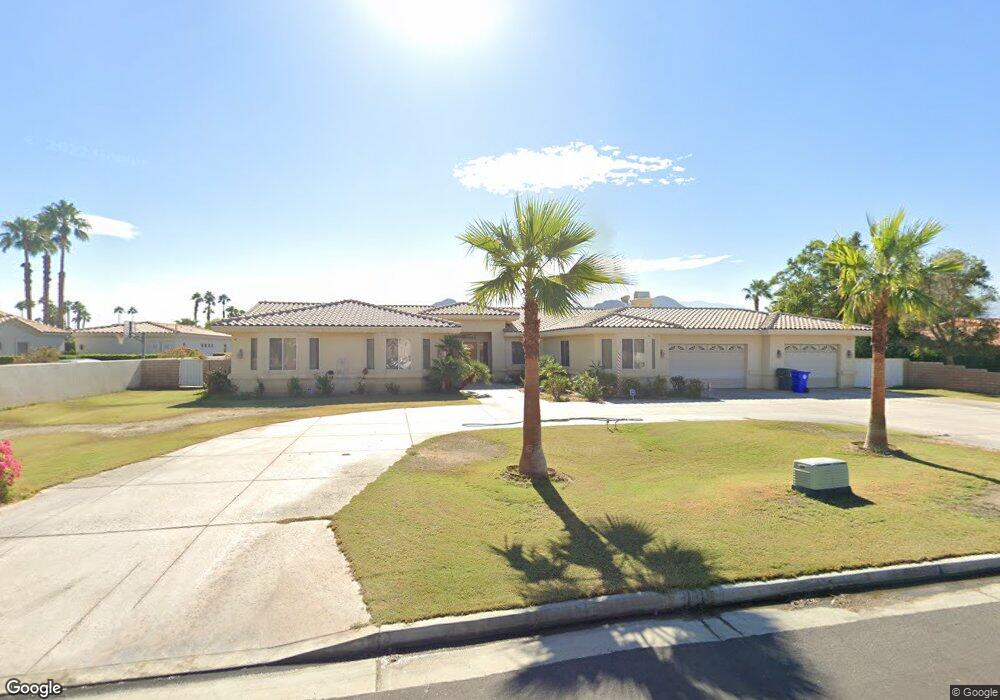
77739 Robin Rd Palm Desert, CA 92211
Estimated Value: $994,000 - $1,473,737
4
Beds
4
Baths
3,660
Sq Ft
$321/Sq Ft
Est. Value
About This Home
This home is located at 77739 Robin Rd, Palm Desert, CA 92211 and is currently estimated at $1,173,684, approximately $320 per square foot. 77739 Robin Rd is a home located in Riverside County with nearby schools including Gerald R. Ford Elementary School, Colonel Mitchell Paige Middle School, and Palm Desert High School.
Ownership History
Date
Name
Owned For
Owner Type
Purchase Details
Closed on
Mar 8, 2007
Sold by
Bozich Darinco and Bozich Barbara M
Bought by
Bozich Darinco and Bozich Barbara M
Current Estimated Value
Purchase Details
Closed on
Oct 10, 2001
Sold by
Murray Matthew G and Murray Mary Jane
Bought by
Bozich Darinco and Bozich Barbara M
Home Financials for this Owner
Home Financials are based on the most recent Mortgage that was taken out on this home.
Original Mortgage
$119,250
Interest Rate
6.62%
Mortgage Type
Purchase Money Mortgage
Purchase Details
Closed on
Feb 10, 1999
Sold by
Stern Donald J and Stern Victoria M
Bought by
Murray Matthew G and Murray Mary Jane
Home Financials for this Owner
Home Financials are based on the most recent Mortgage that was taken out on this home.
Original Mortgage
$62,000
Interest Rate
6.78%
Mortgage Type
Seller Take Back
Purchase Details
Closed on
Jul 8, 1997
Sold by
Stern Donald J and Stern Victoria M
Bought by
Stern Donald J and Stern Victoria M
Create a Home Valuation Report for This Property
The Home Valuation Report is an in-depth analysis detailing your home's value as well as a comparison with similar homes in the area
Purchase History
| Date | Buyer | Sale Price | Title Company |
|---|---|---|---|
| Bozich Darinco | -- | None Available | |
| Bozich Darinco | $159,000 | First American Title Co | |
| Murray Matthew G | $85,000 | First American Title Co | |
| Stern Donald J | -- | -- |
Source: Public Records
Mortgage History
| Date | Status | Borrower | Loan Amount |
|---|---|---|---|
| Closed | Bozich Darinco | $119,250 | |
| Previous Owner | Murray Matthew G | $62,000 |
Source: Public Records
Tax History
| Year | Tax Paid | Tax Assessment Tax Assessment Total Assessment is a certain percentage of the fair market value that is determined by local assessors to be the total taxable value of land and additions on the property. | Land | Improvement |
|---|---|---|---|---|
| 2025 | $11,641 | $895,695 | $234,877 | $660,818 |
| 2023 | $11,641 | $860,915 | $225,757 | $635,158 |
| 2022 | $11,001 | $844,035 | $221,331 | $622,704 |
| 2021 | $10,735 | $14,198 | $0 | $14,198 |
| 2020 | $10,541 | $819,004 | $214,768 | $604,236 |
| 2019 | $10,340 | $802,946 | $210,557 | $592,389 |
| 2018 | $10,144 | $787,203 | $206,430 | $580,773 |
| 2017 | $9,952 | $771,769 | $202,383 | $569,386 |
| 2016 | $9,723 | $756,637 | $198,415 | $558,222 |
| 2015 | $9,453 | $722,000 | $189,000 | $533,000 |
| 2014 | $9,224 | $722,000 | $189,000 | $533,000 |
Source: Public Records
Map
Nearby Homes
- 77739 Cape Verde Dr
- 58 Payson Cir
- 20 Tucson Cir
- 67 Tempe Trail
- 43733 Avenida Alicante
- 77568 Calle Las Brisas N
- 14 Tucson Cir
- 43756 Avenida Alicante
- 77779 Saint Augustine Dr
- 43518 Via Magellan Dr
- 77955 Calle Las Brisas S
- 43584 Via Magellan Dr
- 43791 Calle Las Brisas W
- 43736 Warner Trail
- 43954 Via Granada
- 77571 Calle Las Brisas S
- 42644 Devonshire St
- 42639 Devonshire St
- 77541 Edinborough St
- 44053 Silver Creek Cir
- 77725 Robin Rd
- 77751 Robin Rd
- 0 Robin Rd Unit 21462289
- 77685 Robin Rd
- 77686 Calle Las Brisas N
- 77686 Cll Las Brisas N
- 77678 Calle Las Brisas N
- 77694 Calle Las Brisas N
- 77694 Cll Las Brisas N
- 77670 Calle Las Brisas N
- 77702 Calle Las Brisas N
- 77670 Cll Las Brisas N
- 39 Marricopa Ct
- 41 Marricopa Ct
- 77662 Calle Las Brisas N
- 77710 Calle Las Brisas N
- 77770 Robin Rd
- 77682 Robin Rd
- 43 Marricopa Ct
- 37 Marricopa Ct
Your Personal Tour Guide
Ask me questions while you tour the home.