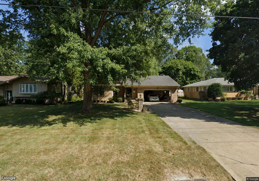
778 Glenbrook Rd Youngstown, OH 44512
Estimated Value: $247,000 - $265,000
4
Beds
3
Baths
1,935
Sq Ft
$132/Sq Ft
Est. Value
About This Home
This home is located at 778 Glenbrook Rd, Youngstown, OH 44512 and is currently estimated at $255,768, approximately $132 per square foot. 778 Glenbrook Rd is a home located in Mahoning County with nearby schools including West Boulevard Elementary School, Boardman Center Middle School, and Boardman High School.
Ownership History
Date
Name
Owned For
Owner Type
Purchase Details
Closed on
Sep 13, 2022
Sold by
Jones Donna
Bought by
Bragdon Terri Lynn Jones
Current Estimated Value
Purchase Details
Closed on
Mar 12, 2009
Sold by
Jones Jack F and Jones Donna M
Bought by
Jones Jack F and Jones Donna M
Purchase Details
Closed on
Jul 7, 1966
Bought by
Jones Jack F and Jones Donna
Create a Home Valuation Report for This Property
The Home Valuation Report is an in-depth analysis detailing your home's value as well as a comparison with similar homes in the area
Home Values in the Area
Average Home Value in this Area
Purchase History
| Date | Buyer | Sale Price | Title Company |
|---|---|---|---|
| Bragdon Terri Lynn Jones | -- | -- | |
| Jones Jack F | -- | Attorney | |
| Jones Jack F | -- | -- |
Source: Public Records
Tax History Compared to Growth
Tax History
| Year | Tax Paid | Tax Assessment Tax Assessment Total Assessment is a certain percentage of the fair market value that is determined by local assessors to be the total taxable value of land and additions on the property. | Land | Improvement |
|---|---|---|---|---|
| 2024 | $3,404 | $65,190 | $9,210 | $55,980 |
| 2023 | $3,360 | $65,190 | $9,210 | $55,980 |
| 2022 | $2,667 | $49,060 | $8,680 | $40,380 |
| 2021 | $2,669 | $49,060 | $8,680 | $40,380 |
| 2020 | $2,682 | $49,060 | $8,680 | $40,380 |
| 2019 | $2,565 | $42,660 | $7,550 | $35,110 |
| 2018 | $2,212 | $42,660 | $7,550 | $35,110 |
| 2017 | $2,117 | $42,660 | $7,550 | $35,110 |
| 2016 | $2,055 | $40,410 | $8,380 | $32,030 |
| 2015 | $2,015 | $40,410 | $8,380 | $32,030 |
| 2014 | $2,021 | $40,410 | $8,380 | $32,030 |
| 2013 | $1,995 | $40,410 | $8,380 | $32,030 |
Source: Public Records
Map
Nearby Homes
- 5200 West Blvd Unit 505
- 768 Crestview Dr
- 715 Crestview Dr
- 29 Gillian Ln
- 272 Shields Rd
- 990 Westport Dr
- 5020 Friendship Ave
- 21.19 acres Truesdale and Lockwood Rd
- 235 Wolcott Dr
- 169 Wolcott Dr
- 396 Brookfield Ave
- 813 Brookfield Ave
- 4225 Stratford Rd
- 6632 Harrington Ave
- 242 Oakley Ave
- 103 Wildwood Dr
- 4250 Oak Knoll Dr
- 117 Overhill Rd
- 6938 Ron Park Place
- 6511 Pembrooke Place
- 782 Glenbrook Rd
- 774 Glenbrook Rd
- 786 Glenbrook Rd
- 768 Glenbrook Rd
- 760 Glenbrook Rd
- 783 Glenbrook Rd
- 792 Glenbrook Rd
- 631 Plymouth Dr
- 781 Glenbrook Rd
- 785 Glenbrook Rd
- 621 Plymouth Dr
- 761 Glenbrook Rd
- 787 Glenbrook Rd
- 756 Glenbrook Rd
- 796 Glenbrook Rd
- 791 Glenbrook Rd
- 641 Plymouth Dr
- 611 Plymouth Dr
- 795 Glenbrook Rd
- 5506 Mill Creek Blvd