Estimated Value: $274,000 - $380,000
4
Beds
2
Baths
3,714
Sq Ft
$91/Sq Ft
Est. Value
About This Home
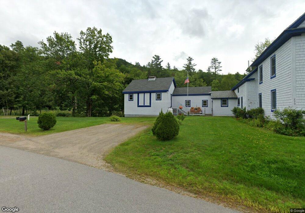
This home is located at 779 Percy Rd, Stark, NH 03582 and is currently estimated at $338,363, approximately $91 per square foot. 779 Percy Rd is a home located in Coos County.
Ownership History
Date
Name
Owned For
Owner Type
Purchase Details
Closed on
Dec 2, 2019
Sold by
Peel Dean
Bought by
Peel Danforth L and Peel Patricia S
Current Estimated Value
Home Financials for this Owner
Home Financials are based on the most recent Mortgage that was taken out on this home.
Original Mortgage
$115,000
Outstanding Balance
$102,096
Interest Rate
3.7%
Mortgage Type
VA
Estimated Equity
$236,267
Create a Home Valuation Report for This Property
The Home Valuation Report is an in-depth analysis detailing your home's value as well as a comparison with similar homes in the area
Home Values in the Area
Average Home Value in this Area
Purchase History
| Date | Buyer | Sale Price | Title Company |
|---|---|---|---|
| Peel Danforth L | $115,000 | -- | |
| Peel Danforth L | $115,000 | -- | |
| Peel Danforth L | $115,000 | -- |
Source: Public Records
Mortgage History
| Date | Status | Borrower | Loan Amount |
|---|---|---|---|
| Open | Peel Danforth L | $115,000 | |
| Closed | Peel Danforth L | $115,000 |
Source: Public Records
Tax History Compared to Growth
Tax History
| Year | Tax Paid | Tax Assessment Tax Assessment Total Assessment is a certain percentage of the fair market value that is determined by local assessors to be the total taxable value of land and additions on the property. | Land | Improvement |
|---|---|---|---|---|
| 2024 | $3,246 | $298,900 | $70,800 | $228,100 |
| 2023 | $3,514 | $169,600 | $41,900 | $127,700 |
| 2022 | $2,775 | $169,600 | $41,900 | $127,700 |
| 2021 | $3,408 | $171,100 | $41,900 | $129,200 |
| 2020 | $3,080 | $171,100 | $41,900 | $129,200 |
| 2019 | $2,926 | $161,900 | $41,900 | $120,000 |
| 2018 | $2,771 | $154,300 | $36,600 | $117,700 |
| 2017 | $2,596 | $142,700 | $36,600 | $106,100 |
| 2016 | $2,448 | $140,500 | $36,600 | $103,900 |
| 2015 | $2,373 | $139,500 | $36,600 | $102,900 |
| 2014 | $2,438 | $139,500 | $36,600 | $102,900 |
| 2013 | $2,379 | $136,100 | $44,000 | $92,100 |
Source: Public Records
Map
Nearby Homes
- 238 Northside Rd
- 388 Percy Rd
- 338 Percy Rd
- 112 Normand Rd
- 68 Short Rd
- 53 Montgomery Rd
- 00 Bell Hill Rd
- 00 Mountain View Rd
- 0 Mountain View Rd
- 1435 Lost Nation Rd
- 406 New Hampshire 110
- 25 Sullivan Rd
- 13 Hillside Ave
- 41 Crow Hill St
- 18 State St
- 38 Riverside Dr
- 50 Church St
- 102 Hillside Ave
- 88 State St
- 1116 W Milan Rd
- 16 Northside Rd
- 772 Percy Rd
- 15 Northside Rd
- 17 Northside Rd
- 22 Northside Rd
- 29 Northside Rd
- 35 Northside Rd
- . Route 110 Stark Hwy
- 211 Styles Road Mill Brook
- 36 Northside Rd
- 1200 Stark Hwy
- 14 Corkum Rd Unit M202L010
- 1197 Stark Hwy
- 746 Percy Rd
- 1202 Stark Hwy
- 48 Northside Rd
- 6 Corkum Rd
- 42 Millbrook Rd
- 19 Corkum Rd
- 40 Millbrook Rd