Estimated Value: $184,663 - $281,000
2
Beds
2
Baths
1,624
Sq Ft
$140/Sq Ft
Est. Value
About This Home
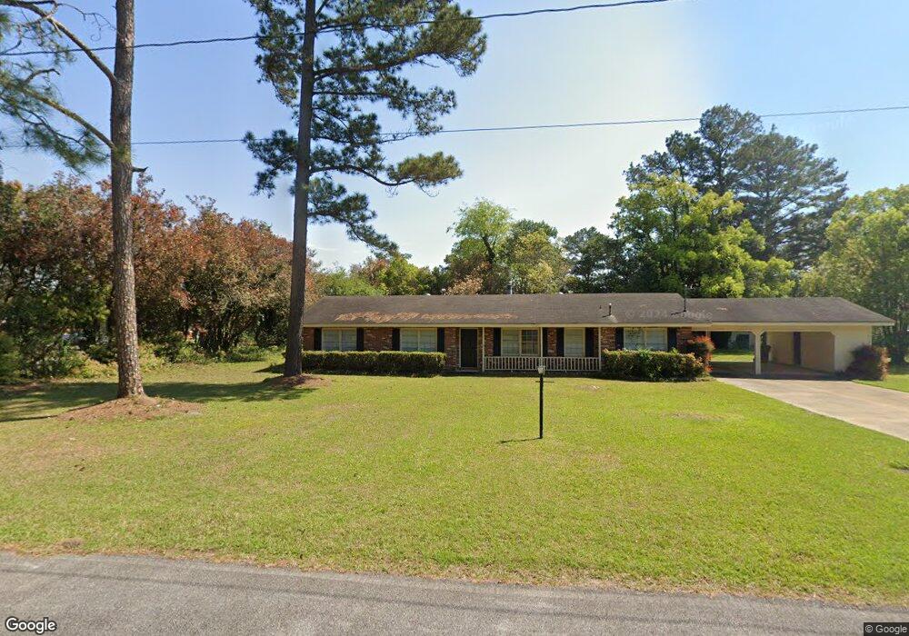
This home is located at 78 27th St NE, Cairo, GA 39828 and is currently estimated at $227,416, approximately $140 per square foot. 78 27th St NE is a home located in Grady County with nearby schools including Cairo High School.
Ownership History
Date
Name
Owned For
Owner Type
Purchase Details
Closed on
Dec 10, 2014
Sold by
Jackson Harold L
Bought by
Tp Investment Associates Llc
Current Estimated Value
Home Financials for this Owner
Home Financials are based on the most recent Mortgage that was taken out on this home.
Original Mortgage
$100,948
Interest Rate
4.07%
Mortgage Type
New Conventional
Purchase Details
Closed on
Jul 29, 2014
Sold by
Davis Juanita
Bought by
Jackson Harold L
Purchase Details
Closed on
Jun 28, 2007
Sold by
Harvey Billy Joe
Bought by
Davis Juanita
Purchase Details
Closed on
Jun 20, 2001
Sold by
Mccullough Robert G
Bought by
Harvey Billy Joe
Purchase Details
Closed on
Feb 6, 1992
Bought by
Mccullough Robert G
Create a Home Valuation Report for This Property
The Home Valuation Report is an in-depth analysis detailing your home's value as well as a comparison with similar homes in the area
Purchase History
| Date | Buyer | Sale Price | Title Company |
|---|---|---|---|
| Tp Investment Associates Llc | $99,547 | -- | |
| Jackson Harold L | -- | -- | |
| Davis Juanita | $116,000 | -- | |
| Harvey Billy Joe | $76,000 | -- | |
| Mccullough Robert G | $67,000 | -- |
Source: Public Records
Mortgage History
| Date | Status | Borrower | Loan Amount |
|---|---|---|---|
| Closed | Tp Investment Associates Llc | $100,948 | |
| Closed | Davis Juanita | $0 |
Source: Public Records
Tax History
| Year | Tax Paid | Tax Assessment Tax Assessment Total Assessment is a certain percentage of the fair market value that is determined by local assessors to be the total taxable value of land and additions on the property. | Land | Improvement |
|---|---|---|---|---|
| 2024 | $2,128 | $63,772 | $4,312 | $59,460 |
| 2023 | $1,794 | $48,481 | $4,800 | $43,681 |
| 2022 | $1,921 | $49,894 | $4,800 | $45,094 |
| 2021 | $1,926 | $49,894 | $4,800 | $45,094 |
| 2020 | $1,931 | $49,894 | $4,800 | $45,094 |
| 2019 | $1,931 | $49,894 | $4,800 | $45,094 |
| 2018 | $1,836 | $49,894 | $4,800 | $45,094 |
| 2017 | $1,765 | $49,894 | $4,800 | $45,094 |
| 2016 | $1,542 | $42,632 | $4,800 | $37,832 |
| 2015 | $1,426 | $42,632 | $4,800 | $37,832 |
| 2014 | -- | $42,632 | $4,800 | $37,832 |
| 2013 | -- | $38,653 | $4,800 | $33,853 |
Source: Public Records
Map
Nearby Homes
- 79 27th St NE
- 76 27th St NE
- 85 28th St NE
- 2630 Pineacre Dr NE
- 77 28th St NE
- 2710 Us Highway 84 E
- 74 27th St NE
- 2690 Us Highway 84 E
- 73 28th St NE
- 78 26th St NE
- 73 27th St NE
- 72 27th St NE
- 74 26th St NE
- 74 28th St NE
- 2575 Pineacre Dr NE
- 71 28th St NE
- 2600 U S 84
- 2600 Us Highway 84 E
- 2600 Us Highway 84 E
- 67 27th St NE
Your Personal Tour Guide
Ask me questions while you tour the home.