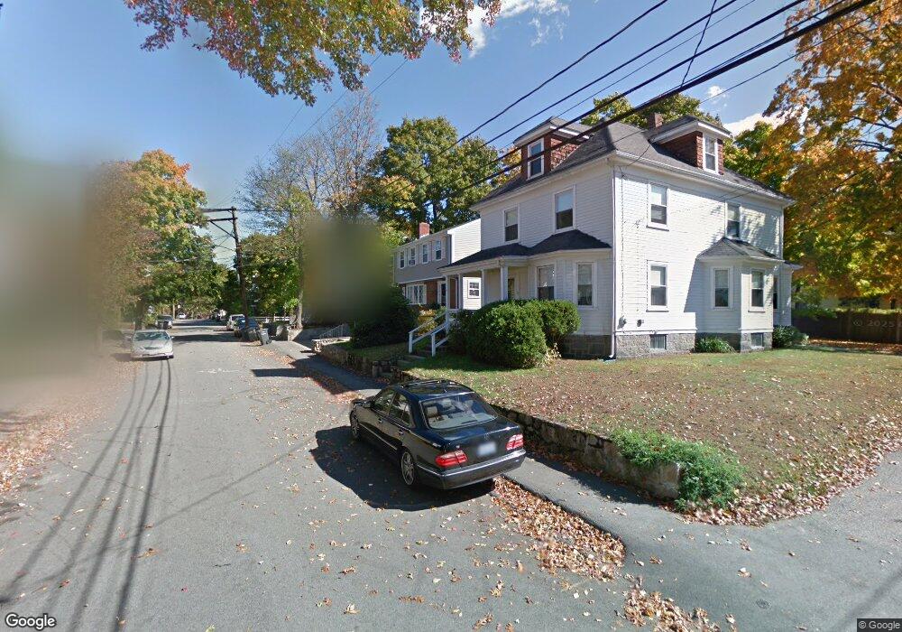
78 Barrows St Dedham, MA 02026
Oakdale NeighborhoodEstimated Value: $657,000 - $752,000
4
Beds
2
Baths
1,470
Sq Ft
$477/Sq Ft
Est. Value
About This Home
This home is located at 78 Barrows St, Dedham, MA 02026 and is currently estimated at $701,833, approximately $477 per square foot. 78 Barrows St is a home located in Norfolk County with nearby schools including Avery, Dedham Middle School, and Dedham High School.
Ownership History
Date
Name
Owned For
Owner Type
Purchase Details
Closed on
Jun 28, 2017
Sold by
Bender Michael and Bender Stephanie M
Bought by
Mascetta Stephanie
Current Estimated Value
Purchase Details
Closed on
Dec 23, 2009
Sold by
Mascetta Stephanie and Bender Stephanie M
Bought by
Bender Michael and Mascetta Stephanie
Purchase Details
Closed on
Nov 8, 1991
Sold by
Macsetta Nicholas D
Bought by
Bender Michael and Stephanie M Bender
Create a Home Valuation Report for This Property
The Home Valuation Report is an in-depth analysis detailing your home's value as well as a comparison with similar homes in the area
Home Values in the Area
Average Home Value in this Area
Purchase History
| Date | Buyer | Sale Price | Title Company |
|---|---|---|---|
| Mascetta Stephanie | -- | -- | |
| Bender Michael | -- | -- | |
| Bender Michael | $130,000 | -- |
Source: Public Records
Mortgage History
| Date | Status | Borrower | Loan Amount |
|---|---|---|---|
| Previous Owner | Bender Michael | $271,384 | |
| Previous Owner | Bender Michael | $40,000 | |
| Previous Owner | Bender Michael | $154,400 |
Source: Public Records
Tax History
| Year | Tax Paid | Tax Assessment Tax Assessment Total Assessment is a certain percentage of the fair market value that is determined by local assessors to be the total taxable value of land and additions on the property. | Land | Improvement |
|---|---|---|---|---|
| 2025 | $8,043 | $637,300 | $315,600 | $321,700 |
| 2024 | $7,713 | $617,000 | $286,300 | $330,700 |
| 2023 | $7,002 | $545,300 | $259,200 | $286,100 |
| 2022 | $6,598 | $494,200 | $243,500 | $250,700 |
| 2021 | $6,138 | $449,000 | $225,400 | $223,600 |
| 2020 | $6,101 | $444,700 | $225,400 | $219,300 |
| 2019 | $5,677 | $401,200 | $196,000 | $205,200 |
| 2018 | $5,517 | $379,200 | $174,000 | $205,200 |
| 2017 | $5,269 | $357,000 | $163,100 | $193,900 |
| 2016 | $5,411 | $349,300 | $151,000 | $198,300 |
| 2015 | $5,420 | $341,500 | $143,000 | $198,500 |
| 2014 | $5,231 | $325,300 | $140,400 | $184,900 |
Source: Public Records
Map
Nearby Homes
- 28 Linden Place
- 56 Mount Vernon St
- 442 High St
- 147 Mount Vernon St
- 46 Park St
- 600 East St
- 42 Churchill Place
- 441 Washington St Unit 301
- 441 Washington St Unit 302
- 46 Church St
- 92 Old River Place
- 55 Church St Unit 1
- 108 High St
- 90 High St Unit 309
- 44 Court St
- 73 Walnut St
- 30 High St ( Cass St Entrance) Unit 209
- 47 Village Ave Unit 203
- 98 Cedar St Unit 2
- 6 Snow Ln
- 80 Barrows St
- 72 Barrows St
- 11 Dunn Place
- 12 Galvin Place
- 75 Barrows St
- 71 Barrows St
- 15 Dunn Place
- 86 Barrows St
- 79 Barrows St
- 79 Barrows St Unit 1
- 79 Barrows St Unit 79
- 67 Barrows St
- 11 Galvin Place
- 85 Barrows St
- 73 Barrows St
- 73 Barrows St Unit 3
- 73 Barrows St Unit 2
- 73 Barrows St Unit 1
- 14 Dunn Place
- 58 Barrows St Unit 2
Your Personal Tour Guide
Ask me questions while you tour the home.