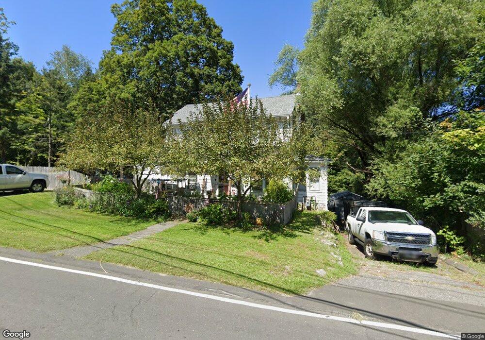
78 Boyd St Winsted, CT 06098
Estimated Value: $268,391 - $346,000
4
Beds
2
Baths
1,984
Sq Ft
$151/Sq Ft
Est. Value
About This Home
This home is located at 78 Boyd St, Winsted, CT 06098 and is currently estimated at $299,848, approximately $151 per square foot. 78 Boyd St is a home located in Litchfield County with nearby schools including Pearson School, Explorations Charter School, and St Anthony School.
Ownership History
Date
Name
Owned For
Owner Type
Purchase Details
Closed on
Jul 31, 1998
Sold by
Watterworth Michele D
Bought by
Reagan Duane A
Current Estimated Value
Home Financials for this Owner
Home Financials are based on the most recent Mortgage that was taken out on this home.
Original Mortgage
$113,190
Interest Rate
6.9%
Purchase Details
Closed on
Aug 25, 1995
Sold by
Wabrek Antoinette Est
Bought by
Miclette Michele D
Create a Home Valuation Report for This Property
The Home Valuation Report is an in-depth analysis detailing your home's value as well as a comparison with similar homes in the area
Home Values in the Area
Average Home Value in this Area
Purchase History
| Date | Buyer | Sale Price | Title Company |
|---|---|---|---|
| Reagan Duane A | $116,000 | -- | |
| Reagan Duane A | $116,000 | -- | |
| Miclette Michele D | $103,900 | -- | |
| Miclette Michele D | $103,900 | -- |
Source: Public Records
Mortgage History
| Date | Status | Borrower | Loan Amount |
|---|---|---|---|
| Open | Miclette Michele D | $141,000 | |
| Closed | Miclette Michele D | $113,190 | |
| Closed | Miclette Michele D | $113,190 |
Source: Public Records
Tax History
| Year | Tax Paid | Tax Assessment Tax Assessment Total Assessment is a certain percentage of the fair market value that is determined by local assessors to be the total taxable value of land and additions on the property. | Land | Improvement |
|---|---|---|---|---|
| 2025 | $3,455 | $118,440 | $33,320 | $85,120 |
| 2024 | $3,226 | $118,440 | $33,320 | $85,120 |
| 2023 | $3,126 | $118,440 | $33,320 | $85,120 |
| 2022 | $3,019 | $90,020 | $24,290 | $65,730 |
| 2021 | $3,019 | $90,020 | $24,290 | $65,730 |
| 2020 | $3,019 | $90,020 | $24,290 | $65,730 |
| 2019 | $3,019 | $90,020 | $24,290 | $65,730 |
| 2018 | $3,019 | $90,020 | $24,290 | $65,730 |
| 2017 | $3,057 | $91,140 | $24,290 | $66,850 |
| 2016 | $3,057 | $91,140 | $24,290 | $66,850 |
| 2015 | $2,980 | $91,140 | $24,290 | $66,850 |
| 2014 | $2,908 | $91,140 | $24,290 | $66,850 |
Source: Public Records
Map
Nearby Homes
Your Personal Tour Guide
Ask me questions while you tour the home.