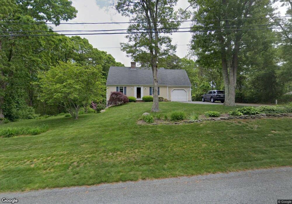
78 Flintrock Rd Barnstable, MA 02630
Barnstable Village NeighborhoodEstimated Value: $803,000 - $879,000
3
Beds
3
Baths
1,921
Sq Ft
$428/Sq Ft
Est. Value
About This Home
This home is located at 78 Flintrock Rd, Barnstable, MA 02630 and is currently estimated at $822,632, approximately $428 per square foot. 78 Flintrock Rd is a home located in Barnstable County with nearby schools including West Barnstable Elementary School, Barnstable United Elementary School, and Barnstable Intermediate School.
Ownership History
Date
Name
Owned For
Owner Type
Purchase Details
Closed on
Dec 11, 2019
Sold by
Sayers Francis G and Sayers Karen E
Bought by
Francis G Sayers T
Current Estimated Value
Create a Home Valuation Report for This Property
The Home Valuation Report is an in-depth analysis detailing your home's value as well as a comparison with similar homes in the area
Home Values in the Area
Average Home Value in this Area
Purchase History
| Date | Buyer | Sale Price | Title Company |
|---|---|---|---|
| Francis G Sayers T | -- | None Available |
Source: Public Records
Tax History Compared to Growth
Tax History
| Year | Tax Paid | Tax Assessment Tax Assessment Total Assessment is a certain percentage of the fair market value that is determined by local assessors to be the total taxable value of land and additions on the property. | Land | Improvement |
|---|---|---|---|---|
| 2025 | $6,661 | $720,900 | $202,800 | $518,100 |
| 2024 | $6,026 | $687,900 | $202,800 | $485,100 |
| 2023 | $5,674 | $631,900 | $200,400 | $431,500 |
| 2022 | $5,701 | $510,800 | $142,500 | $368,300 |
| 2021 | $5,410 | $462,000 | $142,500 | $319,500 |
| 2020 | $5,570 | $454,300 | $142,500 | $311,800 |
| 2019 | $5,140 | $420,600 | $142,500 | $278,100 |
| 2018 | $5,035 | $400,200 | $156,300 | $243,900 |
| 2017 | $4,860 | $388,800 | $156,300 | $232,500 |
| 2016 | $4,794 | $388,800 | $156,300 | $232,500 |
| 2015 | $4,134 | $341,400 | $124,000 | $217,400 |
Source: Public Records
Map
Nearby Homes
- 155 Flintrock Rd
- 98 Flintrock Rd
- 68 Flintrock Rd
- 30 Tally Ho Rd
- 2 Palomino Dr
- 157 Salt Rock Rd
- 56 Flintrock Rd
- 183 Salt Rock Rd
- 211 Flintrock Rd
- 118 Flintrock Rd
- 141 Salt Rock Rd
- 35 Tally Ho Rd
- 18 Tally Ho Rd
- 40 Flintrock Rd
- 26 Hanson Ln
- 205 Salt Rock Rd
- 246 Flintrock Rd
- 174 Salt Rock Rd
- 26 Palomino Dr
- 158 Salt Rock Rd