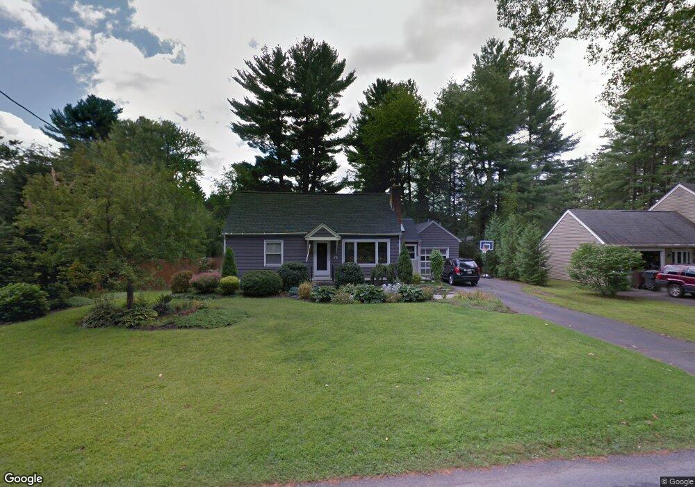
78 Kensington Ave Westfield, MA 01085
Estimated Value: $346,000 - $386,000
3
Beds
2
Baths
1,224
Sq Ft
$298/Sq Ft
Est. Value
About This Home
This home is located at 78 Kensington Ave, Westfield, MA 01085 and is currently estimated at $364,258, approximately $297 per square foot. 78 Kensington Ave is a home located in Hampden County with nearby schools including Westfield High School and Saint Mary High School.
Ownership History
Date
Name
Owned For
Owner Type
Purchase Details
Closed on
Sep 5, 2014
Sold by
Harlin Jeffrey J
Bought by
Harlin Amie M
Current Estimated Value
Purchase Details
Closed on
Sep 12, 2003
Sold by
Zampini Francine E and Zampini Philip R
Bought by
Harlin Amie and Harlin Jeffrey J
Home Financials for this Owner
Home Financials are based on the most recent Mortgage that was taken out on this home.
Original Mortgage
$161,466
Interest Rate
6.22%
Mortgage Type
Purchase Money Mortgage
Purchase Details
Closed on
May 26, 1994
Sold by
Breau Joseph E and Breau Julie A
Bought by
Zampini Philip R and Zampini Francine E
Home Financials for this Owner
Home Financials are based on the most recent Mortgage that was taken out on this home.
Original Mortgage
$96,000
Interest Rate
8.22%
Mortgage Type
Purchase Money Mortgage
Purchase Details
Closed on
Jun 4, 1992
Sold by
Bishop Gladys L and Gogal Norma R
Bought by
Breau Joseph E and Breau Julia A
Create a Home Valuation Report for This Property
The Home Valuation Report is an in-depth analysis detailing your home's value as well as a comparison with similar homes in the area
Home Values in the Area
Average Home Value in this Area
Purchase History
| Date | Buyer | Sale Price | Title Company |
|---|---|---|---|
| Harlin Amie M | -- | -- | |
| Harlin Amie | $164,000 | -- | |
| Zampini Philip R | $120,000 | -- | |
| Breau Joseph E | $50,000 | -- |
Source: Public Records
Mortgage History
| Date | Status | Borrower | Loan Amount |
|---|---|---|---|
| Previous Owner | Breau Joseph E | $180,000 | |
| Previous Owner | Harlin Amie | $161,466 | |
| Previous Owner | Breau Joseph E | $10,000 | |
| Previous Owner | Breau Joseph E | $96,000 |
Source: Public Records
Tax History Compared to Growth
Tax History
| Year | Tax Paid | Tax Assessment Tax Assessment Total Assessment is a certain percentage of the fair market value that is determined by local assessors to be the total taxable value of land and additions on the property. | Land | Improvement |
|---|---|---|---|---|
| 2025 | $4,609 | $303,600 | $124,400 | $179,200 |
| 2024 | $4,593 | $287,600 | $113,100 | $174,500 |
| 2023 | $4,437 | $261,300 | $107,600 | $153,700 |
| 2022 | $4,282 | $231,600 | $96,100 | $135,500 |
| 2021 | $125 | $219,800 | $90,600 | $129,200 |
| 2020 | $4,046 | $210,200 | $90,600 | $119,600 |
| 2019 | $3,956 | $201,100 | $86,300 | $114,800 |
| 2018 | $0 | $201,100 | $86,300 | $114,800 |
| 2017 | $3,841 | $197,800 | $87,800 | $110,000 |
| 2016 | $3,845 | $197,800 | $87,800 | $110,000 |
| 2015 | $3,667 | $197,800 | $87,800 | $110,000 |
| 2014 | $2,742 | $197,800 | $87,800 | $110,000 |
Source: Public Records
Map
Nearby Homes
- 11 Highland Cir
- 324 Russell Rd Unit 204
- 78 Granville Rd Unit 11
- 508 Granville Rd
- 0 Fox Hill Dr
- 53 Yankee Cir
- 128 Crane Ave
- 40 Heritage Ln
- 549 Russell Rd Unit 6B
- 555 Russell Rd Unit D18
- 172 Valley View Dr
- 291 Pochassic Rd
- 13 King Place
- 82 S Maple St Unit 11
- 82 S Maple St Unit 43
- 197 Loomis Rg
- 15 Bates St
- 70 S Maple St
- 74 S Maple St
- 113 Franklin St