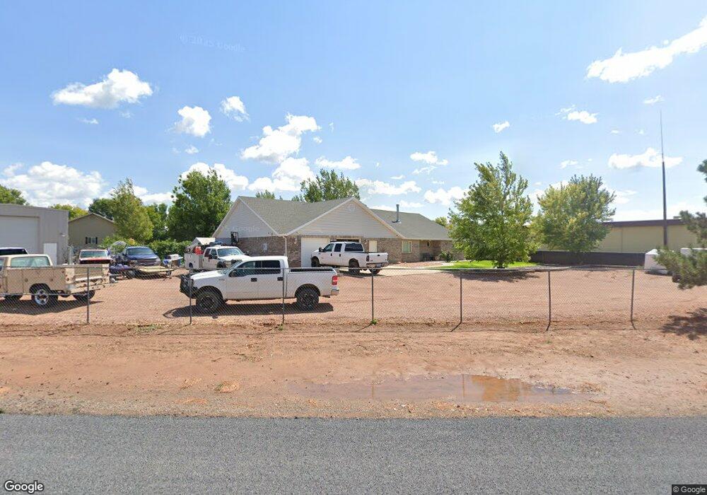
78 N Diagonal St Enterprise, UT 84725
Estimated Value: $454,501 - $574,000
3
Beds
3
Baths
2,337
Sq Ft
$220/Sq Ft
Est. Value
About This Home
This home is located at 78 N Diagonal St, Enterprise, UT 84725 and is currently estimated at $513,125, approximately $219 per square foot. 78 N Diagonal St is a home with nearby schools including Enterprise School and Enterprise High School.
Ownership History
Date
Name
Owned For
Owner Type
Purchase Details
Closed on
Jan 12, 2006
Sold by
Mccoy Gail Thomas and Mccoy Mindy
Bought by
Mccoy G Thomas G and Mccoy Mindy
Current Estimated Value
Home Financials for this Owner
Home Financials are based on the most recent Mortgage that was taken out on this home.
Original Mortgage
$70,800
Interest Rate
5.82%
Mortgage Type
New Conventional
Purchase Details
Closed on
Sep 26, 2005
Sold by
Mccoy G Thomas and Mccoy Mindy
Bought by
Mccoy Gail Thomas and Mccoy Mindy
Home Financials for this Owner
Home Financials are based on the most recent Mortgage that was taken out on this home.
Original Mortgage
$56,800
Interest Rate
5.72%
Mortgage Type
Construction
Create a Home Valuation Report for This Property
The Home Valuation Report is an in-depth analysis detailing your home's value as well as a comparison with similar homes in the area
Home Values in the Area
Average Home Value in this Area
Purchase History
| Date | Buyer | Sale Price | Title Company |
|---|---|---|---|
| Mccoy G Thomas G | -- | First American Title Co | |
| Mccoy Gail Thomas | -- | First American Title Co |
Source: Public Records
Mortgage History
| Date | Status | Borrower | Loan Amount |
|---|---|---|---|
| Closed | Mccoy G Thomas G | $70,800 | |
| Closed | Mccoy Gail Thomas | $56,800 |
Source: Public Records
Tax History Compared to Growth
Tax History
| Year | Tax Paid | Tax Assessment Tax Assessment Total Assessment is a certain percentage of the fair market value that is determined by local assessors to be the total taxable value of land and additions on the property. | Land | Improvement |
|---|---|---|---|---|
| 2025 | $1,752 | $260,755 | $36,575 | $224,180 |
| 2023 | $1,818 | $257,400 | $32,725 | $224,675 |
| 2022 | $1,807 | $243,375 | $28,875 | $214,500 |
| 2021 | $1,681 | $332,200 | $31,500 | $300,700 |
| 2020 | $1,518 | $282,300 | $30,000 | $252,300 |
| 2019 | $1,449 | $261,500 | $30,000 | $231,500 |
| 2018 | $1,262 | $117,865 | $0 | $0 |
| 2017 | $1,191 | $106,865 | $0 | $0 |
| 2016 | $1,257 | $104,445 | $0 | $0 |
| 2015 | $1,203 | $96,470 | $0 | $0 |
| 2014 | $1,321 | $105,985 | $0 | $0 |
Source: Public Records
Map
Nearby Homes
- 379 E Main St
- 0 1 21 Acre Parcel #E-Cwr-2-10 Unit 110695
- 0 1 21 Acre Parcel #E-Cwr-2-10 Unit 25-259941
- 160 S 550 E
- 160 S 550 E Unit 18
- 0 Cottonwood Ln Unit 24-255522
- 0 1 2 Acre Parcel #E-Cwr-6 Unit 25-259933
- 0 1 2 Acre Parcel #E-Cwr-6 Unit 110690
- 99 S 550
- 231 400 E
- 775 E 100 N Unit 2
- 775 E 100 N Unit 56
- 775 E 100 N Unit 60
- 246 S 475 E
- 950 E 100 N
- 260 E 300 S
- 149 S 100 St E
- 242 S 200 St E
- 22 Lot 22
- 0 Lot 29 Unit 25-264161
- 522 E 100 N
- 520 100 N
- 500 100 N
- 560 100 N
- 610 E 100 N
- 29 400 E
- 35 N Diagonal St
- 620 100 N Unit 8
- 620 100 N Unit 7
- 600 100 N
- 451 100 N
- 100 N 500 E
- E E Main St
- 490 E Main St
- 20 S 550 E
- 0 Commercial Parcel #E-Mas-1-a Unit 103166
- 0 Commercial Parcel #E-Mas-1-a Unit 23-242768
- 650 100 N
- 0
- 33 S 475 E Unit s 1-5 (5-PLEX)