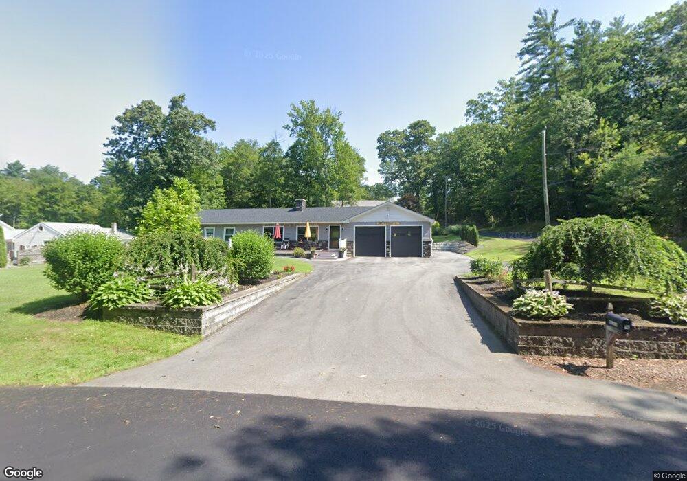
78 Pierson Rd Northfield, MA 01360
Estimated Value: $258,000 - $318,000
2
Beds
1
Bath
1,296
Sq Ft
$229/Sq Ft
Est. Value
About This Home
This home is located at 78 Pierson Rd, Northfield, MA 01360 and is currently estimated at $296,710, approximately $228 per square foot. 78 Pierson Rd is a home located in Franklin County with nearby schools including Pioneer Valley Regional.
Ownership History
Date
Name
Owned For
Owner Type
Purchase Details
Closed on
Jan 15, 2013
Sold by
Walker William C Jr Es and Walker W
Bought by
Walker Timothy J and Walker Lisa M
Current Estimated Value
Purchase Details
Closed on
Nov 15, 2010
Sold by
Walker William C Jr Es and Walker Beaman
Bought by
Walker Timothy J and Walker Thomas E
Create a Home Valuation Report for This Property
The Home Valuation Report is an in-depth analysis detailing your home's value as well as a comparison with similar homes in the area
Home Values in the Area
Average Home Value in this Area
Purchase History
| Date | Buyer | Sale Price | Title Company |
|---|---|---|---|
| Walker Timothy J | $68,000 | -- | |
| Walker Timothy J | -- | -- |
Source: Public Records
Mortgage History
| Date | Status | Borrower | Loan Amount |
|---|---|---|---|
| Previous Owner | Walker Timothy J | $14,500 |
Source: Public Records
Tax History
| Year | Tax Paid | Tax Assessment Tax Assessment Total Assessment is a certain percentage of the fair market value that is determined by local assessors to be the total taxable value of land and additions on the property. | Land | Improvement |
|---|---|---|---|---|
| 2025 | $3,663 | $264,700 | $51,000 | $213,700 |
| 2024 | $3,493 | $257,200 | $48,200 | $209,000 |
| 2023 | $3,165 | $233,100 | $47,800 | $185,300 |
| 2022 | $2,842 | $205,200 | $47,800 | $157,400 |
| 2021 | $3,147 | $195,200 | $45,300 | $149,900 |
| 2020 | $3,023 | $182,000 | $43,200 | $138,800 |
| 2019 | $3,015 | $173,300 | $41,200 | $132,100 |
| 2018 | $2,950 | $165,200 | $41,200 | $124,000 |
| 2017 | $2,611 | $158,700 | $41,200 | $117,500 |
| 2016 | $2,248 | $141,500 | $41,200 | $100,300 |
| 2015 | $2,406 | $144,500 | $41,200 | $103,300 |
Source: Public Records
Map
Nearby Homes
- 14 Wood Way
- 583 Burt Hill Rd
- 181 Main St
- 719 Mount Hermon Station Rd
- 339 Burt Hill Rd
- 94 Main St
- 12A Parker Ave Unit A
- 22 Old Turnpike Rd
- 259 Bolton Rd
- 258 Bolton Rd
- 396 Mount Hermon Station Rd
- 56 Whitetail Dr
- 0 Sears St Unit 23759828
- Lot 14 Northfield Rd
- 12 Wetherby Dr
- 0, Lot 2 Flower Hill Rd
- 0, Lot 1 Flower Hill Rd
- 406 Back Ashuelot Rd
- 119 Newton Hill Rd
- 159 Ashuelot Main St
- 74 Pierson Rd
- 32 Hamilton Dr
- 73 Pierson Rd
- 12 Hamilton Dr
- 66 Pierson Rd
- 16 Hamilton Dr
- 68 Pierson Rd
- 20 Hamilton Dr
- 26 Hamilton Dr
- 190 Winchester Rd
- 19 Hamilton Dr
- 19 Hamilton Dr Unit A
- 19A Hamilton Dr
- 184 Winchester Rd
- 52 Pierson Rd
- 28 Hamilton Dr
- 27 Hamilton Dr
- 214 Winchester Rd
- 34 Hamilton Dr
- 33 Hamilton Dr
Your Personal Tour Guide
Ask me questions while you tour the home.