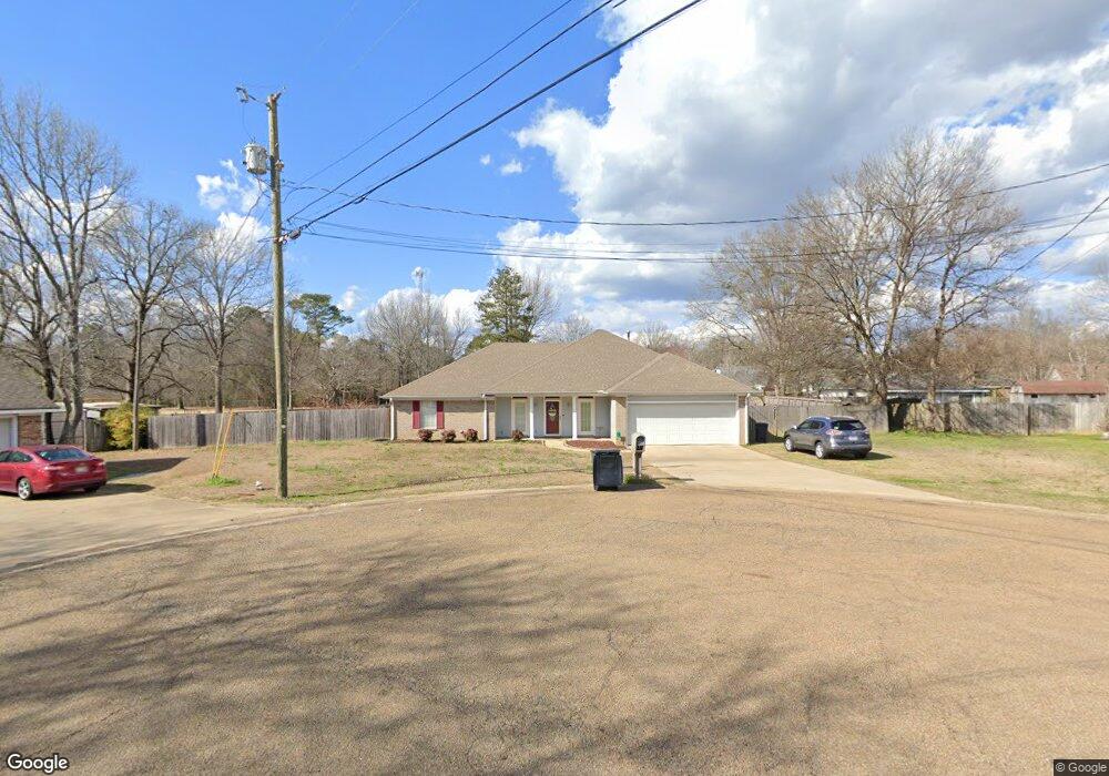
78 Powers Place Columbus, MS 39702
Estimated Value: $256,000 - $301,000
3
Beds
2
Baths
2,160
Sq Ft
$128/Sq Ft
Est. Value
About This Home
This home is located at 78 Powers Place, Columbus, MS 39702 and is currently estimated at $277,456, approximately $128 per square foot. 78 Powers Place is a home located in Lowndes County.
Ownership History
Date
Name
Owned For
Owner Type
Purchase Details
Closed on
Aug 19, 2024
Sold by
Jordan Owen Benjamin and Jordan Ashley F
Bought by
Heberling Dustin Ray and Heberling Sarah Kathleen
Current Estimated Value
Home Financials for this Owner
Home Financials are based on the most recent Mortgage that was taken out on this home.
Original Mortgage
$285,568
Outstanding Balance
$282,131
Interest Rate
6.95%
Mortgage Type
New Conventional
Estimated Equity
-$4,675
Purchase Details
Closed on
Oct 4, 2011
Sold by
Smith Katrina D
Bought by
Jordan Owen Benjamin and Jordan Ashley F
Purchase Details
Closed on
Aug 18, 2010
Sold by
Laird Lu W and La John Tird
Bought by
Smith Katrina D
Create a Home Valuation Report for This Property
The Home Valuation Report is an in-depth analysis detailing your home's value as well as a comparison with similar homes in the area
Home Values in the Area
Average Home Value in this Area
Purchase History
| Date | Buyer | Sale Price | Title Company |
|---|---|---|---|
| Heberling Dustin Ray | -- | None Listed On Document | |
| Heberling Dustin Ray | -- | None Listed On Document | |
| Jordan Owen Benjamin | -- | -- | |
| Smith Katrina D | -- | -- |
Source: Public Records
Mortgage History
| Date | Status | Borrower | Loan Amount |
|---|---|---|---|
| Open | Heberling Dustin Ray | $285,568 | |
| Closed | Heberling Dustin Ray | $285,568 |
Source: Public Records
Tax History Compared to Growth
Tax History
| Year | Tax Paid | Tax Assessment Tax Assessment Total Assessment is a certain percentage of the fair market value that is determined by local assessors to be the total taxable value of land and additions on the property. | Land | Improvement |
|---|---|---|---|---|
| 2025 | $1,147 | $14,789 | $0 | $0 |
| 2024 | $1,135 | $14,789 | $0 | $0 |
| 2023 | $977 | $13,212 | $0 | $0 |
| 2022 | $978 | $13,212 | $0 | $0 |
| 2021 | $930 | $13,212 | $0 | $0 |
| 2020 | $863 | $13,212 | $0 | $0 |
| 2019 | $889 | $13,213 | $0 | $0 |
| 2018 | $889 | $13,108 | $0 | $0 |
| 2017 | $837 | $13,108 | $0 | $0 |
| 2016 | $837 | $13,108 | $0 | $0 |
| 2015 | $871 | $13,508 | $0 | $0 |
| 2014 | $871 | $13,508 | $0 | $0 |
Source: Public Records
Map
Nearby Homes
- 187 Jones Dr
- 524 Jones Dr
- 669 Jones Dr
- 17 Paige Cove
- 358 Rogers Way
- 338 Rogers Way
- 2654 Yorkville Rd E
- 836 Oswalt Rd
- 102 Livingston Ln
- 4 Stringer Ln
- 49 Freeman Dr
- 364 Pinewood Dr
- 186 Wind Chase Dr
- 40 Angela Dr
- 262 Center Rd
- 11 Mckay Dr
- 0 Mckay Dr
- 0 New Hope Rd Unit 25-2493
- 9 Monticello Cir
- 116 Kings Path