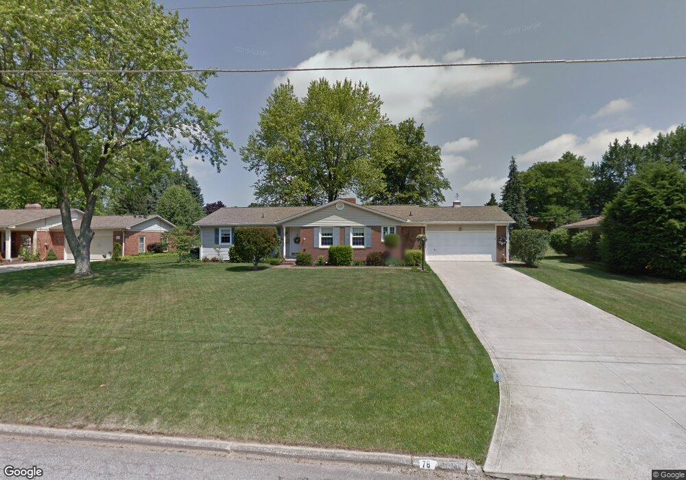
78 Sherbrook Rd Mansfield, OH 44907
Estimated Value: $219,232 - $254,000
3
Beds
2
Baths
1,518
Sq Ft
$159/Sq Ft
Est. Value
About This Home
This home is located at 78 Sherbrook Rd, Mansfield, OH 44907 and is currently estimated at $240,808, approximately $158 per square foot. 78 Sherbrook Rd is a home located in Richland County with nearby schools including Mansfield Christian School, St. Peter's Elementary/Montessori School, and St. Peter's Junior High / High School.
Ownership History
Date
Name
Owned For
Owner Type
Purchase Details
Closed on
Nov 13, 2012
Sold by
Shafer John L and Shafer Sondra L
Bought by
Turner Kevin A and Parnell Kelly L
Current Estimated Value
Purchase Details
Closed on
Oct 8, 2009
Sold by
Shafer John L and Shafer Sondra L
Bought by
Shafer John L and Shafer Sondra L
Purchase Details
Closed on
Jun 4, 1992
Sold by
Shafer John L
Bought by
Shafer John L
Create a Home Valuation Report for This Property
The Home Valuation Report is an in-depth analysis detailing your home's value as well as a comparison with similar homes in the area
Home Values in the Area
Average Home Value in this Area
Purchase History
| Date | Buyer | Sale Price | Title Company |
|---|---|---|---|
| Turner Kevin A | -- | None Available | |
| Shafer John L | -- | None Available | |
| Shafer John L | -- | Attorney | |
| Shafer John L | -- | -- |
Source: Public Records
Tax History
| Year | Tax Paid | Tax Assessment Tax Assessment Total Assessment is a certain percentage of the fair market value that is determined by local assessors to be the total taxable value of land and additions on the property. | Land | Improvement |
|---|---|---|---|---|
| 2024 | $1,884 | $51,510 | $8,550 | $42,960 |
| 2023 | $1,954 | $50,910 | $8,550 | $42,360 |
| 2022 | $1,710 | $39,360 | $7,460 | $31,900 |
| 2021 | $1,722 | $39,360 | $7,460 | $31,900 |
| 2020 | $1,761 | $39,360 | $7,460 | $31,900 |
| 2019 | $1,569 | $33,350 | $6,320 | $27,030 |
| 2018 | $1,547 | $33,350 | $6,320 | $27,030 |
| 2017 | $1,505 | $33,350 | $6,320 | $27,030 |
| 2016 | $1,552 | $33,350 | $6,000 | $27,350 |
| 2015 | $1,552 | $33,350 | $6,000 | $27,350 |
| 2014 | $1,464 | $33,350 | $6,000 | $27,350 |
| 2012 | $597 | $35,110 | $6,320 | $28,790 |
Source: Public Records
Map
Nearby Homes
- 104 Elmridge Rd
- 1179 Burkwood Rd
- 33 Rambleside Dr
- 65 Logan Rd
- 0 Lexington Ave Unit 224009661
- 50 Lilac Ct E
- 1599 S Main St
- 400 James Ave
- 101 Chilton Ave
- 0 George Ave
- 489 Clifton Blvd
- 810 Lexington Ave
- 575 Crescent Rd
- 470 Lexington Ave
- 466 Lexington Ave
- 456 Lexington Ave
- 0 Woodville Rd Unit Lot 14952, 14953
- 0 Woodville Rd Unit Lot 14954, 14955
- 0 Woodville Rd Unit Lot 14956, 14957,
- 794 Mansfield Washington Rd
- 74 Sherbrook Rd
- 82 Sherbrook Rd
- 83 Elmridge Rd
- 79 Elmridge Rd
- 87 Elmridge Rd
- 70 Sherbrook Rd
- 83 Sherbrook Rd
- 86 Sherbrook Rd
- 79 Sherbrook Rd
- 75 Elmridge Rd
- 91 Elmridge Rd
- 75 Sherbrook Rd
- 66 Sherbrook Rd
- 90 Sherbrook Rd
- 71 Elmridge Rd
- 95 Elmridge Rd
- 78 Redwood Rd
- 71 Sherbrook Rd
- 95 Sherbrook Rd
- 74 Redwood Rd
Your Personal Tour Guide
Ask me questions while you tour the home.