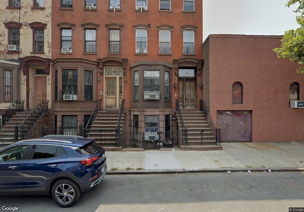
78 W 132nd St New York, NY 10037
Central Harlem NeighborhoodEstimated Value: $722,000
5
Beds
5
Baths
3,744
Sq Ft
$193/Sq Ft
Est. Value
About This Home
This home is located at 78 W 132nd St, New York, NY 10037 and is currently estimated at $722,000, approximately $192 per square foot. 78 W 132nd St is a home located in New York County with nearby schools including Ps 175 Henry H Garnet, Urban Assembly Academy for Future Leaders, and Capital Preparatory Harlem Charter School.
Ownership History
Date
Name
Owned For
Owner Type
Purchase Details
Closed on
Sep 24, 2002
Sold by
Renaissance Homes Llc
Bought by
Smith Adrianne
Current Estimated Value
Home Financials for this Owner
Home Financials are based on the most recent Mortgage that was taken out on this home.
Original Mortgage
$342,000
Outstanding Balance
$141,300
Interest Rate
6.09%
Estimated Equity
$580,700
Create a Home Valuation Report for This Property
The Home Valuation Report is an in-depth analysis detailing your home's value as well as a comparison with similar homes in the area
Home Values in the Area
Average Home Value in this Area
Purchase History
| Date | Buyer | Sale Price | Title Company |
|---|---|---|---|
| Smith Adrianne | -- | -- |
Source: Public Records
Mortgage History
| Date | Status | Borrower | Loan Amount |
|---|---|---|---|
| Open | Smith Adrianne | $342,000 |
Source: Public Records
Tax History Compared to Growth
Tax History
| Year | Tax Paid | Tax Assessment Tax Assessment Total Assessment is a certain percentage of the fair market value that is determined by local assessors to be the total taxable value of land and additions on the property. | Land | Improvement |
|---|---|---|---|---|
| 2025 | $13,794 | $68,676 | $14,937 | $53,739 |
| 2024 | $13,794 | $68,676 | $32,220 | $50,437 |
| 2023 | $13,843 | $68,160 | $19,153 | $49,007 |
| 2022 | $12,837 | $121,620 | $32,220 | $89,400 |
| 2021 | $12,767 | $130,680 | $32,220 | $98,460 |
| 2020 | $12,114 | $141,360 | $32,220 | $109,140 |
| 2019 | $11,972 | $128,160 | $32,220 | $95,940 |
| 2018 | $11,579 | $56,800 | $15,011 | $41,789 |
| 2017 | $10,140 | $53,586 | $15,161 | $38,425 |
| 2016 | $8,842 | $50,553 | $18,944 | $31,609 |
| 2015 | $3,508 | $47,692 | $16,083 | $31,609 |
| 2014 | $3,508 | $47,692 | $16,083 | $31,609 |
Source: Public Records
Map
Nearby Homes
- 430 Lenox Ave Unit 2R
- 51 W 131st St Unit 4-A
- 57 W 130th St Unit GARDEN
- 57 W 130th St Unit DUPLEX
- 57 W 130th St Unit PHA
- 111 W 132nd St
- 106 W 131st St
- 108 W 131st St
- 122 W 132nd St
- 130 W 132nd St
- 380 Lenox Ave Unit 8D
- 380 Lenox Ave Unit PHK
- 380 Lenox Ave Unit PHC
- 129 W 131st St Unit 1
- 124 W 131st St
- 370 Lenox Ave Unit 603
- 370 Lenox Ave Unit 501
- 370 Lenox Ave Unit 401
- 370 Lenox Ave Unit PH1
- 370 Lenox Ave Unit 606
- 78 W 132nd St Unit Building
- 78 W 132nd St Unit 1
- 80 W 132nd St
- 80 W 132nd St Unit 3
- 80 W 132nd St Unit 2
- 76 W 132nd St
- 74 W 132nd St
- 72 W 132nd St
- 440-442 Malcolm x Blvd
- 70 W 132nd St
- 68 W 132nd St
- 68 W 132nd St Unit 2
- 434 Lenox Ave Unit 3
- 434 Lenox Ave Unit 1
- 434 Lenox Ave Unit 4TH FLOOR
- 434 Lenox Ave Unit 3RD FLOOR
- 434 Lenox Ave Unit LIVE/WORK LOFT
- 436 Malcolm x Blvd
- 71 W 131st St
- 436 Lenox Ave