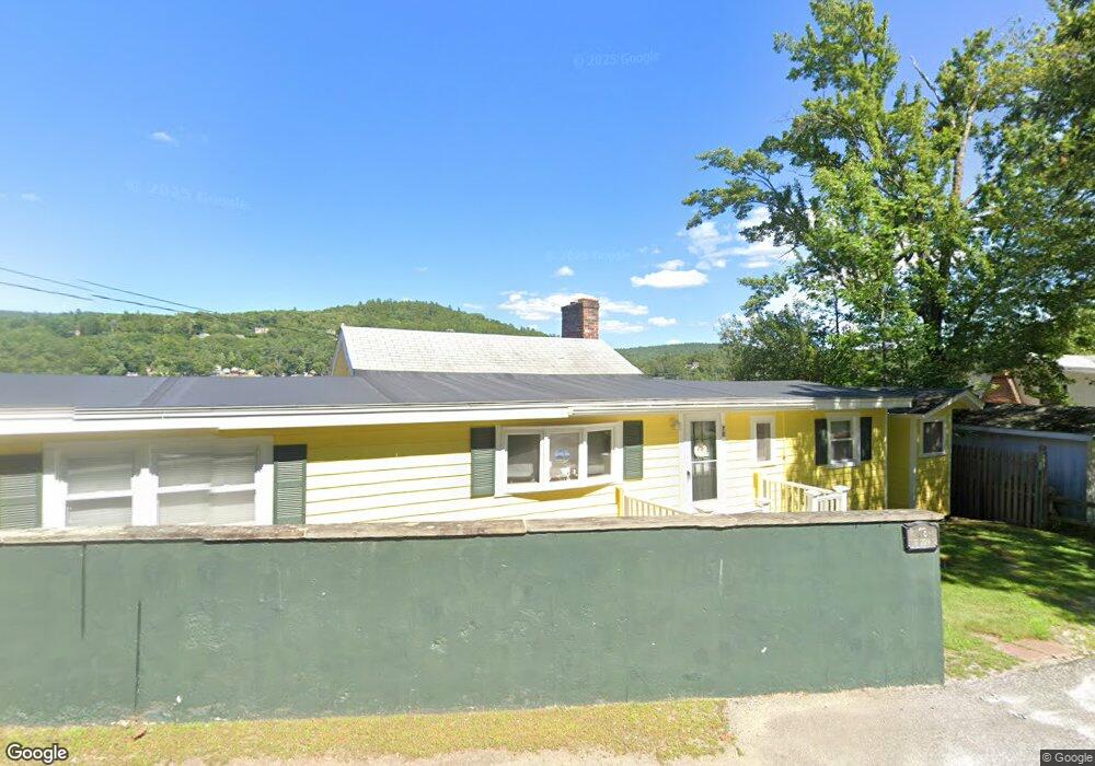
78 W Shore Rd Bristol, NH 03222
Estimated Value: $783,000 - $1,109,033
3
Beds
1
Bath
800
Sq Ft
$1,178/Sq Ft
Est. Value
About This Home
This home is located at 78 W Shore Rd, Bristol, NH 03222 and is currently estimated at $942,508, approximately $1,178 per square foot. 78 W Shore Rd is a home located in Grafton County.
Ownership History
Date
Name
Owned For
Owner Type
Purchase Details
Closed on
Jul 11, 2018
Sold by
Hertrich Russell E and Hertrich Kristine
Bought by
Kristine Hertrich Ret
Current Estimated Value
Purchase Details
Closed on
Mar 22, 2006
Sold by
Oconnor Ann M
Bought by
Hertrich Russell E and Hertrich Kristine
Home Financials for this Owner
Home Financials are based on the most recent Mortgage that was taken out on this home.
Original Mortgage
$250,000
Interest Rate
6%
Mortgage Type
Adjustable Rate Mortgage/ARM
Create a Home Valuation Report for This Property
The Home Valuation Report is an in-depth analysis detailing your home's value as well as a comparison with similar homes in the area
Home Values in the Area
Average Home Value in this Area
Purchase History
| Date | Buyer | Sale Price | Title Company |
|---|---|---|---|
| Kristine Hertrich Ret | -- | -- | |
| Hertrich Russell E | $500,000 | -- |
Source: Public Records
Mortgage History
| Date | Status | Borrower | Loan Amount |
|---|---|---|---|
| Previous Owner | Hertrich Russell E | $250,000 |
Source: Public Records
Tax History Compared to Growth
Tax History
| Year | Tax Paid | Tax Assessment Tax Assessment Total Assessment is a certain percentage of the fair market value that is determined by local assessors to be the total taxable value of land and additions on the property. | Land | Improvement |
|---|---|---|---|---|
| 2024 | $15,771 | $667,700 | $593,700 | $74,000 |
| 2023 | $15,190 | $667,700 | $593,700 | $74,000 |
| 2022 | $14,015 | $667,700 | $593,700 | $74,000 |
| 2021 | $13,494 | $667,700 | $593,700 | $74,000 |
| 2020 | $14,344 | $693,300 | $619,300 | $74,000 |
| 2019 | $11,927 | $523,100 | $458,600 | $64,500 |
| 2018 | $11,404 | $523,100 | $458,600 | $64,500 |
| 2017 | $11,576 | $523,100 | $458,600 | $64,500 |
| 2016 | $10,786 | $523,100 | $458,600 | $64,500 |
| 2015 | $8,875 | $440,900 | $372,500 | $68,400 |
| 2014 | $8,875 | $440,900 | $372,500 | $68,400 |
| 2013 | $8,897 | $440,900 | $372,500 | $68,400 |
Source: Public Records
Map
Nearby Homes
- 26 Don Gerry Rd
- 35 Manor Estates Dr Unit 14
- Lot 7 Hall Rd
- 94 Mandi Ln
- 383 Wulamat Rd
- 199 Cottage City Rd
- 333 Lake St
- 29 Daniels Rd
- 150 Peaked Hill Rd
- 40 Adams Rd
- 114 Ledgewood Terrace
- 30 Beech St Unit 4B
- 30 Beech St Unit 4C
- 135 Pleasant St
- 00 Peaked Hill Rd Unit 7.1, 7.2, 7.3, 7.4,
- 862 Mayhew Turnpike Unit 1
- 125 Verrill Rd
- 80 Patten Rd
- 00 Borough Rd Unit 1,2
- 4 Birchwood Dr Unit A
- 76 W Shore Rd
- 79 W Shore Rd
- 81 W Shore Rd
- 77 W Shore Rd
- 74 W Shore Rd
- 88 W Shore Rd
- 68 W Shore Rd
- 7 Mount Celo Rd
- 65 W Shore Rd
- 64 W Shore Rd
- 95 W Shore Rd
- 60 W Shore Rd
- 19 Mount Celo Rd
- 61 W Shore Rd
- 97 W Shore Rd
- 11 Pasquaney Shores Dr Unit 1
- 25 Mount Celo Rd
- 5 Pasquaney Shores Dr
- 30 Mount Celo Rd
- 57 W Shore Rd