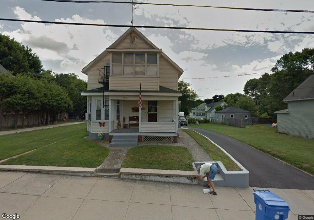
780 Grove St Woonsocket, RI 02895
Bernon District NeighborhoodEstimated Value: $335,000 - $392,000
3
Beds
2
Baths
1,343
Sq Ft
$276/Sq Ft
Est. Value
About This Home
This home is located at 780 Grove St, Woonsocket, RI 02895 and is currently estimated at $370,595, approximately $275 per square foot. 780 Grove St is a home located in Providence County with nearby schools including Woonsocket High School, Founders Academy, and Beacon Charter School.
Ownership History
Date
Name
Owned For
Owner Type
Purchase Details
Closed on
Oct 16, 2017
Sold by
Labrecque Arthur J and Labreque Diane L
Bought by
Labrecque Ft and Labrecque
Current Estimated Value
Purchase Details
Closed on
Mar 24, 2015
Sold by
Labrecque Arthur J and Labrecque Diane L
Bought by
Doyle Melanie L
Purchase Details
Closed on
Jan 1, 1987
Bought by
Labrecque Arthur J and Labrecque Diane L
Create a Home Valuation Report for This Property
The Home Valuation Report is an in-depth analysis detailing your home's value as well as a comparison with similar homes in the area
Home Values in the Area
Average Home Value in this Area
Purchase History
| Date | Buyer | Sale Price | Title Company |
|---|---|---|---|
| Labrecque Ft | -- | -- | |
| Labrecque Ft | -- | -- | |
| Doyle Melanie L | -- | -- | |
| Doyle Melanie L | -- | -- | |
| Labrecque Arthur J | -- | -- |
Source: Public Records
Mortgage History
| Date | Status | Borrower | Loan Amount |
|---|---|---|---|
| Previous Owner | Labrecque Arthur J | $15,000 | |
| Previous Owner | Labrecque Arthur J | $12,000 | |
| Previous Owner | Labrecque Arthur J | $27,324 |
Source: Public Records
Tax History
| Year | Tax Paid | Tax Assessment Tax Assessment Total Assessment is a certain percentage of the fair market value that is determined by local assessors to be the total taxable value of land and additions on the property. | Land | Improvement |
|---|---|---|---|---|
| 2025 | $3,915 | $348,600 | $107,500 | $241,100 |
| 2024 | $3,584 | $246,500 | $95,300 | $151,200 |
| 2023 | $3,446 | $246,500 | $95,300 | $151,200 |
| 2022 | $3,446 | $246,500 | $95,300 | $151,200 |
| 2021 | $3,434 | $144,600 | $59,900 | $84,700 |
| 2020 | $3,470 | $144,600 | $59,900 | $84,700 |
| 2018 | $3,482 | $144,600 | $59,900 | $84,700 |
| 2017 | $3,422 | $113,700 | $46,800 | $66,900 |
| 2016 | $3,620 | $113,700 | $46,800 | $66,900 |
| 2015 | $4,159 | $113,700 | $46,800 | $66,900 |
| 2014 | $3,652 | $114,100 | $51,500 | $62,600 |
Source: Public Records
Map
Nearby Homes
- 635 Park Ave
- 15 Knight St
- 122 Grand St
- 0 Irving Lot 192 Ave Unit 1383138
- 87 Kermit St
- 59 Cooper Ave
- 219 Crawford St
- 0 Irving Lot 206 Ave Unit 1397321
- 190 Crawford St
- 379 Front St
- 59 Division St
- 1 Admiral St
- 147 Warwick St
- 526 Bernon St
- 233 Grove St
- 109 Hemond Ave
- 43 Summit St
- 24 Paradis Ave
- 0 Holbrook Ln Unit 1402850
- 99 Allen St Unit 205
- 764 Grove St
- 794 Grove St
- 754 Grove St
- 771 Grove St
- 781 Grove St
- 757 Grove St
- 100 Blakeley St
- 749 Grove St
- 481 Cottage St
- 112 Blakeley St
- 461 Cottage St
- 814 Grove St
- 63 Blakeley St Unit 101
- 63 Blakeley St Unit 105
- 63 Blakeley St Unit 107
- 63 Blakeley St Unit 201
- 63 Blakeley St Unit 208
- 63 Blakeley St Unit 109
- 63 Blakeley St Unit 102
- 63 Blakeley St Unit 209
Your Personal Tour Guide
Ask me questions while you tour the home.