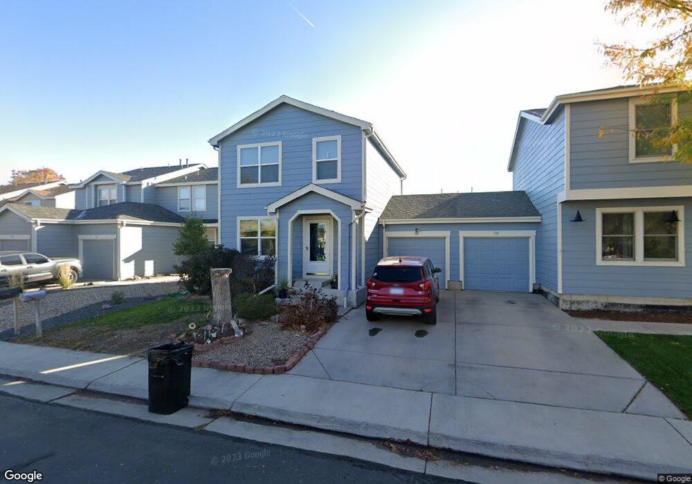
780 Mockingbird Ln Brighton, CO 80601
Estimated Value: $339,318 - $368,000
2
Beds
1
Bath
1,200
Sq Ft
$294/Sq Ft
Est. Value
About This Home
This home is located at 780 Mockingbird Ln, Brighton, CO 80601 and is currently estimated at $353,330, approximately $294 per square foot. 780 Mockingbird Ln is a home located in Adams County with nearby schools including South Elementary School, Rodger Quist Middle School, and Riverdale Ridge High School.
Ownership History
Date
Name
Owned For
Owner Type
Purchase Details
Closed on
Nov 14, 2016
Sold by
Alavarez Bernandetet
Bought by
Alverez Bernandete A and Mcclenodn Paul N
Current Estimated Value
Purchase Details
Closed on
Oct 25, 1999
Sold by
Kaufman & Broad Of Colorado Inc
Bought by
Alvarez Bernadette A
Home Financials for this Owner
Home Financials are based on the most recent Mortgage that was taken out on this home.
Original Mortgage
$102,300
Outstanding Balance
$27,954
Interest Rate
7.25%
Estimated Equity
$325,376
Create a Home Valuation Report for This Property
The Home Valuation Report is an in-depth analysis detailing your home's value as well as a comparison with similar homes in the area
Home Values in the Area
Average Home Value in this Area
Purchase History
| Date | Buyer | Sale Price | Title Company |
|---|---|---|---|
| Alverez Bernandete A | -- | None Available | |
| Alvarez Bernadette A | $113,716 | -- |
Source: Public Records
Mortgage History
| Date | Status | Borrower | Loan Amount |
|---|---|---|---|
| Open | Alvarez Bernadette A | $102,300 |
Source: Public Records
Tax History
| Year | Tax Paid | Tax Assessment Tax Assessment Total Assessment is a certain percentage of the fair market value that is determined by local assessors to be the total taxable value of land and additions on the property. | Land | Improvement |
|---|---|---|---|---|
| 2025 | $2,288 | $23,250 | $5,640 | $17,610 |
| 2024 | $2,288 | $21,380 | $5,190 | $16,190 |
| 2023 | $2,271 | $23,950 | $4,400 | $19,550 |
| 2022 | $2,065 | $18,360 | $3,680 | $14,680 |
| 2021 | $1,958 | $18,360 | $3,680 | $14,680 |
| 2020 | $1,766 | $17,300 | $3,790 | $13,510 |
| 2019 | $1,772 | $17,300 | $3,790 | $13,510 |
| 2018 | $1,491 | $14,450 | $1,220 | $13,230 |
| 2017 | $1,473 | $14,450 | $1,220 | $13,230 |
| 2016 | $1,109 | $10,800 | $1,350 | $9,450 |
| 2015 | $1,098 | $10,800 | $1,350 | $9,450 |
| 2014 | -- | $6,670 | $1,350 | $5,320 |
Source: Public Records
Map
Nearby Homes
- 727 Mockingbird St
- 677 Mockingbird St
- 801 Mockingbird St
- 846 Mockingbird Ln
- 892 Mockingbird Ln
- 1085 Mockingbird St
- 362 Dogwood Ave
- 1305 Waxwing Ave
- 765 S 1st Ave
- 1489 Hummingbird Cir
- 141 E Bromley Ln
- 230 Ash Ave Unit 4
- 475 S 2nd Ave
- 475 S 2nd Ave Unit Plot 1
- 784 S 3rd Ave
- 648 S 3rd Ave
- 303 S 2nd Ave
- 204 E Egbert St
- 617 S 5th Ave
- 219 S 3rd Ave
- 762 Mockingbird Ln
- 782 Mockingbird Ln
- 760 Mockingbird Ln
- 790 Mockingbird Ln
- 752 Mockingbird Ln
- 792 Mockingbird Ln
- 785 Mockingbird St
- 767 Mockingbird St
- 787 Mockingbird St
- 750 Mockingbird Ln
- 765 Mockingbird St
- 795 Mockingbird St
- 806 Mockingbird Ln
- 757 Mockingbird St
- 797 Mockingbird St
- 773 Mockingbird Ln
- 771 Mockingbird Ln
- 781 Mockingbird Ln
- 808 Mockingbird Ln
- 753 Mockingbird Ln
Your Personal Tour Guide
Ask me questions while you tour the home.