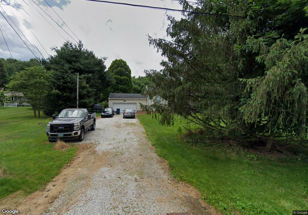
780 W Comet Rd New Franklin, OH 44216
Estimated Value: $170,000 - $266,000
2
Beds
1
Bath
1,310
Sq Ft
$157/Sq Ft
Est. Value
About This Home
This home is located at 780 W Comet Rd, New Franklin, OH 44216 and is currently estimated at $206,149, approximately $157 per square foot. 780 W Comet Rd is a home located in Summit County with nearby schools including Manchester Middle School, Nolley Elementary School, and Manchester High School.
Ownership History
Date
Name
Owned For
Owner Type
Purchase Details
Closed on
Jun 20, 2011
Sold by
Deutsche Bank National Trust Company
Bought by
Zold Sandor
Current Estimated Value
Purchase Details
Closed on
Jun 30, 2010
Sold by
Drowns Barbara A
Bought by
Deutsche Bank National Trust Company
Purchase Details
Closed on
Jul 14, 2005
Sold by
Drowns Roger A
Bought by
Drowns Barbara A
Create a Home Valuation Report for This Property
The Home Valuation Report is an in-depth analysis detailing your home's value as well as a comparison with similar homes in the area
Home Values in the Area
Average Home Value in this Area
Purchase History
| Date | Buyer | Sale Price | Title Company |
|---|---|---|---|
| Zold Sandor | $45,199 | None Available | |
| Deutsche Bank National Trust Company | $80,000 | Attorney | |
| Drowns Barbara A | -- | -- |
Source: Public Records
Tax History Compared to Growth
Tax History
| Year | Tax Paid | Tax Assessment Tax Assessment Total Assessment is a certain percentage of the fair market value that is determined by local assessors to be the total taxable value of land and additions on the property. | Land | Improvement |
|---|---|---|---|---|
| 2025 | $6,291 | $57,705 | $16,433 | $41,272 |
| 2024 | $2,919 | $57,705 | $16,433 | $41,272 |
| 2023 | $6,291 | $57,705 | $16,433 | $41,272 |
| 2022 | $2,793 | $43,502 | $12,264 | $31,238 |
| 2021 | $2,853 | $43,502 | $12,264 | $31,238 |
| 2020 | $2,805 | $43,500 | $12,260 | $31,240 |
| 2019 | $1,607 | $22,250 | $6,130 | $16,120 |
| 2018 | $1,391 | $22,250 | $6,130 | $16,120 |
| 2017 | $1,334 | $22,250 | $6,130 | $16,120 |
| 2016 | $1,318 | $19,330 | $6,130 | $13,200 |
| 2015 | $1,334 | $19,330 | $6,130 | $13,200 |
| 2014 | $1,324 | $19,330 | $6,130 | $13,200 |
| 2013 | $1,371 | $20,100 | $6,130 | $13,970 |
Source: Public Records
Map
Nearby Homes
- 0 W Comet Rd Unit 5079117
- 7060 Manchester Rd
- 11391 Michelle Dr NW
- 0 Babst Ave NW
- 11265 Tritts St NW
- 8817 Willingham Dr NW
- 8655 Spring Grove Ave NW
- 8801 Willingham Dr NW
- 899 Loway Dr
- 8550 Cherryridge Ave NW
- 10400 Strausser St NW
- 5898 Keller Rd
- 6387 Hampsher Rd
- 7709 Brownwood Ave NW
- 8470 Shadyview Ave NW
- Ballenger w/ Basement Plan at Heritage Village
- Columbia w/ Basement Plan at Heritage Village
- Allegheny w/ Basement Plan at Heritage Village
- Hudson w/ Basement Plan at Heritage Village
- 5838 Harter Home Dr
- 766 W Comet Rd
- 796 W Comet Rd
- 843 W Comet Rd
- 812 W Comet Rd
- 736 W Comet Rd
- 830 W Comet Rd
- 7079 NW Akron Ave
- 7119 NW Akron Ave
- 7091 Manchester Rd
- 714 W Comet Rd
- 7091 NW Akron Ave
- 700 W Comet Rd
- 7035 NW Akron Ave
- 0 W Comet Rd Unit 4008575
- 0 W Comet Rd Unit 3126546
- 0 W Comet Rd Unit 3259912
- 0 W Comet Rd Unit 3315619
- 0 W Comet Rd Unit 3368981
- 0 W Comet Rd Unit 3376814
- 0 W Comet Rd Unit 3849327