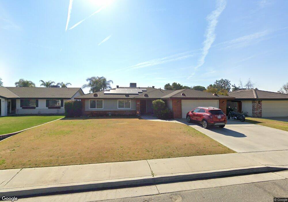
7801 Carol Sue Ct Bakersfield, CA 93308
Fruitvale NeighborhoodEstimated Value: $442,401 - $466,000
4
Beds
2
Baths
1,890
Sq Ft
$241/Sq Ft
Est. Value
About This Home
This home is located at 7801 Carol Sue Ct, Bakersfield, CA 93308 and is currently estimated at $455,100, approximately $240 per square foot. 7801 Carol Sue Ct is a home located in Kern County with nearby schools including Olive Drive Elementary School, Norris Middle School, and Centennial High School.
Ownership History
Date
Name
Owned For
Owner Type
Purchase Details
Closed on
Jul 22, 2025
Sold by
Cmg Mortgage Inc
Bought by
Secretary Of Veterans Affairs
Current Estimated Value
Purchase Details
Closed on
Jun 13, 2025
Sold by
Trustee Corps and Mtc Financial Inc
Bought by
Cmg Mortgage Inc
Purchase Details
Closed on
Sep 17, 2018
Sold by
Davis Richard A
Bought by
Davis Richard A
Home Financials for this Owner
Home Financials are based on the most recent Mortgage that was taken out on this home.
Original Mortgage
$278,910
Interest Rate
4.5%
Mortgage Type
VA
Purchase Details
Closed on
Nov 11, 2011
Sold by
Davis Bonnie L
Bought by
Davis Richard A
Home Financials for this Owner
Home Financials are based on the most recent Mortgage that was taken out on this home.
Original Mortgage
$214,864
Interest Rate
3.93%
Mortgage Type
VA
Purchase Details
Closed on
Nov 10, 2011
Sold by
Mcelwee Bertha Mae and Mcelwee Bertha Mae
Bought by
Davis Richard A
Home Financials for this Owner
Home Financials are based on the most recent Mortgage that was taken out on this home.
Original Mortgage
$214,864
Interest Rate
3.93%
Mortgage Type
VA
Purchase Details
Closed on
Jul 11, 2011
Sold by
Mcelwee Bertha M
Bought by
Mcelwee Bertha Mae and The Bertha Mae Mcelwee Revocab
Purchase Details
Closed on
Mar 5, 2010
Sold by
Deutsche Bank National Trust Company
Bought by
Mcelwee Bertha M
Purchase Details
Closed on
Dec 7, 2009
Sold by
Bucholz Elizabeth
Bought by
Deutsche Bank National Trust Company
Purchase Details
Closed on
Jul 14, 2006
Sold by
Bucholz Robert
Bought by
Bucholz Elizabeth
Home Financials for this Owner
Home Financials are based on the most recent Mortgage that was taken out on this home.
Original Mortgage
$343,200
Interest Rate
7.12%
Mortgage Type
Purchase Money Mortgage
Purchase Details
Closed on
Jun 7, 2000
Sold by
Va
Bought by
Hupp Leo F and Hupp Barbara L
Home Financials for this Owner
Home Financials are based on the most recent Mortgage that was taken out on this home.
Original Mortgage
$93,100
Interest Rate
10.25%
Purchase Details
Closed on
May 30, 2000
Sold by
Hupp Leo F and Hupp Barbara L
Bought by
Bucholz Robert and Bucholz Elizabeth
Home Financials for this Owner
Home Financials are based on the most recent Mortgage that was taken out on this home.
Original Mortgage
$93,100
Interest Rate
10.25%
Create a Home Valuation Report for This Property
The Home Valuation Report is an in-depth analysis detailing your home's value as well as a comparison with similar homes in the area
Home Values in the Area
Average Home Value in this Area
Purchase History
| Date | Buyer | Sale Price | Title Company |
|---|---|---|---|
| Secretary Of Veterans Affairs | -- | Servicelink | |
| Cmg Mortgage Inc | $367,299 | Servicelink | |
| Davis Richard A | -- | Stewart Title | |
| Davis Richard A | -- | Placer Title Company | |
| Davis Richard A | $208,000 | Placer Title Company | |
| Mcelwee Bertha Mae | -- | None Available | |
| Mcelwee Bertha M | $176,000 | Landsafe Title | |
| Deutsche Bank National Trust Company | $165,750 | Landsafe Title | |
| Bucholz Elizabeth | -- | Chicago Title | |
| Hupp Leo F | -- | American Title Co | |
| Bucholz Robert | $133,000 | American Title Co |
Source: Public Records
Mortgage History
| Date | Status | Borrower | Loan Amount |
|---|---|---|---|
| Previous Owner | Davis Richard A | $278,910 | |
| Previous Owner | Davis Richard A | $214,864 | |
| Previous Owner | Bucholz Elizabeth | $343,200 | |
| Previous Owner | Bucholz Robert | $93,100 | |
| Closed | Bucholz Robert | $26,600 |
Source: Public Records
Tax History Compared to Growth
Tax History
| Year | Tax Paid | Tax Assessment Tax Assessment Total Assessment is a certain percentage of the fair market value that is determined by local assessors to be the total taxable value of land and additions on the property. | Land | Improvement |
|---|---|---|---|---|
| 2025 | $3,529 | $261,246 | $50,235 | $211,011 |
| 2024 | $3,529 | $256,124 | $49,250 | $206,874 |
| 2023 | $3,458 | $251,103 | $48,285 | $202,818 |
| 2022 | $3,387 | $246,181 | $47,339 | $198,842 |
| 2021 | $3,301 | $241,355 | $46,411 | $194,944 |
| 2020 | $3,202 | $238,882 | $45,936 | $192,946 |
| 2019 | $3,155 | $238,882 | $45,936 | $192,946 |
| 2018 | $3,052 | $229,607 | $44,153 | $185,454 |
| 2017 | $3,063 | $225,106 | $43,288 | $181,818 |
| 2016 | $2,856 | $220,693 | $42,440 | $178,253 |
| 2015 | $2,808 | $217,379 | $41,803 | $175,576 |
| 2014 | $2,730 | $213,122 | $40,985 | $172,137 |
Source: Public Records
Map
Nearby Homes
- 5433 Westpark St
- 7700 Peanut Ave
- 5216 Westpark St
- 7625 Weldon Ave
- 7800 Pembroke Ave
- 5407 Southshore Dr
- 5100 Ruth Ct
- 7357 Hooper Ave
- 7601 Live Oak Way
- 8118 Whitewater Dr
- 8001 Olive Dr
- 7946 Debbs Ave
- 7601 Darrin Ave
- 7112 Brookshire Ave
- 7421 Feather River Dr
- 7001 Eloy Ave
- 8707 Shore View Dr
- 5510 Edge Water Ct
- 5204 Sand Castle Ct
- 8503 Sun Harbor Dr
- 7805 Carol Sue Ct
- 7709 Carol Sue Ct
- 7808 Peanut Ave
- 7809 Carol Sue Ct
- 7800 Peanut Ave
- 7816 Peanut Ave
- 7705 Carol Sue Ct
- 7708 Carol Sue Ct
- 7716 Peanut Ave
- 7701 Carol Sue Ct
- 7824 Peanut Ave
- 7813 Carol Sue Ct
- 7808 Carol Sue Ct
- 7704 Carol Sue Ct
- 7700 Carol Sue Ct
- 7816 Carol Sue Ct
- 7708 Peanut Ave
- 7900 Peanut Ave
- 7817 Carol Sue Ct
- 5401 Westpark St