78040 Lupine Ln Weston, OR 97886
Estimated Value: $308,000 - $605,000
3
Beds
1
Bath
3,690
Sq Ft
$117/Sq Ft
Est. Value
About This Home
This home is located at 78040 Lupine Ln, Weston, OR 97886 and is currently estimated at $432,433, approximately $117 per square foot. 78040 Lupine Ln is a home located in Umatilla County with nearby schools including Athena Elementary School, Weston Middle School, and Weston-McEwen High School.
Ownership History
Date
Name
Owned For
Owner Type
Purchase Details
Closed on
May 8, 2015
Sold by
Mascak Christina
Bought by
Noland Ronald E and Noland Cindy L
Current Estimated Value
Purchase Details
Closed on
Jan 10, 2005
Sold by
Beaunaux Christina
Bought by
Beaunaux John S and Beaunaux Christina
Home Financials for this Owner
Home Financials are based on the most recent Mortgage that was taken out on this home.
Original Mortgage
$131,000
Interest Rate
5.8%
Mortgage Type
Construction
Create a Home Valuation Report for This Property
The Home Valuation Report is an in-depth analysis detailing your home's value as well as a comparison with similar homes in the area
Home Values in the Area
Average Home Value in this Area
Purchase History
| Date | Buyer | Sale Price | Title Company |
|---|---|---|---|
| Noland Ronald E | $147,000 | Amerititle | |
| Beaunaux John S | -- | Amerititle |
Source: Public Records
Mortgage History
| Date | Status | Borrower | Loan Amount |
|---|---|---|---|
| Previous Owner | Mascak Christina | $30,000 | |
| Previous Owner | Beaunaux John S | $131,000 |
Source: Public Records
Tax History Compared to Growth
Tax History
| Year | Tax Paid | Tax Assessment Tax Assessment Total Assessment is a certain percentage of the fair market value that is determined by local assessors to be the total taxable value of land and additions on the property. | Land | Improvement |
|---|---|---|---|---|
| 2024 | $2,549 | $188,260 | $58,670 | $129,590 |
| 2023 | $2,476 | $182,780 | $56,960 | $125,820 |
| 2022 | $2,308 | $177,460 | $0 | $0 |
| 2021 | $2,326 | $172,300 | $53,690 | $118,610 |
| 2020 | $2,264 | $167,290 | $52,130 | $115,160 |
| 2018 | $2,153 | $157,690 | $49,140 | $108,550 |
| 2017 | $2,117 | $153,100 | $47,710 | $105,390 |
| 2016 | $1,914 | $143,450 | $46,320 | $97,130 |
| 2015 | $1,834 | $131,300 | $42,390 | $88,910 |
| 2014 | $1,674 | $131,300 | $42,390 | $88,910 |
Source: Public Records
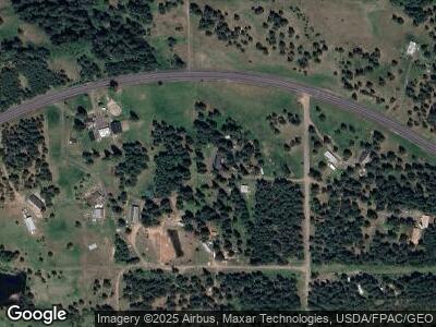
Map
Nearby Homes
- 0 Oregon 204 Unit 24330295
- 58215 Highway 204
- 78288 Black Pine Ln
- 138028 Black Pine Ln
- 58472 Highway 204
- 78228 Snowshoe Rd
- 78259 Strawberry Ln
- 57654 Bingham Rd
- 80260 S Fork Walla Riv Rd
- 61515 Highway 204
- 81890 S Fork Walla River Rd
- 81890 S Fork Walla Riv Rd
- 317 S State St
- 402 E College St
- 402 E Main St
- 604 S Broad St
- 0 Vacant Land Unit 24319177
- 212 S Water St
- 000 Coyote Ridge Rd
- 000 Oregon 204