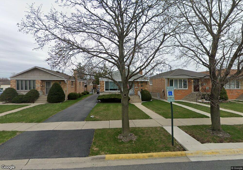
7805 Melvina Ave Burbank, IL 60459
Estimated Value: $276,000 - $309,000
3
Beds
1
Bath
1,029
Sq Ft
$281/Sq Ft
Est. Value
About This Home
This home is located at 7805 Melvina Ave, Burbank, IL 60459 and is currently estimated at $289,390, approximately $281 per square foot. 7805 Melvina Ave is a home located in Cook County with nearby schools including Harry E. Fry School, Reavis High School, and St Albert the Great Catholic School.
Ownership History
Date
Name
Owned For
Owner Type
Purchase Details
Closed on
Dec 7, 2001
Sold by
Murphy Dawn M and Grogan Dawn M
Bought by
Grogan Lawrence M and Grogan Dawn M
Current Estimated Value
Home Financials for this Owner
Home Financials are based on the most recent Mortgage that was taken out on this home.
Original Mortgage
$109,400
Interest Rate
5.94%
Create a Home Valuation Report for This Property
The Home Valuation Report is an in-depth analysis detailing your home's value as well as a comparison with similar homes in the area
Home Values in the Area
Average Home Value in this Area
Purchase History
| Date | Buyer | Sale Price | Title Company |
|---|---|---|---|
| Grogan Lawrence M | -- | Stewart Title |
Source: Public Records
Mortgage History
| Date | Status | Borrower | Loan Amount |
|---|---|---|---|
| Closed | Grogan Lawrence M | $109,400 | |
| Closed | Grogan Lawrence M | $92,000 |
Source: Public Records
Tax History
| Year | Tax Paid | Tax Assessment Tax Assessment Total Assessment is a certain percentage of the fair market value that is determined by local assessors to be the total taxable value of land and additions on the property. | Land | Improvement |
|---|---|---|---|---|
| 2025 | $4,503 | $20,479 | $4,674 | $15,805 |
| 2024 | $4,503 | $20,479 | $4,674 | $15,805 |
| 2023 | $3,984 | $20,479 | $4,674 | $15,805 |
| 2022 | $3,984 | $16,489 | $4,059 | $12,430 |
| 2021 | $3,872 | $16,488 | $4,059 | $12,429 |
| 2020 | $3,882 | $16,488 | $4,059 | $12,429 |
| 2019 | $3,240 | $15,215 | $3,690 | $11,525 |
| 2018 | $3,144 | $15,215 | $3,690 | $11,525 |
| 2017 | $3,076 | $15,215 | $3,690 | $11,525 |
| 2016 | $2,548 | $11,513 | $3,075 | $8,438 |
| 2015 | $2,799 | $12,748 | $3,075 | $9,673 |
| 2014 | $3,349 | $14,581 | $3,075 | $11,506 |
| 2013 | $3,222 | $15,227 | $3,075 | $12,152 |
Source: Public Records
Map
Nearby Homes
- 7851 Moody Ave
- 6124 W 79th St
- 7723 Melvina Ave
- 7827 Meade Ave
- 7948 Merrimac Ave
- 8014 Mobile Ave
- 7820 Nagle Ave
- 6117 W 81st St
- 8033 Austin Ave
- 7805 Natchez Ave
- 7836 Monitor Ave
- 8121 Mcvicker Ave
- 7709 Neenah Ave
- 5822 W 79th St
- 7544 Mason Ave
- 7852 Neenah Ave
- 7745 Nashville Ave
- 8215 Austin Ave
- 7843 Massasoit Ave
- 5735 W 80th St
- 7807 Melvina Ave
- 7809 Melvina Ave
- 7813 Melvina Ave
- 7759 Melvina Ave
- 7804 Moody Ave
- 7800 Moody Ave
- 7816 Moody Ave
- 7815 Melvina Ave
- 7815 Melvina Ave
- 7820 Moody Ave
- 7757 Melvina Ave
- 7804 Melvina Ave
- 7800 Melvina Ave
- 7822 Moody Ave
- 7751 Melvina Ave
- 7758 Moody Ave
- 7810 Melvina Ave
- 7810 Melvina Ave
- 7814 Melvina Ave
- 7814 Melvina Ave
Your Personal Tour Guide
Ask me questions while you tour the home.