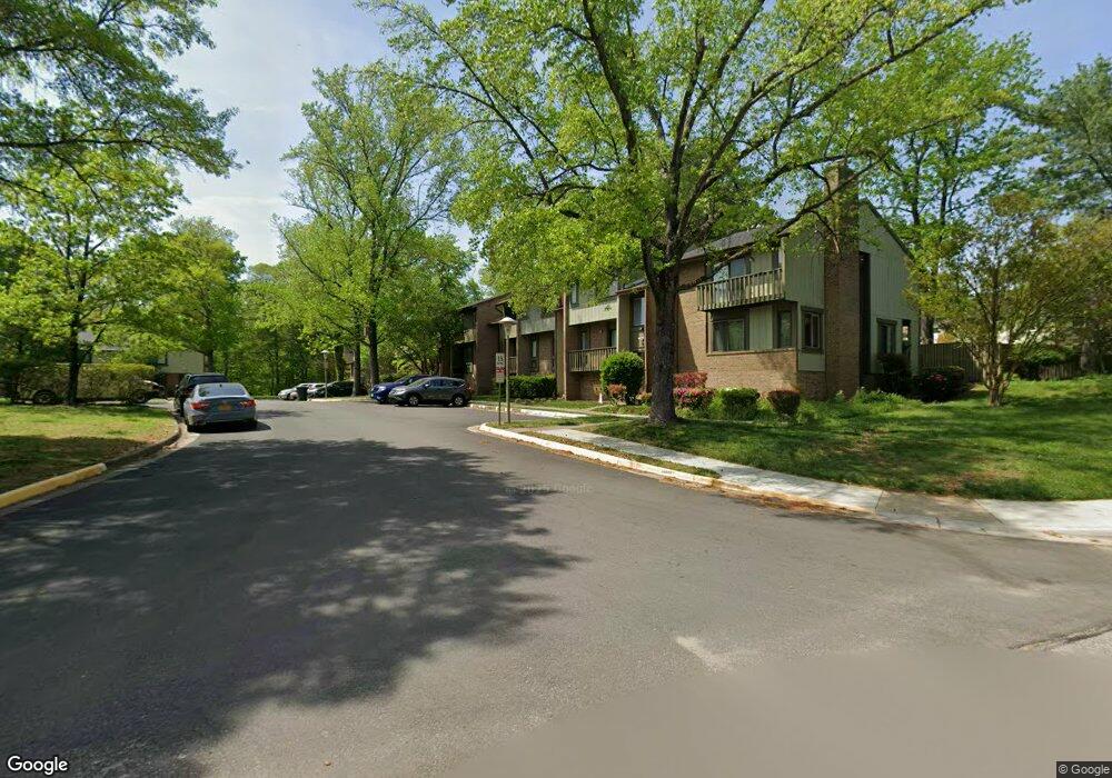
7806 Marconi Ct Springfield, VA 22153
Estimated Value: $507,000 - $567,000
3
Beds
2
Baths
1,376
Sq Ft
$390/Sq Ft
Est. Value
About This Home
This home is located at 7806 Marconi Ct, Springfield, VA 22153 and is currently estimated at $537,064, approximately $390 per square foot. 7806 Marconi Ct is a home located in Fairfax County with nearby schools including Saratoga Elementary School, Key Middle, and Lewis High School.
Ownership History
Date
Name
Owned For
Owner Type
Purchase Details
Closed on
Mar 15, 2016
Sold by
Diggs Richard A and Diggs Richard A
Bought by
Diggs Richard A
Current Estimated Value
Home Financials for this Owner
Home Financials are based on the most recent Mortgage that was taken out on this home.
Original Mortgage
$284,750
Outstanding Balance
$225,378
Interest Rate
3.65%
Mortgage Type
New Conventional
Estimated Equity
$311,686
Purchase Details
Closed on
Aug 25, 2005
Sold by
Chamowitz Michael J
Bought by
Diggs Richard A and Diggs Jr,Richard A
Home Financials for this Owner
Home Financials are based on the most recent Mortgage that was taken out on this home.
Original Mortgage
$296,000
Interest Rate
5.68%
Mortgage Type
Construction
Create a Home Valuation Report for This Property
The Home Valuation Report is an in-depth analysis detailing your home's value as well as a comparison with similar homes in the area
Home Values in the Area
Average Home Value in this Area
Purchase History
| Date | Buyer | Sale Price | Title Company |
|---|---|---|---|
| Diggs Richard A | -- | None Available | |
| Diggs Richard A | $370,000 | -- |
Source: Public Records
Mortgage History
| Date | Status | Borrower | Loan Amount |
|---|---|---|---|
| Open | Diggs Richard A | $284,750 | |
| Previous Owner | Diggs Richard A | $296,000 |
Source: Public Records
Tax History Compared to Growth
Tax History
| Year | Tax Paid | Tax Assessment Tax Assessment Total Assessment is a certain percentage of the fair market value that is determined by local assessors to be the total taxable value of land and additions on the property. | Land | Improvement |
|---|---|---|---|---|
| 2025 | $5,233 | $481,610 | $170,000 | $311,610 |
| 2024 | $5,233 | $451,690 | $160,000 | $291,690 |
| 2023 | $4,794 | $424,800 | $150,000 | $274,800 |
| 2022 | $4,629 | $404,840 | $140,000 | $264,840 |
| 2021 | $4,295 | $366,000 | $120,000 | $246,000 |
| 2020 | $4,192 | $354,180 | $113,000 | $241,180 |
| 2019 | $4,073 | $344,160 | $110,000 | $234,160 |
| 2018 | $3,735 | $324,740 | $95,000 | $229,740 |
| 2017 | $3,539 | $304,820 | $90,000 | $214,820 |
| 2016 | $3,531 | $304,820 | $90,000 | $214,820 |
| 2015 | $3,310 | $296,560 | $88,000 | $208,560 |
| 2014 | $3,201 | $287,490 | $85,000 | $202,490 |
Source: Public Records
Map
Nearby Homes
- 7702 Brandeis Way
- 7719 Durer Ct
- 7700 Shadowcreek Terrace
- 7730 Shadowcreek Terrace
- 8408 Dampier Ct
- 8508 Laurel Oak Dr
- 8498 Laurel Oak Dr
- 7673 Northern Oaks Ct
- 8322 Cushing Ct
- 8726 Wadebrook Terrace
- 8334 Terra Grande Ave
- 8321 Terra Grande Ave
- 8109 Overton Ct
- 8298 Lindside Way
- 8108 Kings Point Ct
- 8080 Powderbrook Ln
- 8006 Northumberland Rd
- 7752 Milford Haven Dr Unit 52D
- 8934 Milford Haven Ct Unit 34A
- 7658 Henry Knox Dr
- 7804 Marconi Ct
- 7808 Marconi Ct
- 7802 Marconi Ct
- 7810 Marconi Ct
- 7812 Marconi Ct
- 7800 Marconi Ct
- 7814 Marconi Ct
- 7816 Marconi Ct
- 7774 Brandeis Way
- 7772 Brandeis Way
- 7770 Brandeis Way
- 7818 Marconi Ct
- 7768 Brandeis Way
- 7766 Brandeis Way
- 7764 Brandeis Way
- 7762 Brandeis Way
- 7820 Marconi Ct
- 8501 Jenner Ct
- 7822 Marconi Ct
- 7760 Brandeis Way