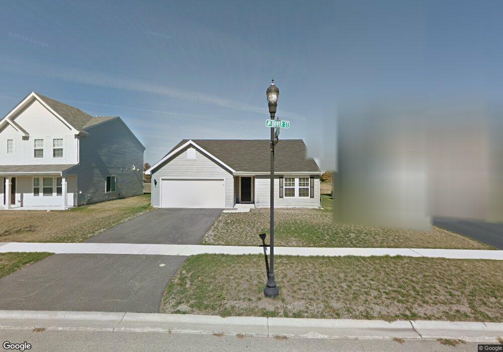
781 Dover St Pingree Grove, IL 60140
Estimated Value: $313,000 - $418,000
2
Beds
2
Baths
1,805
Sq Ft
$197/Sq Ft
Est. Value
About This Home
This home is located at 781 Dover St, Pingree Grove, IL 60140 and is currently estimated at $356,288, approximately $197 per square foot. 781 Dover St is a home located in Kane County with nearby schools including Hampshire Middle School, Hampshire High School, and Cambridge Lakes Charter School.
Ownership History
Date
Name
Owned For
Owner Type
Purchase Details
Closed on
Nov 30, 2022
Sold by
Kinsella Edward W and Kinsella Susan J
Bought by
Edward W Kinsella Trust and Susan J Kinsella Trust
Current Estimated Value
Purchase Details
Closed on
Feb 17, 2012
Sold by
Drh Cambridge Homes Inc
Bought by
Kinsella Edward W and Kinsella Susan J
Home Financials for this Owner
Home Financials are based on the most recent Mortgage that was taken out on this home.
Original Mortgage
$126,990
Interest Rate
3.87%
Mortgage Type
New Conventional
Create a Home Valuation Report for This Property
The Home Valuation Report is an in-depth analysis detailing your home's value as well as a comparison with similar homes in the area
Home Values in the Area
Average Home Value in this Area
Purchase History
| Date | Buyer | Sale Price | Title Company |
|---|---|---|---|
| Edward W Kinsella Trust | -- | -- | |
| Kinsella Edward W | $167,000 | Fatic |
Source: Public Records
Mortgage History
| Date | Status | Borrower | Loan Amount |
|---|---|---|---|
| Previous Owner | Kinsella Edward W | $126,990 |
Source: Public Records
Tax History Compared to Growth
Tax History
| Year | Tax Paid | Tax Assessment Tax Assessment Total Assessment is a certain percentage of the fair market value that is determined by local assessors to be the total taxable value of land and additions on the property. | Land | Improvement |
|---|---|---|---|---|
| 2024 | $8,364 | $96,515 | $30,777 | $65,738 |
| 2023 | $8,182 | $87,280 | $27,832 | $59,448 |
| 2022 | $7,845 | $80,472 | $25,661 | $54,811 |
| 2021 | $7,672 | $75,689 | $24,136 | $51,553 |
| 2020 | $7,553 | $73,757 | $23,520 | $50,237 |
| 2019 | $7,422 | $70,791 | $22,574 | $48,217 |
| 2018 | $7,260 | $66,439 | $21,186 | $45,253 |
| 2017 | $7,075 | $62,563 | $20,175 | $42,388 |
| 2016 | $7,063 | $59,561 | $19,207 | $40,354 |
| 2015 | -- | $56,253 | $18,140 | $38,113 |
| 2014 | -- | $53,743 | $15,630 | $38,113 |
| 2013 | -- | $54,729 | $15,917 | $38,812 |
Source: Public Records
Map
Nearby Homes
- 700 Brighton Dr
- 560 Canterbury Ln
- 395 Brookhaven Trail
- 410 Brookhaven Trail
- 955 Emerald Dr
- 898 Emerald Dr
- 460 Lancaster Dr
- 562 Lancaster Dr
- 1157 Clearwater Dr
- 932 Clover Ln
- Lot 019 Old Stage Rd
- 1173 Sonoma Ct
- 163 Maryland Ln
- 1286 Newport Cir
- 1255 Waterfront Ln
- 1385 Broadland Dr
- 1641 Sandcastle Ln
- 1701 Windward Dr
- 1740 Spinnaker St
- 1192 Alta Vista Dr