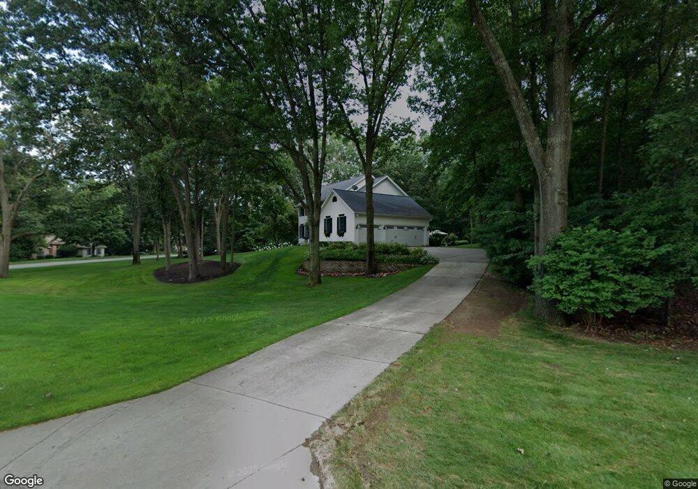
7811 Spring Point Ct NE Rockford, MI 49341
Estimated Value: $591,687 - $791,000
4
Beds
4
Baths
4,200
Sq Ft
$161/Sq Ft
Est. Value
About This Home
This home is located at 7811 Spring Point Ct NE, Rockford, MI 49341 and is currently estimated at $675,922, approximately $160 per square foot. 7811 Spring Point Ct NE is a home located in Kent County with nearby schools including Meadow Ridge Elementary School, East Rockford Middle School, and Rockford High School Freshman Center.
Ownership History
Date
Name
Owned For
Owner Type
Purchase Details
Closed on
Jul 6, 2020
Sold by
Korlewitz James A and Korlewitz Christine C
Bought by
Korlewitz James and Korlewitz Christine C
Current Estimated Value
Purchase Details
Closed on
Jun 25, 2007
Sold by
Primacy Closing Corp
Bought by
Korlewitz James A and Korlewitz Christine C
Purchase Details
Closed on
Mar 29, 1996
Bought by
Michael and Amy Bivins
Create a Home Valuation Report for This Property
The Home Valuation Report is an in-depth analysis detailing your home's value as well as a comparison with similar homes in the area
Home Values in the Area
Average Home Value in this Area
Purchase History
| Date | Buyer | Sale Price | Title Company |
|---|---|---|---|
| Korlewitz James | -- | None Available | |
| Korlewitz James A | $299,000 | Metropolitan Title Company | |
| Primacy Closing Corp | $365,000 | Metropolitan Title Company | |
| Michael | $39,000 | -- |
Source: Public Records
Tax History Compared to Growth
Tax History
| Year | Tax Paid | Tax Assessment Tax Assessment Total Assessment is a certain percentage of the fair market value that is determined by local assessors to be the total taxable value of land and additions on the property. | Land | Improvement |
|---|---|---|---|---|
| 2025 | $3,763 | $243,700 | $0 | $0 |
| 2024 | $3,763 | $232,200 | $0 | $0 |
| 2023 | $3,600 | $199,900 | $0 | $0 |
| 2022 | $5,055 | $191,000 | $0 | $0 |
| 2021 | $4,859 | $182,100 | $0 | $0 |
| 2020 | $3,332 | $177,300 | $0 | $0 |
| 2019 | $4,756 | $161,700 | $0 | $0 |
| 2018 | $4,810 | $167,700 | $49,400 | $118,300 |
| 2017 | $4,686 | $162,600 | $0 | $0 |
| 2016 | $4,486 | $142,300 | $0 | $0 |
| 2015 | -- | $142,300 | $0 | $0 |
| 2013 | -- | $137,300 | $0 | $0 |
Source: Public Records
Map
Nearby Homes
- 7650 Courtland Dr NE
- 4749 Windcliff Dr NE Unit 9
- 4777 Windcliff Dr NE
- 4985 Tiamo Ln NE
- 7878 Northland Dr NE
- 8241 Courtland Dr NE
- 5090 Natchez Ct NE
- 8365 Atlanta Dr NE
- 8343 Atlanta Dr NE
- 5700 Kies St NE
- 4286 Millpond Dr NE
- 8311 Rum Creek Trail NE
- 6950 Barkley Creek Dr NE
- 175 S Main St
- 131 S Monroe St NE
- 142 E Division St NE
- 126 S Main St
- 178 Maple St NE
- 8035 Jericho Ave NE
- 107 S Main St
- 7793 Spring Point Ct NE
- 5046 Glen Oaks Dr NE
- 7864 Newport Ave NE
- 7775 Spring Point Ct NE
- 5118 Glen Oaks Dr NE
- 7800 Spring Point Ct NE
- 5081 Glen Oaks Dr NE
- 7776 Spring Point Ct NE
- 5014 Glen Oaks Dr NE
- 7778 Forest Ct NE
- 7753 Spring Point Ct NE
- 7855 Newport Ave NE
- 5103 Glen Oaks Dr NE
- 7764 Forest Ct NE
- 7754 Spring Point Ct NE
- 5139 Glen Oaks Dr NE
- 5184 Glen Oaks Dr NE
- 5001 Glen Oaks Dr NE
- 7725 Spring Point Ct NE
- 7750 Forest Ct NE