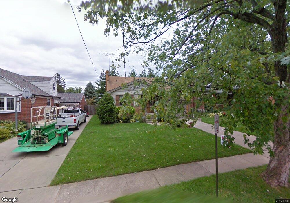
7816 Matson Ct Cincinnati, OH 45236
Estimated Value: $240,000 - $295,000
3
Beds
2
Baths
1,387
Sq Ft
$194/Sq Ft
Est. Value
About This Home
This home is located at 7816 Matson Ct, Cincinnati, OH 45236 and is currently estimated at $268,955, approximately $193 per square foot. 7816 Matson Ct is a home located in Hamilton County with nearby schools including Amity Elementary School, Deer Park Jr/Sr High School, and Ohr Torah Cincinnati.
Ownership History
Date
Name
Owned For
Owner Type
Purchase Details
Closed on
Sep 6, 2022
Sold by
Storer Anne E
Bought by
Gruter Johnathan D and Gruter David J
Current Estimated Value
Home Financials for this Owner
Home Financials are based on the most recent Mortgage that was taken out on this home.
Original Mortgage
$181,649
Outstanding Balance
$173,017
Interest Rate
4.88%
Mortgage Type
FHA
Estimated Equity
$95,938
Purchase Details
Closed on
Jun 20, 2002
Sold by
Kissing Steven M and Kissing Mary E
Bought by
Storer Anne E
Home Financials for this Owner
Home Financials are based on the most recent Mortgage that was taken out on this home.
Original Mortgage
$109,528
Interest Rate
6.91%
Mortgage Type
FHA
Create a Home Valuation Report for This Property
The Home Valuation Report is an in-depth analysis detailing your home's value as well as a comparison with similar homes in the area
Home Values in the Area
Average Home Value in this Area
Purchase History
| Date | Buyer | Sale Price | Title Company |
|---|---|---|---|
| Gruter Johnathan D | $185,000 | None Listed On Document | |
| Storer Anne E | $119,900 | Ati Title Agency Of Ohio Inc |
Source: Public Records
Mortgage History
| Date | Status | Borrower | Loan Amount |
|---|---|---|---|
| Open | Gruter Johnathan D | $181,649 | |
| Previous Owner | Storer Anne E | $109,528 |
Source: Public Records
Tax History Compared to Growth
Tax History
| Year | Tax Paid | Tax Assessment Tax Assessment Total Assessment is a certain percentage of the fair market value that is determined by local assessors to be the total taxable value of land and additions on the property. | Land | Improvement |
|---|---|---|---|---|
| 2024 | $3,988 | $65,251 | $11,883 | $53,368 |
| 2023 | $4,067 | $65,251 | $11,883 | $53,368 |
| 2022 | $4,016 | $49,659 | $10,063 | $39,596 |
| 2021 | $3,929 | $49,659 | $10,063 | $39,596 |
| 2020 | $3,636 | $49,659 | $10,063 | $39,596 |
| 2019 | $3,545 | $43,561 | $8,827 | $34,734 |
| 2018 | $3,545 | $43,561 | $8,827 | $34,734 |
| 2017 | $3,373 | $43,561 | $8,827 | $34,734 |
| 2016 | $3,659 | $46,708 | $9,181 | $37,527 |
| 2015 | $3,343 | $46,708 | $9,181 | $37,527 |
| 2014 | $3,344 | $46,708 | $9,181 | $37,527 |
| 2013 | $3,253 | $44,912 | $8,827 | $36,085 |
Source: Public Records
Map
Nearby Homes
- 7818 Eustis Ct
- 7708 Eustis Ct
- 3873 E Galbraith Rd
- 3805 O'Leary Ave
- 8040 Sagamore Dr
- 8349 Plainfield Rd
- 8363 Wexford Ave
- 7400 Plainfield Rd
- 4158 E Galbraith Rd
- 8397 Wicklow Ave
- 4116 Superior Ave
- 3817 Gardner Ave
- 7675 Sagamore Dr
- 7215 Maryland Ave
- 7651 Sagamore Dr
- 4207 Linden Ave
- 7212 Maryland Ave
- 4106 Orchard Ln
- 4126 Orchard Ln
- 3753 N Berkley Cir
- 7820 Matson Ct
- 7812 Matson Ct
- 7824 Matson Ct
- 7815 Dearborn Ave
- 7811 Dearborn Ave
- 7819 Dearborn Ave
- 3896 Matson Ave
- 7800 Matson Ct
- 3900 Matson Ave
- 7817 Matson Ct
- 7823 Dearborn Ave
- 7821 Matson Ct
- 7813 Matson Ct
- 3904 Matson Ave
- 7825 Matson Ct
- 7809 Matson Ct
- 7825 Dearborn Ave
- 7829 Matson Ct
- 7832 Matson Ct
- 7805 Matson Ct